
Ramsey County is a county located in the U.S. state of Minnesota. As of the 2010 census, the population was 508,640, making it the second-most populous county in Minnesota. Its county seat and largest city is Saint Paul, the state capital. The county was founded in 1849 and is named for Alexander Ramsey, the first governor of the Minnesota Territory.

Nicollet Avenue is a major street in Minneapolis, Richfield, Bloomington, and Burnsville in the U.S. state of Minnesota. It passes through a number of locally well-known neighborhoods and districts, notably Eat Street in south Minneapolis and the traffic-restricted Nicollet Mall in downtown Minneapolis.
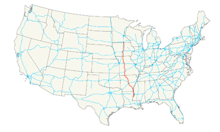
U.S. Route 65 is a north–south United States highway in the southern and midwestern United States. The southern terminus of the route is at U.S. Route 425 in Clayton, Louisiana. The northern terminus is at Interstate 35 just south of Interstate 90 in Albert Lea, Minnesota. Parts of its modern route in Iowa and historic route in Minnesota follow the old Jefferson Highway.
Minnesota State Highway 65 is a highway in the east–central and northeast parts of the U.S. state of Minnesota, which starts at its split from I-35W, skipping past the downtown Minneapolis core, only to resume at the intersection with Washington Avenue at the north end of downtown Minneapolis to continue north to its northern terminus at its intersection with U.S. Highway 71 (US 71) in Littlefork near International Falls.
Minnesota State Highway 47 is a 126.872-mile-long (204.181 km) highway in east–central Minnesota, which runs from its intersection with Central Avenue in Minneapolis and continues north to its northern terminus at its intersection with U.S. Highway 169 in Aitkin.
Interstate 35E (I-35E) is an Interstate Highway in the US state of Minnesota, passing through downtown Saint Paul. It is one of two through routes for Interstate 35 through the Twin Cities of Minneapolis and Saint Paul, the other being Interstate 35W through Minneapolis. Thus, both ends of I-35E are shared with I-35W and I-35. This is one of two pairs of suffixed Interstates that has not been eliminated; I-35 also splits into I-35E and I-35W in Dallas-Fort Worth, Texas.
Interstate 35W (I-35W) is an Interstate Highway in the U.S. state of Minnesota, passing through downtown Minneapolis. It is one of two through routes for I-35 through the Twin Cities of Minneapolis and Saint Paul, the other being I-35E through downtown Saint Paul.
Minnesota State Highway 280 is a 3.710-mile-long (5.971 km) highway in the Twin Cities region of Minnesota that runs from its interchange with Interstate 94/US Highway 52 in Saint Paul to its interchange with Interstate 35W in Roseville.
Minnesota State Highway 51 is a 11.274-mile-long (18.144 km) highway in Minnesota, which runs from its intersection with State Highway 5 in Saint Paul and continues north to its northern terminus at its interchange with Interstate 694 / U.S. Highway 10 in Arden Hills.

Ayd Mill Road is a road in Saint Paul, Minnesota. It runs diagonally through Saint Paul, connecting with Interstate 35E at its southeast terminus, and feeds into Selby Avenue at its northwest end. Indirect access to I-94 is possible via Selby and Snelling Avenues. Originally known as the Short Line Road, it was renamed in 1987 for John Ayd, a German settler who maintained a mill and residence in the area in the mid-to-late 19th century.
The Riverview Corridor is a transit corridor connecting Downtown Saint Paul and the Mall of America in Bloomington via the Minneapolis-Saint Paul International Airport. The corridor serves an area from the Saint Paul Union Depot to the Mall via parts of the METRO Green Line and the METRO Blue Line, and a route running parallel to West 7th Street, which runs southwest from Downtown Saint Paul. The corridor creates a triangle connecting opposite ends of the Blue Line and Green Line.
U.S. Highway 169 (U.S. 169) is a major north–south highway in the U.S. state of Minnesota, connecting the Minnesota River valley with the Twin Cities and the Iron Range. Much of the route is built to expressway or freeway standards.

Summit Avenue is a street in St. Paul, Minnesota, United States, known for being the longest avenue of Victorian homes in the country, having a number of historic houses, churches, synagogues, and schools. The street starts just west of downtown St. Paul and continues four and a half miles west to the Mississippi River where Saint Paul meets Minneapolis. Other cities have similar streets, such as Prairie Avenue in Chicago, Euclid Avenue in Cleveland, and Fifth Avenue in New York City. Summit Avenue is notable for having preserved its historic character and mix of buildings, as compared to these other examples. Historian Ernest R. Sandeen described Summit Avenue as "the best preserved example of the Victorian monumental residential boulevard."

Shepard Road and Warner Road are the names given to a four-lane road running along the banks of the Mississippi River in Saint Paul, Minnesota. Shepard Road runs from the southwestern boundary of the county to downtown Saint Paul. From downtown east the road is known as Warner Road (County Road 36; it runs to a junction with US Highways 61 and 10.

Saint Paul, Minnesota is noted for its neighborhoods. The city has been called "fifteen small towns with one mayor", owing to the neighborhood-based life of much of the city. Saint Paul is partially governed by not 15 but 17 City Districts.

West Seventh is a neighborhood in Saint Paul, Minnesota, United States. This area is colloquially known as the West End, and is not to be confused with the West Side, a different neighborhood. The West End lies at the base of Summit Hill and along the western bluffs of the Mississippi River, spanning the entire length of West Seventh Street, or Old Fort Road; it is also known as the Fort Road area. Fort Road was a historic Native American and fur trader path along the Mississippi River from downtown Saint Paul to Fort Snelling.
Larpenteur Avenue is a main thoroughfare in Ramsey County, Minnesota, United States. Originally named Minneapolis Avenue, it was renamed by the Saint Paul City Council in 1904 in honor of Auguste Louis Larpenteur, a fur trader and one of the original 12 citizens in the city of Saint Paul. The west end of Larpenteur Avenue is at the border with Hennepin County in Lauderdale, immediately west of Minnesota State Highway 280. Larpenteur continues east from Lauderdale through the cities of Falcon Heights, Roseville, and Saint Paul, where it is an exit off of Interstate 35E and bisected by Lake Phalen to the east. It ends at Minnesota State Highway 120 in Maplewood at the border of Washington County.

Selby Avenue is a street in Saint Paul, Minnesota, United States, that runs east–west from Summit Avenue near downtown toward the Mississippi River. The street runs through the Summit-University and Union Park neighborhoods. The street, especially between Dale Street and Snelling Avenue, has been associated with Saint Paul's black community. The far eastern end of the street has historically been more densely developed and architecturally significant.


