| Upatoi Creek | |
|---|---|
| Location | |
| Country | United States |
| Physical characteristics | |
| Source | |
| - location | Upatoi, Georgia |
| - elevation | 370 ft |
| Mouth | |
- location | Columbus, Georgia |
- elevation | 177 ft |
| Length | 35.5 miles |
Upatoi Creek is a 35.5-mile-long (57.1 km) [1] river in western Georgia, just outside Columbus. It runs from Upatoi, through South Columbus, and to the Chattahoochee River.

Georgia is a state in the Southeastern United States. It began as a British colony in 1733, the last and southernmost of the original Thirteen Colonies to be established. Named after King George II of Great Britain, the Province of Georgia covered the area from South Carolina south to Spanish Florida and west to French Louisiana at the Mississippi River. Georgia was the fourth state to ratify the United States Constitution, on January 2, 1788. In 1802–1804, western Georgia was split to the Mississippi Territory, which later split to form Alabama with part of former West Florida in 1819. Georgia declared its secession from the Union on January 19, 1861, and was one of the original seven Confederate states. It was the last state to be restored to the Union, on July 15, 1870. Georgia is the 24th largest and the 8th most populous of the 50 United States. From 2007 to 2008, 14 of Georgia's counties ranked among the nation's 100 fastest-growing, second only to Texas. Georgia is known as the Peach State and the Empire State of the South. Atlanta, the state's capital and most populous city, has been named a global city. Atlanta's metropolitan area contains about 55% of the population of the entire state.
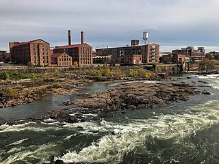
Columbus is a consolidated city-county located on the west central border of the U.S. state of Georgia. Located on the Chattahoochee River directly across from Phenix City, Alabama, Columbus is the county seat of Muscogee County, with which it officially merged in 1970. Columbus is the third-largest city in Georgia and the fourth-largest metropolitan area. According to the 2017 estimates from the U.S. Census Bureau, Columbus has a population of 194,058 residents, with 303,811 in the Columbus metropolitan area. The metro area joins the nearby Alabama cities of Auburn and Opelika to form the Columbus–Auburn–Opelika Combined Statistical Area, which has a 2017 estimated population of 499,128.
Upatoi is a community and post office in the northeastern Muscogee County, Georgia, United States. The community is on Georgia Route 22 and U.S. Route 80 approximately 15 miles east of Columbus. Upatoi was annexed by the city of Columbus in 1971 as part of the consolidation of the city and county governments.
The stream begins at the outflow of Juniper Lake at 32°31′58″N84°36′12″W / 32.53278°N 84.60333°W [2] at an elevation of 370 feet. [3] The stream flows to the west and forms the boundary between Talbot and Marion counties and Talbot and Chattahoochee counties. The stream continues to the west and southwest through the northern margin of Fort Benning. The stream continues to the southwest forming the boundary between Muscogee and Chattahoochee counties. [4] The confluence with the Chattahoochee River is at the Georgia-Alabama border and the western boundary of Fort Benning [5] at 32°22′41″N84°58′14″W / 32.37806°N 84.97056°W Coordinates: 32°22′41″N84°58′14″W / 32.37806°N 84.97056°W and an elevation of 177 feet. [2]

Talbot County is a county located in the west central portion of the U.S. state of Georgia. The 2010 census showed a population of 6,865. The county seat and largest city is Talbotton.

Marion County is a county located in the U.S. state of Georgia. As of the 2010 Census reflected a population of 8,742. The county seat is Buena Vista. The county was created on December 14, 1827. The county was named for General Francis Marion of South Carolina.

Chattahoochee County, also known as Cusseta-Chattahoochee County, is a county located in the west central portion of the U.S. state of Georgia. As of the 2010 census, the population was 11,267. The county seat is Cusseta, with which the county shares a consolidated city-county government. Despite the city-county government Cusseta is not coterminous with the county; it remains a geographically distinct municipality within the county. The county was created on February 13, 1854.
