Related Research Articles

Talbot County is a county located in the west central portion of the U.S. state of Georgia. The 2020 census showed a population of 5,733. The county seat and largest city is Talbotton.

Muscogee County is a county located on the central western border of the U.S. state of Georgia named after the Muscogee that originally inhabited the land with its western border with the state of Alabama that is formed by the Chattahoochee River. As of the 2020 census, the population was 206,922. Its county seat and only city is Columbus, with which it has been a consolidated city-county since the beginning of 1971.

Harris County is a county located in the west-central portion of the U.S. state of Georgia; its western border with the state of Alabama is formed by the Chattahoochee River. As of the 2020 census, the population was 34,668. The county seat is Hamilton. The largest city in the county is Pine Mountain, a resort town that is home to the Franklin D. Roosevelt State Park. Harris County was created on December 14, 1827, and named for Charles Harris, a Georgia judge and attorney. Harris County is part of the Columbus, GA-AL metropolitan area and has become a popular suburban and exurban destination of residence for families relocating from Columbus. Because of this, Harris has become the sixth-wealthiest county in Georgia in terms of per capita income and the wealthiest in the state outside of Metro Atlanta.

Chattahoochee County, also known as Cusseta-Chattahoochee County, is a county located on the western border in central Georgia. As of the 2020 census, the population was 9,565. The county seat is Cusseta, with which the county shares a consolidated city-county government. The city of Cusseta remains a geographically distinct municipality within Chattahoochee County. The county was created on February 13, 1854.

Cusseta is a city in Chattahoochee County, Georgia, United States. It is part of the Columbus, Georgia-Alabama metropolitan statistical area. The population was 9,565 in 2020. The city is the county seat of Chattahoochee County, with which it shares a consolidated city-county government. Despite this, Cusseta is not coterminous with the county; it remains a geographically distinct municipality within the county.

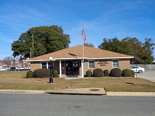
Waverly Hall is a town in Harris County, Georgia, United States. It is part of the Columbus, Georgia-Alabama metropolitan statistical area. The population was 638 in 2020.

Greenville is a city and the county seat of Meriwether County, Georgia, United States. The population was 794 at the 2020 census, down from 876 in 2010. The city is located 60 miles (97 km) southwest of Atlanta and is part of the Atlanta metropolitan area.
Columbus is a consolidated city-county located on the west-central border of the U.S. state of Georgia. Columbus lies on the Chattahoochee River directly across from Phenix City, Alabama. It is the county seat of Muscogee County, with which it officially merged in 1970; the original merger excluded Bibb City, which joined in 2000 after dissolving its own city charter.

Talbotton is a city in Talbot County, Georgia, United States. The population was 970 at the 2010 census. The city is the county seat of Talbot County.
Butler is the county seat of Taylor County, Georgia, United States. Its population was 1,972 at the 2010 census, and 1,881 in 2020.

Preston is an unincorporated community in Webster County, Georgia, United States, located seventeen miles west of Americus. The population was 453 at the 2000 census. From 1857 to 2009, Preston was an incorporated municipality. The community is the county seat of Webster County.

Weston is an unincorporated community in Webster County, Georgia, United States. The population was 75 at the 2000 census. In 2009, the former town was disincorporated and consolidated with the Unified Government of Webster County.

Raber Township is a civil township of Chippewa County in the U.S. state of Michigan. The population was 632 at the 2020 census.

Manitou Beach–Devils Lake is a census-designated place (CDP) in Lenawee County in the U.S. state of Michigan. The population of the CDP was 2,032 at the 2020 census. It is located within Rollin Township to the south and Woodstock Township to the north.
Garfield Township is a civil township of Mackinac County in the U.S. state of Michigan. The population was 1,146 at the 2010 census, and 1,166 in 2020.
Oregonia is an unincorporated community in northwestern Washington Township, Warren County, Ohio, United States, on the east shore of the Little Miami River about five miles northeast of Lebanon and six miles south of Waynesville. The ZIP Code for Oregonia is 45054.

Clarksville is an unincorporated community in Baltimore Hundred, Sussex County, Delaware, United States located just west of Millville. It is centered, more or less, along Delaware Route 26. Many tourists from the Baltimore–Washington metropolitan area pass through the town on their way to and from the Delaware Beaches.

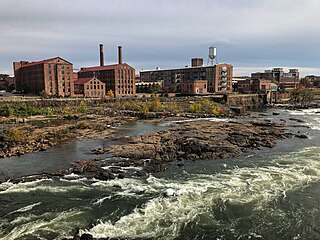
Downtown Columbus, Georgia, also called "Uptown", is the central business district of the city of Columbus, Georgia. The commercial and governmental heart of the city has traditionally been toward the eastern end of Downtown Columbus, between 10th Street and 1st Avenue. Recent developments, particularly between Broadway and 2nd Avenue, have expanded the boundaries of the "central" part of the neighborhood. The term "Downtown Columbus" can also mean this smaller, more commercial area, particularly when used in the context of the city's nightlife and restaurants.
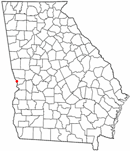
Upatoi Creek is a 35.5-mile-long (57.1 km) river in western Georgia, just outside Columbus. It runs from Upatoi, through South Columbus, and to the Chattahoochee River.
Bibb City was a city in west-central Georgia, United States. It had been the company town of the Bibb Manufacturing Company in Muscogee County, and had a population of 510 in its last official U.S. census (2000). The entire city area, consisting of historic Columbus Mill and the associated mill village owned by the company, is now part of the consolidated city-county of Columbus. It is listed in the National Register of Historic Places as Bibb City Historic District.
References
- 1 2 3 4 Utapoi, GA, 7.5 Minute Topographic Quadrangle, USGS, 1955
- ↑ U.S. Geological Survey Geographic Names Information System: Upatoi, Georgia
- ↑ "Columbus Consolidated Government - City/County Consolidation: Columbus, Georgia".
- ↑ "Upatoi ZIP Code". zipdatamaps.com. 2022. Retrieved November 18, 2022.
- ↑ "Post Offices". Jim Forte Postal History. Retrieved June 24, 2019.
Municipalities and communities of Muscogee County, Georgia, United States | ||
|---|---|---|
| Cities |  | |
| Neighborhoods | ||
| Military base | ||
| Footnotes | ‡ This symbol represents that the indicated city is part of two or more counties. | |
| Central cities/largest cities |  Columbus, Georgia Metropolitan Statistical Area Auburn, Alabama Metropolitan Statistical Area Tuskegee, Alabama Micropolitan Statistical Area (defunct) | |
|---|---|---|
| Cities in Georgia | ||
| Cities in Alabama | ||
| Counties in Georgia | ||
| Counties in Alabama | ||