Upper Colorado River Authority

Last updated
Upper Colorado River Authority
Abbreviation UCRA
Formation 1935
Type Government-owned corporation
Purpose Water conservation
Headquarters 512 Orient St., San Angelo, Texas, 76903
Region served
Concho, Coke, Schleicher, and Tom Green Counties in Texas
Chairperson
Jeffie Roberts
Main organ
Board of Directors
Website http://www.ucratx.org/

The Upper Colorado River Authority or UCRA was created in 1935 by the Texas Legislature as a quasi-governmental entity to manage the Colorado River as a water resource in Tom Green County and Coke County, Texas. [1] The authority has since been extended to include Schleicher County and Concho County. The organization is managed by a nine-person Board of Directors appointed to six-year terms by the Governor of Texas. [2]

Texas Legislature

The Legislature of the state of Texas is the state legislature of Texas. The legislature is a bicameral body composed of a 31-member Senate and a 150-member House of Representatives. The state legislature meets at the Capitol in Austin. It is a powerful arm of the Texas government not only because of its power of the purse to control and direct the activities of state government and the strong constitutional connections between it and the Lieutenant Governor of Texas, but also due to Texas's plural executive.

Colorado River (Texas) river in Texas

The Colorado River is an 862-mile (1,387 km) long river in the U.S. state of Texas. It is the 18th longest river in the United States and the longest river with both its source and its mouth within Texas.

Tom Green County, Texas County in the United States

Tom Green County is a county located on the Edwards Plateau in the U.S. state of Texas. As of the 2010 census, its population was 110,224. Its county seat is San Angelo. The county was created in 1874 and organized the following year.

Contents

The UCRA has served as a lending institution, offering loans to municipalities in its served district for water management projects. The authority also participates in the Clean Rivers Program, and other environmental programs of the state of Texas. In 2008, the UCRA began construction in San Angelo of the Concho River Basin Education and Research Center, which offers educational programs to schoolchildren about water use and conservation. [3]

Public finance study of the role of the government in the economy; branch of economics

Public finance is the study of the role of the government in the economy. It is the branch of economics which assesses the government revenue and government expenditure of the public authorities and the adjustment of one or the other to achieve desirable effects and avoid undesirable ones.

San Angelo, Texas City in Texas, United States

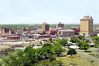
San Angelo is a city in and the county seat of Tom Green County, Texas, United States. Its location is in the Concho Valley, a region of West Texas between the Permian Basin to the northwest, Chihuahuan Desert to the southwest, Osage Plains to the northeast, and Central Texas to the southeast. According to a 2014 Census estimate, San Angelo has a total population of 100,450. It is the principal city and center of the San Angelo metropolitan area, which has a population of 118,182.

Water conservation policies, strategies and activities to manage fresh water as a sustainable resource

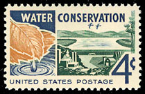
Water conservation includes all the policies, strategies and activities to sustainably manage the natural resource of fresh water, to protect the hydrosphere, and to meet the current and future human demand. Population, household size, and growth and affluence all affect how much water is used. Factors such as climate change have increased pressures on natural water resources especially in manufacturing and agricultural irrigation. Many US cities have already implemented policies aimed at water conservation, with much success.

Reservoirs

The Upper Colorado River Authority does not directly manage or operate any dams. The authority has helped to provide financial and administrative support to other operating authorities to establish three reservoirs on the Upper Colorado River and its tributaries: [1]

Dam A barrier that stops or restricts the flow of surface or underground streams

A dam is a barrier that stops or restricts the flow of water or underground streams. Reservoirs created by dams not only suppress floods but also provide water for activities such as irrigation, human consumption, industrial use, aquaculture, and navigability. Hydropower is often used in conjunction with dams to generate electricity. A dam can also be used to collect water or for storage of water which can be evenly distributed between locations. Dams generally serve the primary purpose of retaining water, while other structures such as floodgates or levees are used to manage or prevent water flow into specific land regions. The earliest known dam is the Jawa Dam in Jordan, dating to 3,000 BC.

Tributary stream or river that flows into a main stem river or lake

A tributary or affluent is a stream or river that flows into a larger stream or main stem river or a lake. A tributary does not flow directly into a sea or ocean. Tributaries and the main stem river drain the surrounding drainage basin of its surface water and groundwater, leading the water out into an ocean.

E.V. Spence Reservoir

E.V. Spence Reservoir is an artificial lake located west of the town of Robert Lee, Texas. The reservoir was impounded by the creation of Robert Lee Dam in 1969, with the support of the Upper Colorado River Authority, to provide a reliable water supply for Robert Lee and the surrounding communities in Coke County. The lake also serves as a recreational venue for fishing, boating, and swimming. Robert Lee Dam is managed by the Colorado River Municipal Water District.

O.C. Fisher Reservoir is an artificial lake located west of the city of San Angelo, Texas. With the financial support of the Upper Colorado River Authority, construction on the dam to form the reservoir was begun by the United States Army Corps of Engineers in 1947 and the lake was officially impounded in 1952. Originally named San Angelo Lake, the reservoir was renamed in 1975 for local U.S. Congressman O.C. Fisher, to honor his 23 years of service in the United States Congress.

United States Army Corps of Engineers federal agency under the Department of Defense and a major Army command

The United States Army Corps of Engineers (USACE) is a U.S. federal agency under the Department of Defense and a major Army command made up of some 37,000 civilian and military personnel, making it one of the world's largest public engineering, design, and construction management agencies. Although generally associated with dams, canals and flood protection in the United States, USACE is involved in a wide range of public works throughout the world. The Corps of Engineers provides outdoor recreation opportunities to the public, and provides 24% of U.S. hydropower capacity.

See also

Lower Colorado River Authority

The Lower Colorado River Authority (LCRA) is a nonprofit public utility created in November 1934 by the Texas Legislature. LCRA's mission is to enhance the lives of the Texans it serves through water stewardship, energy and community service. LCRA provides public power, manages the lower Colorado River, builds and operates transmission lines, owns public parks, and offers community services.

Related Research Articles

Rio Grande river forming part of the US-Mexico border

The Rio Grande is one of the principal rivers in the southwest United States and northern Mexico. The Rio Grande begins in south-central Colorado in the United States and flows to the Gulf of Mexico. Along the way, it forms part of the Mexico–United States border. According to the International Boundary and Water Commission, its total length was 1,896 miles (3,051 km) in the late 1980s, though course shifts occasionally result in length changes. Depending on how it is measured, the Rio Grande is either the fourth- or fifth-longest river system in North America.

Concho County, Texas County in the United States

Concho County is a county located on the Edwards Plateau in the U.S. state of Texas. As of the 2010 census, the population was 4,087. Its county seat is Paint Rock. The county was founded in 1858 and later organized in 1879. It is named for the Concho River.

Christoval, Texas CDP in Texas, United States

Christoval is a census-designated place (CDP) in Tom Green County, Texas, United States. The population was 504 at the 2010 census. It is part of the San Angelo, Texas Metropolitan Statistical Area.

The Texas Highland Lakes is a chain of six fresh water reservoirs in Central Texas formed by six dams on the lower Colorado River. The Texas Colorado River winds southeast from West Texas to Matagorda Bay and the Gulf of Mexico.

Metropolitan Water District of Southern California water district in Southern California, United States

The Metropolitan Water District of Southern California is a regional wholesaler and the largest supplier of treated water in the United States. The name is usually shortened to "Met," "Metropolitan," or "MWD." It is a cooperative, of fourteen cities, eleven municipal water districts and one county water authority, that provides water to 19 million people in a 5,200-square-mile (13,000 km2) service area. It was created by an act of the California Legislature in 1928, primarily to build and operate the Colorado River Aqueduct. Metropolitan became the first contractor to the State Water Project in 1960.

Guadalupe-Blanco River Authority

The Guadalupe-Blanco River Authority or GBRA was formed in 1933 by the Texas legislature. Its main concerns are water supply and water conservation in the Guadalupe River Basin, which includes the Blanco, Comal, and San Marcos rivers. The authority extends over ten counties. The general offices of the authority are located at 933 East Court Street in Seguin.

Water Valley, Texas Unincorporated community in Texas, United States

Water Valley is an unincorporated community in Tom Green County, Texas, United States. According to the Handbook of Texas, the community had an estimated population of 120 in 2000. The community is part of the San Angelo, Texas Metropolitan Statistical Area.

Quinapoxet River river in the United States of America

The Quinapoxet River is part of the Nashua River watershed in northern Massachusetts in the United States. It is part of the Massachusetts Water Resources Authority water system supplying drinking water to the greater Boston area.

South Concho River river in the United States of America

The South Concho River is one of the few rivers in Texas to run south to north for its entire length. Rising from Anson Springs some 4 miles (6.4 km) south of Christoval, Texas, in Tom Green County, it flows north through the town of Christoval, then continues north for 13 miles (21 km) before it joins the Middle Concho to form Twin Buttes Reservoir in what is now southwest San Angelo. When released, the river flows through Lake Nasworthy, and continues north to join the North Concho River at Bell St. in east San Angelo. The river is known for its cool, clear, deep water and its pecan-covered banks. Watercress grows in the shallows along the banks.

Colorado River Storage Project

The Colorado River Storage Project is a United States Bureau of Reclamation project designed to oversee the development of the upper Colorado River basin. The project provides hydroelectric power, flood control and water storage for participating states along the upper portion of the Colorado River and its major tributaries.

North Concho River river in the United States of America

The North Concho River is a river in western-central Texas and one of three tributaries of the Concho River. The river is 88 miles (142 km) long. The other two tributaries are the Middle Concho and South Concho Rivers. The Concho River flows into the Colorado River.

Twin Buttes Reservoir is an artificial lake located about 6 mi (9.7 km) southwest of the city of San Angelo, Texas, and immediately upstream from Lake Nasworthy. With the financial support of the Upper Colorado River Authority, construction on Twin Buttes Dam to form the reservoir was completed in 1963. The dam is an unusual one – it dams the Middle and South Concho Rivers separately; a stabilization channel runs between the two sides of the lake. Water levels fell significantly during the 2010–13 Southern United States drought and remained low into 2014.

San Angelo State Park

San Angelo State Park is a Texas state park in San Angelo, Texas in the United States. It encompasses 7,677 acres (3,107 ha) leased by Texas Parks and Wildlife Department from the United States Army Corps of Engineers. It opened in 1995 and is located on the shores of the O.C. Fisher Reservoir.

San Angelo Museum of Fine Arts Art museum in Texas, USA

The San Angelo Museum of Fine Arts is an art museum serving 14 counties located in San Angelo, Texas. The museum features a growing permanent collection and is home to traveling exhibitions. In addition, it features a research library, an education wing, a rooftop sculpture collection, and community meeting space.

O.H. Ivie Lake is a reservoir on the Colorado and Concho Rivers in Concho, Coleman, and Runnels counties, 55 miles east of San Angelo, Texas in the United States. The reservoir was formed in 1990 by the construction of S. W. Freese Dam at the Concho-Coleman county line by Brown and Root. The lake and dam are owned and operated by the Colorado River Municipal Water District.

References

  1. 1 2 Upper Colorado River Authority from the Texas Handbook Online
  2. Upper Colorado River Authority (2009). "About Us". Accessed August 4, 2009.
  3. Upper Colorado River Authority (2009). "Concho River Basin Education & Research Center". Accessed August 4, 2009.