Riverview is a neighbourhood in Ottawa, Ontario, Canada. It is southeast of the downtown adjacent to the Rideau River, its location on which is its namesake. The 2021 Census population of Riverview is 13,113.
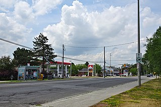
Blackburn Hamlet is a suburban community in Innes Ward, in the east end of Ottawa, Ontario, Canada. Before the 2001 amalgamation of the city of Ottawa, it was in the city of Gloucester. It is surrounded by rural areas and contains several older and newer areas of settlement. According to the Canada 2021 Census, its population was 8,173. The community took its name from Robert Blackburn, former Member of Parliament for Russell.

Heron Gate or Herongate is a neighbourhood in Alta Vista Ward and Gloucester-Southgate Ward in the south end of Ottawa, Ontario, Canada. It is defined by the Herongate Tenant Coalition as being bounded on the north by Heron Road, on the west by Heron-Walkley Park and Albion Road, and by the Walkley rail corridor on the south. The total population for this area according to the Canada 2021 Census was 9,974.

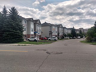
Centrepointe is a neighbourhood in College Ward in the urban west end of the city of Ottawa, Ontario, Canada. It was formerly part of the city of Nepean. It is a residential subdivision in the west/central part of Ottawa, developed from 1984 onwards, and is informally bounded by Baseline Road to the north, Woodroffe Avenue to the east, the CN railroad to the south, and the Briargreen subdivision and Forest Ridge Apartments to the west. The housing stock includes approximately 1,000 detached homes, with the remainder mostly townhomes and terrace homes.

Alta Vista Ward is a city ward in the city of Ottawa, Ontario, Canada represented on Ottawa City Council. Alta Vista Ward was created prior to the 1966 election when Gloucester Ward was split in half due to population growth in the Alta Vista area. Until the 1972 elections, the ward was represented by two councillors. Prior to the 1980 election, the Ward was split in half, with the western half remaining as Alta Vista ward and the eastern half became Canterbury Ward. They were reunited prior to the 1994 Election and was known as Ward 10, and given the name Alta Vista-Canterbury Ward in 1995. During this time, on regional council it was known as just Alta Vista Ward. It was renamed to Alta Vista in 2000.

Lindenlea is a neighbourhood in Rideau-Rockcliffe Ward in Ottawa, Ontario, Canada, northeast of Downtown. It is bordered by Maple Lane to the north, Acacia Avenue to the east, Beechwood Avenue to the south and Springfield Road to the west.

Britannia is a group of neighbourhoods in Bay Ward in the west end of Ottawa, Ontario, Canada. It is located on the Ottawa River across from Aylmer, Quebec, adjacent to its namesake, Britannia Bay, north of Richmond Road, west of the Kichi Zibi Mikan and east of Boyce Avenue. The total population of this area was 6,692 as of the 2016 census. The area constituted a municipal ward from 1973 to 1994.
Alta Vista is a neighbourhood in Alta Vista Ward in Ottawa, Ontario, Canada. Its boundaries according to the Alta Vista Community Association are that part of Alta Vista Ward south of Smyth Road in the north, north of Walkley Road and east of the Rideau River, and west of the "greenspace underneath Haig Drive". However, the name is ambiguous, as there are several sub-neighbourhoods in this area,, as the neighbourhood could refer to the ward as a whole, down to the core Alta Vista area,, centred on Alta Vista Drive.

Manor Park is a neighbourhood in Rideau-Rockcliffe Ward in the east end of Ottawa, Ontario, Canada on the east side of Rockcliffe Park.
Glabar Park is a neighbourhood in Bay Ward, in the west end of Ottawa, Ontario, Canada. It is bounded on the west by Woodroffe Avenue north by Carling Avenue, south by The Queensway and on the east by Maitland Avenue. The population at the 2011 census was about 2,806.

Carlingwood is a neighbourhood in Bay Ward in the west end of Ottawa, Ontario, Canada. The neighbourhood is roughly bounded on the north by Richmond Road, on the east by Sherbourne Road, on the south by Carling Avenue and on the west by Woodroffe Avenue. This area corresponds to census tract 5050032.01, which had a population of 3,558 according to the Canada 2016 Census.

Elmvale Acres is a neighbourhood in south Ottawa, Ontario, Canada, located in Alta Vista Ward. It was built in the late 1950s by the contractor and property developer, Robert Campeau, with construction beginning in 1955. It is bounded on the north by Smyth Road, on the east by Othello Avenue behind Elmvale Acres Shopping Centre, on the south by Pleasant Park Road and on the west by the Hydro Corridor. According to the 2016 Census, the population for this area was 2,627.

Carlington is a neighbourhood located in River Ward in the west-end of Ottawa, Ontario, Canada.
Central Park is a neighbourhood in River Ward in the west end of Ottawa, Ontario, Canada. It is bounded on the east by Merivale Road, on the south by Baseline Road, on the west by Clyde Avenue and on the north by the Carlington neighbourhood. The population of the neighbourhood in 2016 was 3,888 in an area of 0.91 km2. It more than doubled its population between 2001 and 2006 as the neighbourhood expanded. Excluding the residences south of Baseline which are included in the Census Tract, the population of the neighbourhood is 3,760.

Carleton Heights is a neighbourhood in River Ward in Ottawa, Ontario, Canada. According to the Carleton Heights and Area Community Association, the neighbourhood is bounded on the north by the Central Experimental Farm, on the east by the Rideau River, on the south by the junction of Prince of Wales Drive and Fisher Avenue and on the west by Fisher Avenue. The neighbourhood is sometimes referred to as Hog's Back after the nearby falls. The total population of the neighbourhood is 7,586 according to the Canada 2016 Census.
Guildwood Estates is a sub neighbourhood within the Alta Vista area of Ottawa, Ontario, Canada. It can be broadly described as south of Kilborn Ave., west of the Walkley-Kilborn greenspace, east of Parkland and north of Heron Road. The population of this area according to the Canada 2011 Census was 3,179. However, maps usually show Guildwood Estates as the western section of this area, while the eastern half is the neighbourhood of Urbandale Acres. Guildwood Estates is newer, having mostly been built in the early 1970s, while Urbandale Acres was built in the 1960s.
Bayshore is a neighbourhood in Bay Ward in the west end of Ottawa, Ontario, Canada. Prior to amalgamation in 2001, the neighbourhood was in the City of Nepean. It is bounded east by row houses off Bayshore Drive, to the north Carling Avenue, to the west Holly Acres Drive and the Lakeview neighbourhood, and to the south Ontario Highway 417. The main street in Bayshore is Woodridge Crescent, while the Bayshore Station is the major bus transit station.

Foster Farm, nicknamed "the Farm", is a neighbourhood in the Britannia area of Bay Ward in the west end of Ottawa, Ontario, Canada. It is roughly bounded to the north by Richmond Road, to the east by Pinecrest Road, to the west by the former Ottawa/Nepean city limits and the south by the Highway 417, the Queensway. It is bordered by Fairfield Heights, Queensway Terrace North, Redwood, Michele Heights. The total population of this area according to the 2016 Canada Census was 3,636.

Cyrville is a neighbourhood in Beacon Hill-Cyrville Ward in the east-end of Ottawa, Ontario, Canada. The area is located within the former City of Gloucester, and is roughly bounded on the north, west and south by the former Gloucester City limit, and on the east by the Aviation Parkway and Highway 417. Once a francophone farming village, the area now a mix of residential and industrial land, being home to the Cyrville Industrial Area. It has been described as a "tangle of freeways and utility corridors". It has a population of 4513, 280 of which live south of the Queensway.

Hawthorne Meadows is a neighbourhood in Alta Vista Ward in southeast Ottawa, Ontario, Canada. It is triangular in shape; it is bounded on the west by St. Laurent Boulevard, on the northeast by Russell Road and on the south by Walkley Road. According to the Canada 2016 Census, the population of this area was 3,577.

