
U.S. Route 91 or U.S. Highway 91 is a 172.7-mile-long (277.9 km) north–south United States highway running from Brigham City, Utah, to Idaho Falls, Idaho, in the U.S. states of Idaho and Utah. Despite the "1" as the last digit in the number, US 91 is no longer a cross-country artery, as it has mostly been replaced by Interstate 15. The highway currently serves to connect the communities of the Cache Valley to I-15 and beyond. Prior to the mid-1970s, US 91 was an international commerce route from Long Beach, California, to the Canada–US border north of Sweetgrass, Montana. US 91 was routed on the main streets of most of the communities it served, including Las Vegas Boulevard in Las Vegas and State Street in Salt Lake City. From Los Angeles to Salt Lake, the route was built along the corridor of the Arrowhead Trail. A portion of the highway's former route in California is currently State Route 91.

State Route 201 (SR-201) is an east–west expressway and freeway located in Salt Lake County in the U.S. state of Utah. Colloquially known by some as the 21st South Freeway, the route serves as an alternative to Interstate 80 (I-80) through Salt Lake City. From the western terminus of the route west of Magna, the highway heads east through Kennecott Copper property as an expressway before running through the western suburbs of Salt Lake City as a freeway. Shortly after the route returns on a surface route, SR-201 terminates on its eastern end at State Street.
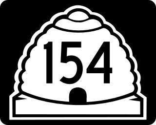
State Route 154 (SR-154) or Bangerter Highway is a partial expressway running west and then north from Draper through western Salt Lake County, eventually reaching the Salt Lake City International Airport in Salt Lake City. Construction began in 1988 after planning for the highway began more than two decades prior. For the next ten years, portions of the highway opened as constructed, with the entire route finished by 1998.

State Route 68 (SR-68) is a state highway in the U.S. state of Utah. It is a major thoroughfare throughout the Wasatch Front as it runs north–south for 70.8 miles (113.9 km), linking US-6 near Elberta to US-89 in Woods Cross. The route intersects several major freeways and highways in the Salt Lake City metropolitan area including I-215, I-80, and I-15. The route is more commonly referred to as Redwood Road, after the street it is routed along throughout Salt Lake County. The highway is also routed for a short distance along 500 South and 200 West in Bountiful and Camp Williams Road in Utah County. The route is a surface street for its entire length.

State Route 186 (SR-186) is a state highway entirely within Salt Lake City, capital of the U.S. state of Utah. It forms a quarter-beltway connecting US-89 and I-15 leading north from Salt Lake City to I-80 leading east; as such, it effectively forms the missing (non-freeway) quarter of the I-215 belt route around the city, though it does not directly connect to I-215 at the north end. Despite this beltway role, the route passes through downtown Salt Lake City because downtown is built right up to the northern mountains surrounding City Creek Canyon. The portion of the route connecting downtown to I-80 is a high-capacity street heavily used by commuters, especially those travelling to the University of Utah or between downtown and eastern neighborhoods, but the portion on Capitol Hill north of downtown is much narrower and has sharp turns around the Capitol grounds. The roadway runs 9.34 miles (15.03 km) along Victory Road, Columbus Street, 300 North, State Street, 400 South, 500 South, and Foothill Drive.
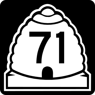
State Route 71 (SR-71) is a state highway completely within the Salt Lake City metropolitan area in the northern portion of the US state of Utah. It runs from SR-154 in the southwest side of the city to SR-186 in Downtown Salt Lake City. The route spans 22.47 miles (36.16 km) as it runs along portions of 12600 South, 12300 South, 900 East, and 700 East streets.

Interstate 15 (I-15) runs north–south in the U.S. state of Utah through the southwestern and central portions of the state, passing through most of the state's population centers, including St. George and those comprising the Wasatch Front: Provo–Orem, Salt Lake City, and Ogden–Clearfield. It is Utah's primary and only north–south interstate highway, as the vast majority of the state's population lives along its corridor; the Logan metropolitan area is the state's only Metropolitan Statistical Area through which I-15 does not pass. In 1998, the Utah State Legislature designated Utah's entire portion of the road as the Veterans Memorial Highway.

U.S. Route 89 in the U.S. state of Utah is a north-south United States Highway spanning more than 502 miles (807.891 km) through the central part of the state, making it the longest road in Utah. Between Provo and Brigham City, US-89 serves as a local road, paralleling Interstate 15, but the portions from Arizona north to Provo and Brigham City northeast to Wyoming serve separate corridors. The former provides access to several national parks and Arizona, and the latter connects I-15 with Logan, the state's only Metropolitan Statistical Area not on the Interstate.
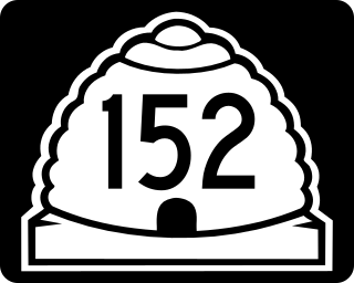
State Route 152 (SR-152) is a state highway in the suburbs of Salt Lake City, Utah connecting SR-71 in Murray to I-215 and city-maintained Highland Drive in Cottonwood Heights, though for almost all of its length it forms the border between Murray and Holladay. The route, which is 3.04 miles (4.89 km), is laid on the entire length of the Van Winkle Expressway and a portion of Highland Drive.
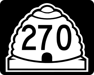
State Route 270 is a short north–south thoroughfare that sits completely within Salt Lake City in Salt Lake County, entirely along South West Temple Street. The southern terminus is at West 900 South, with ramps to and from I-15/I-80 at exit 305D; its northern terminus is at US-89.

State Route 269 (SR-269) is a state highway in the U.S. state of Utah that sits completely within Salt Lake City in Salt Lake County. It consists entirely of a one-way pair of 500 South and 600 South, two parallel one-way streets that connect I-15 and I-80 to downtown Salt Lake City. SR-269 was designated in 1960 and constructed later that decade, coinciding with the construction of I-15 in the area.

State Route 266 is a west–east thoroughfare completely within Salt Lake County in northern Utah that connects both sides of the I-215 beltway. It is known as 4500 South and 4700 South along the route.

The Green Line is a light rail line on the Utah Transit Authority's (UTA) TRAX system in Salt Lake City, Utah, in the United States, operated by the Utah Transit Authority (UTA). It opened on August 7, 2011, and runs between Airport Station at the Salt Lake City International Airport and West Valley Central Station in West Valley City serving a total of eighteen stations: thirteen in Salt Lake City, one in South Salt Lake, and four in West Valley City.
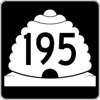
State Route 195 (SR-195) was a north–south state highway in the U.S. state of Utah, following 2300 East in Salt Lake County. Formed in 1947, the route initially created a link from south of the University of Utah to future I-80. By the late-1960s, the route was extended south to Holladay, including an unbuilt portion of 2300 East between 2100 South and I-80. Following relinquishments of the route to Salt Lake City and Holladay, the road was deleted from the state highway system in 2007.

State Route 181 (SR-181) was a state highway in the U.S. state of Utah connecting SR-152 in Murray and Holladay north to SR-186 in Salt Lake City at its peak, the former being suburbs of the latter. The route was 6.9 miles (11.10 km) for thirty-eight years before being truncated in 2007 and decommissioned entirely later in the same year.

State Route 151 (SR-151), sometimes known as the South Jordan Parkway, is a state highway in the U.S. state of Utah connecting SR-154 in South Jordan to Interstate 15 (I-15) in Sandy. The route spans 4.24 miles (6.82 km) in southern Salt Lake County.

Main Street is the most important commercial street in Salt Lake City, Utah, United States though it also extends south into the cities of South Salt Lake, Millcreek, and Murray. Its commercial importance is almost totally derived from the few blocks of the street which are immediately south of Temple Square that have attracted banks, major retailers, and heavy foot traffic throughout Salt Lake City's history; the long southern extension of Main Street south of about 500 and 600 South, in contrast, is always in the shadow of State Street, which is more designed for the long-distance automobile traffic that is common away from downtown.
State Street is a wide 17.3-mile-long (27.8 km) street in Salt Lake County, Utah leading almost straight south from the steps of the Utah State Capitol Building, through Salt Lake City, South Salt Lake, Millcreek, Murray, eastern Midvale, Sandy, and northwestern Draper. Because it follows the most direct route from downtown Salt Lake City to the Point of the Mountain pass to Utah County, it was the undisputed main road south from Salt Lake City until Interstate 15 (I-15) was built to the west. It retains the U.S. Highway 89 designation for all but the northernmost seven blocks despite I-15's proximity. Due to its history as a route for long-distance travel, travel within the Wasatch Front region, and travel between the cities along the east side of the Jordan River, it has attracted a wide variety of retail and service businesses along its entire length, creating a nearly continuous commercial axis for the Salt Lake Valley.
5600 West BRT is a proposed bus rapid transit (BRT) line in western Salt Lake County, Utah, United States, that will be operated by the Utah Transit Authority (UTA) and will run along 5600 West (SR-172). Initially, it will only run along a short segment almost entirely within West Valley City, with a connection to Downtown Salt Lake City. However, it will eventually run from South Jordan to the Salt Lake City International Airport.) It is the fifth of several BRT lines that UTA either operates or has planned for in Utah County and the Salt Lake Valley. UTA's BRT is described by UTA as "light rail on rubber tires". While it was initially planned for phase 1 of the project to be completed in 2015, the project is currently stalled.
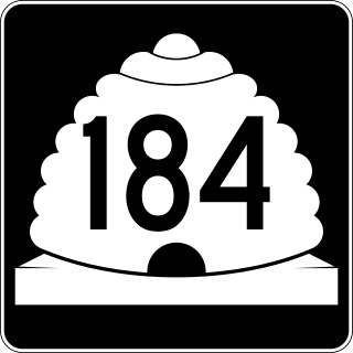
State Route 184 was a state highway in the U.S. state of Utah. It was a 1.9-mile (3.1 km) loop that connected U.S. Route 89 (US-89) in Salt Lake City with the Utah State Capitol. The route was originally added to the state highway system in 1935 as part of SR-181, and SR-184 was created in 1963 as a split from that route. It would remain until 2007, when it was deleted in a series of highway realignments in the Salt Lake City area. However, its route remains on the state highway system as SR-186.
