South Salt Lake, Utah

Last updated

South Salt Lake, Utah
City of South Salt Lake
City of South Salt Lake City Hall, South Salt Lake City, UT.JPG
South Salt Lake City Hall, South Salt Lake, Utah
Motto: 
City on the Move
Salt Lake County Utah incorporated and unincorporated areas South Salt Lake highlighted.svg
Location in Salt Lake County and the state of Utah.
Coordinates: 40°42′28″N111°53′21″W / 40.70778°N 111.88917°W / 40.70778; -111.88917
CountryUnited States
State Utah
County Salt Lake
Settled1847
Incorporated 1938
Named for Great Salt Lake
Area
[1]
  Total6.94 sq mi (17.98 km2)
  Land6.94 sq mi (17.98 km2)
  Water0.00 sq mi (0.00 km2)
Elevation
4,255 ft (1,297 m)
Population
 (2010)
  Total23,617
  Estimate 
(2019) [2]
25,582
  Density3,685.11/sq mi (1,422.76/km2)
Time zone UTC−7 (Mountain (MST))
  Summer (DST) UTC−6 (MDT)
ZIP codes
84106, 84115, 84119
Area code(s) 385, 801
FIPS code 49-71070 [3]
GNIS feature ID1432753 [4]
Website https://sslc.gov/

South Salt Lake is a city in Salt Lake County, Utah, United States and is part of the Salt Lake City Metropolitan Statistical Area. The population was 23,617 at the 2010 census.

Contents

History

Balloons with the South Salt Lake City Logo and Motto Balloons With City Logo Columbus Center 2010.JPG
Balloons with the South Salt Lake City Logo and Motto

Jesse Fox Jr. developed the area South Salt Lake referred to as Central Park around 1890. Mr. Fox chose the name after visiting New York and seeing Central Park there. He was impressed by the park and its design within an urban environment. Despite South Salt Lake being rural at the time, he decided to name the area Central Park. In 1925 the LDS Central Park Ward was created and named after the development.

In 1936, an attempted annexation by Salt Lake City failed due to concerns over funding and implementation of a sewer system. On August 14, 1936, a resolution creating the Town of Central Park was approved by the Board of County Commissioners - however, this did not last long, as voters then decided to disincorporate the town in 1937. In a close vote, voters then approved incorporation of South Salt Lake.

On September 29, 1938, still in need of a sewer system, South Salt Lake voted to incorporate as the Town of South Salt Lake, with Robert R. Fitts as the first town president. The town was also lacking many other basic amenities at the time that would be easier to implement with incorporation, such as a post office and fire department. In 1939, the Works Progress Administration finally began construction of a sewer system, with a cost of $462,000. The original boundary of South Salt Lake was from 500 East to 300 West and 2100 South to Mill Creek on the south.

On August 1, 1950, the population had increased enough for South Salt Lake to be designated as a third class city. This changed the form of government to a mayor and city council. The town president of the time, Marlow Callahan, became the first mayor of the City of South Salt Lake. [5]

In the 1990s, South Salt Lake annexed portions of an unincorporated portion of Salt Lake County to the south, and nearly doubled in land area and population. On January 4, 2010, Cherie Wood became South Salt Lake's first female mayor.

Geography

Bridge at Fitts Park in the City of South Salt Lake, UT Bridge at Fitts Park 2010.JPG
Bridge at Fitts Park in the City of South Salt Lake, UT

According to the United States Census Bureau, the city has a total area of 6.9 square miles (18 km2), all land.

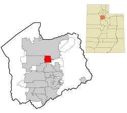
The city is bordered by the Jordan River on the west, 500 East and 700 East on the east, 2100 South on the north, and 3900 South on the south. West Valley City lies to the west, Salt Lake City to the north, northeast, and east; and Millcreek to the east, south, and southeast. Because of its location next to the Jordan River and well away from the mountains, it is mostly flat, only ranging in elevation from about 4,330 feet (1,320 m) to 4,380 feet (1,340 m). It has a fairly high water table, with some areas being somewhat swampy before development in the early 1900s. Much city water comes through wells from the aquifer beneath the city. Three tributaries of Mill Creek converge in Fitts Park.

Demographics

Historical population
CensusPop.Note
1940 1,599
1950 7,704381.8%
1960 9,52023.6%
1970 7,810−18.0%
1980 10,41333.3%
1990 10,129−2.7%
2000 22,038117.6%
2010 23,6177.2%
2020 26,77713.4%
U.S. Decennial Census [6]

According to estimates from the U.S. Census Bureau, [7] as of 2018, there were 25,365 people in South Salt Lake. The racial makeup of the city was 56.2% non-Hispanic White, 10.5% Black, 2.5% Native American, 11.1% Asian, 1.7% Pacific Islander, and 3.7% from two or more races. 16.3% of the population were Hispanic or Latino of any race.

As of the census [3] of 2010, there were 23,617 people, 9,160 housing units, with a total of 8,554 households . The population density was 3,401.1 people per square mile (1,231.4/km2)with a land area of 6.94 miles. The racial makeup of the city was 69.5% White, 4.4% African American, 2.6% Native American, 5.0% Asian, 1.0% Pacific Islander, and 4.1% from two or more races. Hispanic or Latino of any race was 29.1% of the population.

There were 8,554 households, out of which 26.9% had children under the age of 18 living with them, 33% were married couples living together, 14.1% had a female householder with no husband present, and 46.2% were non-family house holds. 34% of all households were made up of individuals, and 13.9% had someone living alone who was 65 years of age or older. The average household size was 2.46 and the average family size was 3.24.

In the city, the population was spread out, with 77.8% over the age of 18, 11.5% from 20 to 24, 12.5% from 25 to 29, 6.1% from 45 to 49, and 6.8% who were 65 years of age or older. The median age was 30.3 years. For every 100 females, there were 121.0 males. For every 100 females age 18 and over, there were 127.1 males.

The median income for a household in the city was $35,547 and the median income for a family was $37,632. Males had a median income of $27,432 versus $22,275 for females. The per capita income for the city was $15,786. [8] According to US Census Bureau data, the number of persons below the poverty level in 2009-2013 was 29.7%, over twice the Utah average. [9]

Economy

Crime

Public Safety Officers hoisting the flag on the 4th of July, South Salt Lake City, UT City of South Salt Lake Police and Fire honor guard.JPG
Public Safety Officers hoisting the flag on the 4th of July, South Salt Lake City, UT

Since 2007, crime in South Salt Lake has been reduced by 30%. Former SSL Police Chief Chris Snyder attributes the drop in crime to 4 factors: 1) Increased attention to code enforcement, 2) Crime Free Rental Housing program that results in greater landlord scrutiny of potential renters, 3) Partnerships, such as that with United Way of Salt Lake, combined with community organizing, such as the Promise South Salt Lake initiative, South Salt Lake Community Connection that address resident needs and improve neighborhoods, and 4) Extensive youth development efforts, such as Promise afterschool programs delivered in nine Neighborhood Centers across the city, and urban/neighborhood revitalization projects. There is a new emphasis on redevelopment (including the Market Station development) and a reduction in the number of liquor licenses allowed to be issued is anticipated to reduce crime in the city. [16]

The Motovo Real Estate Blog ranked South Salt Lake as the "Most Dangerous Place in Utah" citing data from the 2012 FBI Uniform Crime Report. Their report found that South Salt Lake had the most violent crimes per capita in Utah, with the second highest non-violent crime rate as well. [17]

Transportation

I-15, I-80, and SR-201 intersect in the northwestern portion of the city. This interchange is known locally as the "Spaghetti Bowl" due to its complex array of on and off ramps, which extend to several other city roads in the area. US-89 runs north-to-south along State Street through the heart of South Salt Lake, serving as the primary commercial corridor and includes an interchange at I‑80. SR-171 (3300 South) traverses the city east-to-west, with an interchange at I‑15. SR-71 (South 700 East) runs along the southern part of the east border of the city and also has an interchange at I‑80.

The S Line streetcar at the South Salt Lake City station, December 2013 The S Line Street Car in South Salt Lake City, UT December 2013.jpg
The S Line streetcar at the South Salt Lake City station, December 2013

Utah Transit Authority's (UTA) TRAX light rail runs through the city at about 200 West, with 3 stations located within the city limits. All three of the TRAX lines (Blue, Red, and Green) enter the city from the north at Central Pointe station. (The UTA Police Department was located at the Central Pointe station until it moved to its new location at the Murray Central station in July 2016.) From Central Pointe station the Green Line heads west to West Valley City while both the Blue and Red lines continue south to stop at the Millcreek station before leaving the city just south of the Meadowbrook station. UTA also has several local bus routes that run through the city, many of which stop every fifteen minutes. [18]

In December 2013, the S Line streetcar (formerly known as Sugar House Streetcar) opened for service. [19] The S Line was built along an existing rail line just south of 2100 South (the northern border of the city) from the Central Pointe station to the Sugar House neighborhood in southeastern Salt Lake City. [20] In addition to Central Pointe station, the S Line will include stops at South Main Street (South Salt Lake City station), South 300 East (300 East station), and South 500 East (500 East station) before leaving the city. Although operated by UTA, the S Line is a joint project between South Salt Lake, Salt Lake City, and UTA. [21]

Notable sites

One of South Salt Lake's most notable and historic buildings is the Columbus Center. Originally a school around the turn of the 20th century, it was later used as a daycare center beginning in the 1950s. After being condemned in the late 1980s, it was renovated and expanded to include a branch of the Salt Lake County Library System as well as an auditorium, senior center and several other facilities.

The Columbus Center in South Salt Lake City, UT The Columbus Center in South Salt Lake City, UT.JPG
The Columbus Center in South Salt Lake City, UT

Education

South Salt Lake lies within the Granite School District. The city is served by three public elementary schools (Lincoln, Woodrow Wilson, and Roosevelt) (PK–6), and one junior high school (Granite Park Junior High). With Mayor Wood's emphasis on education, two charter schools have located in South Salt Lake, Alianza (K–8) and the Utah International Charter School (7–12). The Salt Lake City campus of Broadview University is located next to the South Salt Lake city offices, and the city also has strong ties and partnerships with local institutions of higher education, Salt Lake Community College and Westminster College. Utah State University has a satellite campus located within the Granite District Offices at 2500 South State Street, also in South Salt Lake.

See also

Related Research Articles

<span class="mw-page-title-main">Magna, Utah</span> Metro Township in Utah, United States

Magna is a metro township in Salt Lake County, Utah, United States. The current population of the township stands at 29,251 according to the 2020 census, a 10.4% increase over 26,505 in 2010.

<span class="mw-page-title-main">Sandy, Utah</span> City in Salt Lake County, Utah, United States

Sandy is a city in the Salt Lake City metropolitan area, located in Salt Lake County, Utah, United States. The population was 96,904 according to the 2020 United States Census.

<span class="mw-page-title-main">South Jordan, Utah</span> City in Salt Lake County, Utah, United States

South Jordan is a city in south central Salt Lake County, Utah, United States, 18 miles (29 km) south of Salt Lake City. Part of the Salt Lake City metropolitan area, the city lies in the Salt Lake Valley along the banks of the Jordan River between the 10,000-foot (3,000 m) Oquirrh Mountains and the 11,000-foot (3,400 m) Wasatch Mountains. The city has 3.5 miles (5.6 km) of the Jordan River Parkway that contains fishing ponds, trails, parks, and natural habitats. The Salt Lake County fair grounds and equestrian park, 67-acre (27 ha) Oquirrh Lake, and 37 public parks are located inside the city. As of 2020, there were 77,487 people in South Jordan.

<span class="mw-page-title-main">West Valley City, Utah</span> City in Utah, United States

West Valley City is a city in Salt Lake County and a suburb of Salt Lake City in the U.S. state of Utah. The population was 140,230 at the 2020 census, making it the second-most populous city in Utah after Salt Lake City. The city incorporated in 1980 from a large, quickly growing unincorporated area, combining the four communities of Granger, Hunter, Chesterfield, and Redwood. It is home to the Maverik Center and USANA Amphitheatre.

<span class="mw-page-title-main">Sugar House, Salt Lake City</span> Neighborhood in Salt Lake City, Utah

Sugar House is a neighborhood in Salt Lake City, Utah. The name is officially two words, although it is often colloquially written as "Sugarhouse." As a primary commercial and residential hub of the region, it is often referred to as Salt Lake's "Second Downtown." Once a primarily residential area with a suburban-style retail hub, the neighborhood has transformed in recent years as mid-rise offices, residential blocks, and hotels have been constructed in the vicinity of Sugar House Park.

<span class="mw-page-title-main">TRAX (light rail)</span> Light rail system in the Salt Lake Valley, Utah, United States

TRAX is a light rail system in the Salt Lake Valley of Utah, in the United States, serving Salt Lake City and many of its suburbs throughout Salt Lake County. The official name of Transit Express is rarely, if ever, used. The system is operated by the Utah Transit Authority (UTA). All TRAX trains are electric, receiving power from overhead wires.

<span class="mw-page-title-main">Utah Transit Authority</span> Public transportation operator northern Utah, United States

The Utah Transit Authority (UTA) is a special service district responsible for providing public transportation throughout the Wasatch Front of Utah, in the United States, which includes the metropolitan areas of Ogden, Park City, Provo, Salt Lake City and Tooele. It operates fixed route buses, flex route buses, express buses, ski buses, three light rail lines in Salt Lake County (TRAX), a streetcar line in Salt Lake City, and a commuter rail train (FrontRunner) from Ogden through Salt Lake City to Provo. UTA is headquartered in Salt Lake City with operations and garages in locations throughout the Wasatch Front, including Ogden, Midvale and Orem. Light rail vehicles are stored and maintained at yards at locations in South Salt Lake and Midvale. UTA's commuter rail equipment is stored and serviced at a facility in Salt Lake City. In 2022, the system had a ridership of 31,233,700, or about 119,300 per weekday as of the third quarter of 2023.

<span class="mw-page-title-main">Transportation in Salt Lake City</span>

Transportation in Salt Lake City consists of a wide network of roads, an extensive bus system, a light rail system, and a commuter rail line. Although Salt Lake City, Utah, is a traditionally car-oriented city, the rapidly growing public transit system has a high number of riders for a city of its size, and public transit is widely supported by its residents and businesses.

<span class="mw-page-title-main">Blue Line (TRAX)</span> Light rail line in Salt Lake City, Utah, USA

The Blue Line is a light rail line on the TRAX system in the Salt Lake Valley of Utah, in the United States, operated by the Utah Transit Authority (UTA). It is the first line of the TRAX system completed. The line opened on December 4, 1999, one year ahead of schedule after two years of construction. In addition to Salt Lake City, it also serves the communities of South Salt Lake, Murray, Midvale, Sandy and Draper. The line was known as the North/South Line or the Sandy/Salt Lake Line until color names were adopted for each TRAX line in August 2011. An extension of the line to Draper began service on August 18, 2013.

<span class="mw-page-title-main">Red Line (TRAX)</span> Light rail line in Salt Lake City, Utah, USA

The Red Line is a light rail line on the TRAX system in the Salt Lake Valley of Utah operated by the Utah Transit Authority (UTA). It originally began operation in December 2001 as the peak-hour-only Sandy/University Line, running from the University of Utah south to Sandy Civic Center on the Blue Line. It was later rerouted to South Jordan and renamed the Red Line in August 2011, running as an all-day route. The current line runs from the University of Utah Medical Center in Salt Lake City through the south end of Downtown Salt Lake City, South Salt Lake, Murray, Midvale, West Jordan, and South Jordan to the University of Utah's South Jordan Medical Center in Daybreak.

<span class="mw-page-title-main">Trolley station (UTA)</span>

Trolley station is a light rail station in the Central City neighborhood of Salt Lake City, Utah, United States serviced by the Red Line of the Utah Transit Authority's (UTA) TRAX light rail system. The Red Line provides service from the University of Utah to the Daybreak community of South Jordan.

<span class="mw-page-title-main">900 East station</span>

900 East is a light rail station in the Central City neighborhood of Salt Lake City, Utah, United States serviced by the Red Line of the Utah Transit Authority's (UTA) TRAX light rail system. The Red Line provides service from the University of Utah to the Daybreak community in South Jordan.

<span class="mw-page-title-main">Central Pointe station</span>

Central Pointe station is a light rail station in South Salt Lake, Utah, in the United States, served by all three lines of the Utah Transit Authority's (UTA) TRAX light rail system. In December 2013, the station also became the western terminus for the S Line.

<span class="mw-page-title-main">Sandy Civic Center station</span>

Sandy Civic Center station is a light rail station in Sandy, Utah, United States serviced by the Blue Line of Utah Transit Authority's TRAX light rail system. The Blue Line provides service from Downtown Salt Lake City to Draper. Prior to the opening of the Draper extension in 2013, this station was the southernmost on the Blue Line. The station opened on December 4, 1999, as part of the first operating segment of the TRAX system on the Sandy/University Line.

<span class="mw-page-title-main">Green Line (TRAX)</span> Light rail line in Salt Lake City, Utah, US

The Green Line is a light rail line on the Utah Transit Authority's (UTA) TRAX system in Salt Lake City, Utah, in the United States, operated by the Utah Transit Authority (UTA). It opened on August 7, 2011, and runs between Airport Station at the Salt Lake City International Airport and West Valley Central Station in West Valley City serving a total of eighteen stations: thirteen in Salt Lake City, one in South Salt Lake, and four in West Valley City.

<span class="mw-page-title-main">S Line (Utah Transit Authority)</span> Streetcar line in Salt Lake County, Utah, United States

The S Line, or S-Line, is a public transit streetcar line in northeastern Salt Lake County, Utah, in the United States, that connects the business district of the Sugar House neighborhood of Salt Lake City with the neighboring city of South Salt Lake, as well as the Utah Transit Authority's (UTA) TRAX light rail system. It is a joint project between UTA, Salt Lake City, and South Salt Lake. It opened for service on December 8, 2013. It is operated by UTA and is UTA's first streetcar line.

<span class="mw-page-title-main">Ogden Central Station</span> Commuter rail station in Ogden, Utah, United States

Ogden Central Station is a commuter rail train and bus station in Ogden, Utah, United States. It is served by the FrontRunner, Utah Transit Authority's (UTA) commuter rail train, the Ogden Express, a UTA bus rapid transit service, as well as UTA local and commuter bus service, and Greyhound Lines long-distance bus service.

<span class="mw-page-title-main">South Salt Lake City station</span>

South Salt Lake City is a streetcar stop in South Salt Lake, Utah, in the United States, served by Utah Transit Authority's (UTA) S Line. The S Line provides service from the Sugar House neighborhood of Salt Lake City to the city of South Salt Lake.

<span class="mw-page-title-main">Mount Timpanogos Transit Center</span> Bus transfer center in Orem, Utah, U.S.

The Mount Timpanogos Transit Center was a staffed, open air bus transfer station in southeast Orem, Utah, United States. It functioned as both the Utah Transit Authority's (UTA) customer service center for Utah County, as well as a bus transfer center for UTA's buses in east central Utah Valley. Prior to the opening of the FrontRunner commuter rail extension south to Provo in 2012), it was the busiest bus stop within the entire UTA bus system.

References

  1. "2019 U.S. Gazetteer Files". United States Census Bureau. Retrieved August 7, 2020.
  2. 1 2 "U.S. Census website". United States Census Bureau . Retrieved January 31, 2008.
  3. "US Board on Geographic Names". United States Geological Survey. October 25, 2007. Retrieved January 31, 2008.
  4. "City of South Salt Lake".
  5. "Census of Population and Housing". Census.gov. Retrieved June 4, 2015.
  6. "U.S. Census Bureau QuickFacts". U.S. Census Bureau. Retrieved January 10, 2020.
  7. American Fact Finder
  8. "South Salt Lake (city) QuickFacts from the US Census Bureau". quickfacts.census.gov. Retrieved November 13, 2015.
  9. Henetz, Patty; Nii, Jennifer (April 21, 2004). "Colonel's landmark KFC is mashed". Deseret Morning News . Salt Lake City: Deseret Digital Media. Associated Press . Retrieved May 12, 2013.
  10. Wendy Leonard, "South Salt Lake breaks ground for Utah's first Chinatown", Deseret News, March 21, 2011
  11. "Salt Lake Chinatown 鹽湖城中國城". Salt Lake Chinatown 鹽湖城中國城.
  12. Wendy Leonard and Nkoyo Iyamba, "South Salt Lake breaks ground for Utah's Chinatown", ksl.com, March 21, 2011
  13. Heather L. King, "Diverse Asian options surround South Salt Lake's Chinatown", The Salt Lake Tribune, November 6, 2012
  14. "South Salt Lake hopes new downtown will change attitudes". Deseret News . March 27, 2017.
  15. Palmer, Rebecca (February 16, 2008). "Bars to dwindle in South Salt Lake Aim is one permit per 3,000 residents: 8 establishments". Deseret News . Salt Lake City: Deseret Digital Media . Retrieved May 12, 2013.
  16. "These Are The 10 Most Dangerous Places in Utah". Movoto.com. Retrieved November 13, 2015.
  17. "Salt Lake County System Map" (JPG) (Map). rideuta.com. Utah Transit Authority. April 2013. Retrieved May 12, 2013.
  18. Vo-Duc, Viviane (September 5, 2013). "New streetcar S-line set to open Dec. 8 in Sugar House". Deseret News . Salt Lake City: Deseret Digital Media . Retrieved September 17, 2013.
  19. "State Street Closed At Night Next Two Weekends for Streetcar Construction". Utah Transit Authority. April 18, 2013. Retrieved May 12, 2013.
  20. "Sugar House Street Car". rideuta.com. Utah Transit Authority . Retrieved May 12, 2013.