West Valley City, Utah

Last updated

West Valley City, Utah
E Center outside 2002.jpg
The Maverik Center in West Valley City, home of the Utah Grizzlies ice hockey team and the Salt Lake City Stars basketball team.
Flag of West Valley City, Utah.svg
Seal of West Valley City, Utah.png
Motto: 
"Progress as promised." [1]
Salt Lake County Utah incorporated and unincorporated areas West Valley City highlighted.svg
Location within Salt Lake County
USA Utah relief location map.svg
Red pog.svg
West Valley City
Location within Utah
Usa edcp relief location map.png
Red pog.svg
West Valley City
Location within the United States
Coordinates: 40°41′21″N111°59′38″W / 40.68917°N 111.99389°W / 40.68917; -111.99389
Country United States
State Utah
County Salt Lake
Settled1847
Incorporated 1980
Government
  Mayor Karen Lang [2]
Area
[3]
  Total35.88 sq mi (92.92 km2)
  Land35.83 sq mi (92.79 km2)
  Water0.05 sq mi (0.14 km2)
Elevation
4,304 ft (1,312 m)
Population
 (2020) [4]
  Total140,230
  Density3,913.76/sq mi (1,511.11/km2)
Time zone UTC−7 (Mountain (MST))
  Summer (DST) UTC−6 (MDT)
Area code(s) 385, 801
FIPS code 49-83470 [5]
GNIS feature ID1437843 [6]
Website www.wvc-ut.gov

West Valley City is a city in Salt Lake County and a suburb of Salt Lake City in the U.S. state of Utah. The population was 140,230 at the 2020 census, [4] making it the second-most populous city in Utah after Salt Lake City. The city incorporated in 1980 from a large, quickly growing unincorporated area, combining the four communities of Granger, Hunter, Chesterfield, and Redwood. It is home to the Maverik Center and Utah First Credit Union Amphitheatre.

Contents

History

The earliest known residents of the western Salt Lake Valley were Native American bands of the Ute and Shoshoni tribes.

The first European people to live in the area were the Latter-day Saints. The Euro-Americans arrived in the Salt Lake Valley in 1847. The area was first staked out by settler Joseph Harker and his family in the area they named as "over Jordan" (referring to the land west of the Jordan River, which runs through the valley).

The Granger area was settled by Welsh pioneers who came to Utah with Dan Jones in 1849. Irrigation systems and agriculture were developed in the area, and Elias Smith proposed the area's name on account of its successful farming. The population of Granger and its vicinity was about 1,000 people in 1930. [7]

Hunter was not settled until 1876. This settlement was started by Rasmus Nielson, Edward Rushton, August Larsen and about seven others along with their families. Irrigation began in 1881 and the main crop was fruit trees. [8]

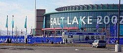
The city began to experience rapid growth in the 1970s, when the area that is now West Valley City consisted of the four separate communities of Hunter, Granger, Chesterfield, and Redwood. These four unincorporated areas merged in 1980 to form the present-day city. During the 2002 Olympic Winter Games, West Valley City was the official venue for men's and women's ice hockey.

On May 19, 2011, the city unveiled an official plan to create a downtown area for the city over the course of 10 years, building on plans and development that already existed. It will be known as Fairbourne Station (named after Joseph Fairbourne, an early settler who operated a weigh station in the area in the late 19th century) and will consist of approximately 40 acres (16 ha), costing $500 million to build. The center will include a civic center (consisting of city hall, a courthouse, police headquarters, and a library), an eight-story Embassy Suites hotel, a plaza, and residential development, as well as the end of the TRAX Green Line, and a stop on the 3500 South MAX bus rapid transit line. Valley Fair Mall and the Maverik Center are located nearby, as is I-215. As of 2016, the development is incomplete with the TRAX line having opened in 2011 and the hotel in 2012, but the City Hall and the government center still under construction. [9] [10]

Serial killer Ted Bundy was arrested in Granger on August 16, 1975, on a routine traffic stop. [11]

Geography

According to the United States Census Bureau, the city has a total area of 35.5 square miles (91.8 km2), of which 35.4 square miles (91.7 km2) is land and 0.1 square miles (0.2 km2) (0.17%) is water.

West Valley is located on the northwest side of the Salt Lake Valley between Salt Lake City on the north, South Salt Lake on the east, Magna Township on the west, and Taylorsville and Kearns Township on the south. The Oquirrh Mountains loom over the city to the west, while the Jordan River marks the eastern boundary.

Government

Elected officials of West Valley City as of 2022
OfficialPositionTerm ends
Karen Lang [2] Mayor
City Council members
Don ChristiansenAt-large2023
Lars NordfeltAt-large2025
Tom HuynhDistrict 12023
Scott HarmonDistrict 22025
William WhetstoneDistrict 32023
Jake FitisemanuDistrict 42025

West Valley City has a nonpartisan, strong city manager form of government, which means that the city manager is analogous to a corporation's CEO, while the mayor fills a role similar to chairman of the board, with the City Council acting as the "board". The mayor is a voting member of the City Council. The West Valley City Council meets each Tuesday night at 6:30 PM, except fifth Tuesdays. City Hall is located at 3600 South Constitution Boulevard.

The mayor and six councilors are elected to four-year terms. Mayoral elections are held the same year as three of the councilors. The other three councilors are staggered two years from the mayoral. Two council seats are at-large, or citywide, and the remaining four seats represent districts of approximately 28,000 residents. Officials are not subject to term limits. As of November 2013, the most recent election was held in November, 2013. [12]

In the Utah State Legislature, West Valley City is in Senate Districts 1, 3, 5, and 12 represented by Democrat Luz Escamilla, Democrat Gene Davis, Democrat Karen Mayne, and Republican Daniel Thatcher and House Districts 30, 31, and 33, represented by Republican Fred Cox, Republican Sophia DiCaro, and Republican Craig Hall. Federally, West Valley City lies in the 2nd and 4th congressional districts, represented by Republican Chris Stewart and Democrat Ben McAdams. [13]

Police

West Valley City police car, April 2017 West Valley City police car (33578466224).jpg
West Valley City police car, April 2017

The West Valley City Police Department (WVCPD) provides law enforcement services to the city. [14] As of 2021 the police chief is Colleen Jacobs, a 21 year veteran of the department, who oversees 218 sworn officers and 47 support staff. [15] [16]

In 2013, the city police's narcotics unit was disbanded after an officer-involved critical incident revealed drugs and money had not been booked into evidence. Officers in the unit were also found to be keeping change and small items from seized vehicles, and placing tracking devices on potential suspects' vehicles without warrants. [17]

In 2016, Officer Cody Brotherson was killed in the line of duty, the department's only such fatality. [18]

In 2019, an officer shot and killed a handcuffed man who was attempting to pull an officer's gun out of its holster: this killing was found legally justified by the district attorney. [19]

Demographics

Historical population
CensusPop.Note
1980 72,299
1990 86,97620.3%
2000 108,89625.2%
2010 129,48018.9%
2020 140,2308.3%
source: [4] [20] [21]

2020 census

West Valley City, Utah – Racial and ethnic composition
Note: the US Census treats Hispanic/Latino as an ethnic category. This table excludes Latinos from the racial categories and assigns them to a separate category. Hispanics/Latinos may be of any race.
Race / Ethnicity (NH = Non-Hispanic)Pop 2000 [22] Pop 2010 [23] Pop 2020 [24] % 2000% 2010% 2020
White alone (NH)76,54569,49861,00470.29%53.67%43.50%
Black or African American alone (NH)1,0902,2543,7201.00%1.74%2.65%
Native American or Alaska Native alone (NH)1,0141,1371,2310.93%0.88%0.88%
Asian alone (NH)4,6146,3037,9204.24%4.87%5.65%
Pacific Islander alone (NH)3,1184,6476,3342.86%3.59%4.52%
Other race alone (NH)752844430.07%0.22%0.32%
Mixed race or Multiracial (NH)2,3142,4654,3002.12%1.90%3.07%
Hispanic or Latino (any race)20,12642,89255,27818.48%33.13%39.42%
Total108,896129,480140,230100.00%100.00%100.00%

According to estimates from the U.S. Census Bureau, [25] as of 2018, there were 136,401 people in West Valley City. The racial makeup of the city was 46.5% non-Hispanic White, 2.3% Black, 1.1% Native American, 6.0% Asian, 3.9% Pacific Islander, and 4.2% from two or more races. 38.1% of the population were Hispanic or Latino of any race.

As of the census of 2010, there were 129,480 people, 38,535 households, and 34,900 families residing in the city. The population density was 3,647.32 people per square mile (2,266.35/km2). There were 38,978 housing units at an average density of 1,097.97 per square mile (682.25/km2). The racial makeup of the city was 65.37% White, 1.96% African American, 1.26% Native American, 4.97% Asian, 3.64% Pacific Islander, 18.96% from other races, and 3.85% from two or more races. Hispanic or Latino of any race were 33.13% of the population.

There were 38,535 households, out of which 47.1% had children under the age of 18 living with them, 61.3% were married couples living together, 13.2% had a female householder with no husband present, and 19.6% were non-families. 14.7% of all households were made up of individuals, and 3.9% had someone living alone who was 65 years of age or older. The average household size was 3.36 and the average family size was 3.71.

In the city, the population was spread out, with 33.7% under the age of 18, 12.9% from 18 to 24, 30.7% from 25 to 44, 17.4% from 45 to 64, and 5.4% who were 65 years of age or older. The median age was 27 years. For every 100 females, there were 102.3 males. For every 100 females age 18 and over, there were 100.5 males.

The median income for a household in the city was $45,773, and the median income for a family was $48,593. Males had a median income of $32,116 versus $22,693 for females. The per capita income for the city was $15,031. About 6.7% of families and 8.7% of the population were below the poverty line, including 11.0% of those under age 18 and 3.5% of those age 65 or over.

A stake center of the Church of Jesus Christ of Latter-day Saints in West Valley, Utah. LDS stake center in West Valley City, Utah (cropped).jpg
A stake center of the Church of Jesus Christ of Latter-day Saints in West Valley, Utah.

Economy

Companies based in West Valley City include Backcountry.com, C.R. England, FranklinCovey, and USANA Health Sciences.

Top employers

According to the City's 2017 Comprehensive Annual Financial Report, [26] these are the top employers in the city:

#Employer# of Employees
1 Discover Financial 4,200
2 United Parcel Service 1,320
3 Swift Transportation 1,118
4 Select Portfolio Servicing 987
5 Hexcel 953
6 Verizon Wireless 916
7 West Valley City 909
8 Sutter Health 804
9 USANA Health Sciences 778
10 Walmart 629
11Jacobsen Construction616
12Pride Transport606
13 Six Continents 587
14 C.R. England 544
15Wheeler CAT 520
16 ATK Launch Systems 452
17 Old Dominion Freight Line 441
18 Jordan Valley Medical 418
19 Zions Bank Commercial414
20 Freightliner of Utah402
21Hunt Electric397
22 Federal Express 396
23 Zions Bank Data366
24 YRC Worldwide 360
25 ADP 338

Education

The city lies in the Granite School District. It has 21 elementary schools, four junior high schools, and two high schools - Granger Senior High, which opened in 1958, and Hunter, which opened in 1990. The city also contains multiple charter schools: East Hollywood High School, a charter school specializing in film education; American Preparatory Academy; and Monticello Academy.

Transportation

The West Valley Central Green Line station. 35 MAX - Magna to Millcreek bus.jpg
The West Valley Central Green Line station.
A continuous-flow intersection on the Bangerter Highway in West Valley City. Intersection continuous flow.jpg
A continuous-flow intersection on the Bangerter Highway in West Valley City.

West Valley City is on the same address grid system as Salt Lake City, and therefore follows the same street numbering system. I-215 runs through eastern portions of the city parallel to I-15, which lies farther east of the city. The SR-201 freeway lies along the northern border with Salt Lake City and continues west into Magna as an expressway. Bangerter Highway, which runs south from Salt Lake City International Airport, traverses the approximate center of the city and services the rapidly growing western and southern ends of the valley. The Mountain View Corridor also runs through the western portion of the city. The city is served by several bus routes operated by the Utah Transit Authority, and an intermodal transportation hub located in the city center near Valley Fair Mall and the Maverik Center. In addition to local bus routes, the West Valley Intermodal Hub is serviced by TRAX light rail and MAX bus rapid transit (BRT) lines. The 3500 South MAX BRT line began service in 2008 [27] and the TRAX Green Line to the intermodal hub was completed and began service in 2011. [28]

Sports and entertainment

Rush playing at the USANA Amphitheatre in 2007. Rush at USANA Amphitheater.jpg
Rush playing at the USANA Amphitheatre in 2007.

West Valley City is home to the Maverik Center and the Utah Grizzlies of the ECHL along with the Salt Lake City Stars of the NBA G League. It is also home to the Utah Cultural Celebration Center, Stonebridge Golf Course, The Ridge Golf Course, Rocky Mountain Raceways, USANA Amphitheatre, and the Valley Fair Mall. West Valley City is also home to The Drive-in.

Neighborhoods

Chesterfield, Redwood, Westshire, East Granger (84119)

The Eastern side of West Valley City consists of the Redwood, Chesterfield and East Granger neighborhoods. The neighborhood population in 2013 was 54,832. This area of West Valley City has a median household income of $42,512, which is lower when compared to the rest of the city and region. The neighborhood's racial makeup was 51.17% White, 35.08% Hispanic or Latino, 4.73% Asian, 3.24% Native Hawaiian and Other Pacific Islander and 2.51% African-American. [29]

Much of Eastern West Valley's residential architecture is based on common brick ranch styles from the 1960s and 1970s. To the north of Parkway Boulevard exists a significant number of light industrial development. South of Parkway is mostly residential and commercial, including Valley Fair Mall and the Maverik Center. The Westshire neighborhood is located directly south of Valley Fair Mall and consists of 160 homes built by modernist architect Ron Molen. This neighborhood is unique in that all homes were built in the 1960s and 1970s in the Mid-Century Modern style and are excellent examples of modernist residential architecture. [30] West Valley City planners are currently developing a planned mass-transit anchored Downtown area near the Valley Fair Mall with the emergence of the Fairbourne Station as a gathering place and revitalization of the mall. [31]

West Granger, Hunter, Lakepark (84120)

The Central portion of West Valley City consists of the West Granger and Hunter, south of 3100 South, with the Lakepark and Westlake Business Park commercial and office developments taking up the majority of the space north of 3100 South. The neighborhood population in 2013 was 49,107. This area of West Valley City has a median household income of $55,087, which is typical for the state of Utah and Northern Salt Lake County. The neighborhood's racial makeup was 53.82% White, 32.11% Hispanic or Latino, 5.04% Asian, 4.54% Native Hawaiian and Other Pacific Islander and 1.57% African-American. [32]

Much of Central West Valley's residential architecture is based on common brick ranch styles from the 1960s and 1970s. The Highbury planned development is currently being established in the northwestern portion of this area. This is a large planned mixed residential and commercial area with a large pond and many casual restaurants in a walk-able district near 5600 West.

West Hunter, Woodhaven, Oquirrh (84128)

The western portion of West Valley City consists of the West Hunter, Woodhaven, and Oquirrh neighborhoods. The neighborhood population in 2013 was 28,475. This area of West Valley City has a median household income of $64,356, which is slightly higher than the median for both the state of Utah and Salt Lake County. The neighborhood's racial makeup was 60.65% White, 29.62% Hispanic or Latino, 3.15% Asian, 2.37% Native Hawaiian and Other Pacific Islander and 1.39% African-American. [33]

Much of western West Valley's residential architecture is based on 1990s and 2000s planned developments. The majority of the neighborhood is residential, with the exception of many strip-mall style commercial developments along its eastern border of 5600 West. The city's master plan calls for a Hunter Town Center development near the intersection of 5600 West and 3500 South, but no structures have yet been developed specifically for this. [34] This side of West Valley City is also home to USANA Amphitheater, though it technically shares the 84118 zip code with Kearns and Taylorsville, rather than West Valley City.

Key to the City

West Valley City has presented the Key to the city to several visiting dignitaries. Past recipients have included Mayor Yéah Samaké of Ouélessébougou, Mali; Governor of Chiapas Juan Sabines Guerrero; and United States Secretary of State Hillary Clinton. [35] The key was awarded to Tongan queen mother Halaevalu Mataʻaho ʻAhomeʻe on July 28, 2011, when she visited the city for the rededication of the Tongan United Methodist Church. [35] It was also presented by Mayor Mike Winder on December 14, 2011 to Axl Rose of Guns N' Roses when they performed in the Maverik Center the day after it was announced that the band was to be inducted into the Rock and Roll Hall of Fame. [36]

Sister cities

West Valley City has sister cities, as designated by Sister Cities International:

Notable people

See also

Related Research Articles

<span class="mw-page-title-main">Orem, Utah</span> City in Utah, United States

Orem is a city in Utah County, Utah, United States, in the northern part of the state. It is adjacent to Provo, Lindon, and Vineyard and is approximately 45 miles south of Salt Lake City.

<span class="mw-page-title-main">Salt Lake City</span> State capital and largest city of Utah, United States

Salt Lake City, often shortened to Salt Lake or SLC, is the capital and most populous city of the U.S. state of Utah. It is the seat of Salt Lake County, the most populous county in the state. The city is the core of the Salt Lake City Metropolitan Statistical Area (MSA), which had a population of 1,257,936 at the 2020 census. Salt Lake City is further situated within a larger metropolis known as the Salt Lake City–Ogden–Provo Combined Statistical Area, a corridor of contiguous urban and suburban development stretched along a 120-mile (190 km) segment of the Wasatch Front, comprising a population of 2,746,164, making it the 22nd largest in the nation. With a population of 200,133 in 2020, it is the 117th most populous city in the United States. It is also the central core of the larger of only two major urban areas located within the Great Basin.

<span class="mw-page-title-main">Salt Lake County, Utah</span> County in Utah, United States

Salt Lake County is located in the U.S. state of Utah. As of the 2020 United States census, the population was 1,185,238, making it the most populous county in Utah. Its county seat and largest city is Salt Lake City, the state capital. The county was created in 1850. Salt Lake County is the 37th most populated county in the United States and is one of four counties in the Rocky Mountains to make it into the top 100. Salt Lake County has been the only county of the first class in Utah – under the Utah Code is a county with a population of 700,000 or greater. Although, Utah County directly to the south has recently reached this threshold.

<span class="mw-page-title-main">Weber County, Utah</span> County in Utah, United States

Weber County is a county in the U.S. state of Utah. As of the 2020 census, the population was 262,223, making it Utah's fourth-most populous county. Its county seat and largest city is Ogden, the home of Weber State University. The county was named after a fur trapper John Weber.

<span class="mw-page-title-main">Provo, Utah</span> City in Utah, United States

Provo is a city in and the county seat of Utah County, Utah, United States. It is 43 miles (69 km) south of Salt Lake City along the Wasatch Front, and lies between the cities of Orem to the north and Springville to the south. With a population at the 2020 census of 115,162, Provo is the fourth-largest city in Utah and the principal city in the Provo-Orem metropolitan area, which had a population of 526,810 at the 2010 census. It is Utah's second-largest metropolitan area after Salt Lake City.

<span class="mw-page-title-main">Layton, Utah</span> City in Utah, United States

Layton (/ˈleɪʔɪn/) is a city in Davis County, Utah, United States. It is part of the Ogden-Clearfield Metropolitan Statistical Area. As of the 2020 census, the city had a population of 81,773, with 2022 Census Bureau estimates showing an increase to 82,601. 2024 estimates place Layton's population at 87,392. Layton is the most populous city in Davis County and the ninth most populous in Utah.

<span class="mw-page-title-main">Fillmore, Utah</span> City in Utah, United States

Fillmore is a city and the county seat of Millard County, Utah, United States. The population was 2,592 at the 2020 United States Census. It is named for the thirteenth U.S. President Millard Fillmore, who was in office when Millard County was created by the Utah Territorial legislature.

<span class="mw-page-title-main">Magna, Utah</span> Metro Township in Utah, United States

Magna is a metro township in Salt Lake County, Utah, United States. The current population of the township stands at 29,251 according to the 2020 census, a 10.4% increase over 26,505 in 2010.

<span class="mw-page-title-main">Midvale, Utah</span> City in Utah, United States

Midvale City is located in the heart of Salt Lake County, Utah, United States. It is part of the Salt Lake City metropolitan area. Midvale's population was 34,124 according to 2019 estimates from the U.S. Census Bureau.

<span class="mw-page-title-main">Murray, Utah</span> City in Utah, United States

Murray is a city situated on the Wasatch Front in the core of Salt Lake Valley in the U.S. state of Utah. Named for territorial governor Eli Murray, and according to the 2020 census, Murray had a population of 50,637. Murray shares borders with Taylorsville, Holladay, South Salt Lake, Millcreek and West Jordan, Utah. Once teeming with heavy industry, Murray's industry mix has now shifted significantly toward healthcare, retail, and professional, scientific, and technical services. Known for its central location in Salt Lake County, Murray has been called the Hub of Salt Lake County. Unlike most of its neighboring communities, Murray operates its own police, fire, power, water, library, and parks and recreation departments and has its own school district. While maintaining many of its own services, Murray has one of the lowest city tax rates in the state.

<span class="mw-page-title-main">Sandy, Utah</span> City in Salt Lake County, Utah, United States

Sandy is a city in the Salt Lake City metropolitan area, located in Salt Lake County, Utah, United States. The population was 96,904 according to the 2020 United States Census.

<span class="mw-page-title-main">South Jordan, Utah</span> City in Salt Lake County, Utah, United States

South Jordan is a city in south central Salt Lake County, Utah, United States, 18 miles (29 km) south of Salt Lake City. Part of the Salt Lake City metropolitan area, the city lies in the Salt Lake Valley along the banks of the Jordan River between the 10,000-foot (3,000 m) Oquirrh Mountains and the 11,000-foot (3,400 m) Wasatch Mountains. The city has 3.5 miles (5.6 km) of the Jordan River Parkway that contains fishing ponds, trails, parks, and natural habitats. The Salt Lake County fair grounds and equestrian park, 67-acre (27 ha) Oquirrh Lake, and 37 public parks are located inside the city. As of 2020, there were 77,487 people in South Jordan.

<span class="mw-page-title-main">South Salt Lake, Utah</span> City in Utah, United States

South Salt Lake is a city in Salt Lake County, Utah, United States and is part of the Salt Lake City Metropolitan Statistical Area. The population was 23,617 at the 2010 census.

<span class="mw-page-title-main">West Jordan, Utah</span> City in Utah, United States

West Jordan is a city in Salt Lake County, Utah, United States. It is a suburb of Salt Lake City. According to the 2020 Census, the city had a population of 116,961, placing it as the third most populous in the state. The city occupies the southwest end of the Salt Lake Valley at an elevation of 4,330 feet (1,320 m). Named after the nearby Jordan River, the limits of the city begin on the river's western bank and end in the eastern foothills of the Oquirrh Mountains, where Kennecott Copper Mine, the world's largest man-made excavation, is located.

<span class="mw-page-title-main">St. George, Utah</span> City in Utah, United States

St. George is a city in and the county seat of Washington County, Utah, United States. Located in southwestern Utah on the Arizona border, it is the principal city of the St. George Metropolitan Statistical Area (MSA). The city lies in the northeasternmost part of the Mojave Desert, immediately south of the Pine Valley Mountains, which mark the southern boundary of the Great Basin. St. George lies slightly northwest of the Colorado Plateau, which ends at the Hurricane Fault. The city is 118 miles (190 km) northeast of Las Vegas, Nevada, and 300 miles (480 km) south-southwest of Salt Lake City, Utah, on Interstate 15.

<span class="mw-page-title-main">Ogden, Utah</span> City in Utah, United States

Ogden is a city in and the county seat of Weber County, Utah, United States, approximately 10 miles (16 km) east of the Great Salt Lake and 40 miles (64 km) north of Salt Lake City. The population was 87,321 in 2020, according to the US Census Bureau, making it Utah's eighth largest city. The city served as a major railway hub through much of its history, and still handles a great deal of freight rail traffic which makes it a convenient location for manufacturing and commerce. Ogden is also known for its many historic buildings, proximity to the Wasatch Mountains, and as the location of Weber State University.

<span class="mw-page-title-main">Blue Line (TRAX)</span> Light rail line in Salt Lake City, Utah, USA

The Blue Line is a light rail line on the TRAX system in the Salt Lake Valley of Utah, in the United States, operated by the Utah Transit Authority (UTA). It is the first line of the TRAX system completed. The line opened on December 4, 1999, one year ahead of schedule after two years of construction. In addition to Salt Lake City, it also serves the communities of South Salt Lake, Murray, Midvale, Sandy and Draper. The line was known as the North/South Line or the Sandy/Salt Lake Line until color names were adopted for each TRAX line in August 2011. An extension of the line to Draper began service on August 18, 2013.

<span class="mw-page-title-main">Salt Lake City metropolitan area</span> Metropolitan area in Salt Lake and Tooele counties in Utah, United States

The Salt Lake City metropolitan area is the metropolitan area centered on the city of Salt Lake City, Utah. The Office of Management and Budget and the United States Census Bureau currently define the Salt Lake City, Utah Metropolitan Statistical Area as comprising two counties: Salt Lake and Tooele. As of the 2020 census, the MSA had a population of 1,257,936. The Salt Lake City Metropolitan Area and the Ogden-Clearfield Metropolitan Area were a single metropolitan area known as the Salt Lake City-Ogden Metropolitan Area until being separated in 2005.

<span class="mw-page-title-main">Green Line (TRAX)</span> Light rail line in Salt Lake City, Utah, US

The Green Line is a light rail line on the Utah Transit Authority's (UTA) TRAX system in Salt Lake City, Utah, in the United States, operated by the Utah Transit Authority (UTA). It opened on August 7, 2011, and runs between Airport Station at the Salt Lake City International Airport and West Valley Central Station in West Valley City serving a total of eighteen stations: thirteen in Salt Lake City, one in South Salt Lake, and four in West Valley City.

<span class="mw-page-title-main">West Valley Central station</span> Light rail station in Utah

West Valley Central station is a light rail station in West Valley City, Utah served by the Green Line of the Utah Transit Authority's (UTA) TRAX light rail system. The Green Line provides service from the Salt Lake City International Airport to this station.

References

  1. "About Us". West Valley City, Utah. Retrieved August 14, 2018.
  2. 1 2 "Mayor Karen Lang | West Valley City, UT - Official Site".
  3. "2019 U.S. Gazetteer Files". United States Census Bureau. Retrieved August 7, 2020.
  4. 1 2 3 "QuickFacts West Valley City city, Utah". United States Census Bureau. Retrieved January 31, 2022.
  5. "U.S. Census website". United States Census Bureau . Retrieved January 31, 2008.
  6. "US Board on Geographic Names". United States Geological Survey. October 25, 2007. Retrieved January 31, 2008.
  7. Jenson, Andrew. Encyclopedic History of the Church of Jesus Christ of Latter-day Saints. (Salt Lake City: Deseret News Press, 1941) p. 295
  8. Jenson. Encyclopedic History. p. 346
  9. New name for WVC project: Fairbourne Station. The Salt Lake Tribune. May 19, 2011.
  10. "Official Fairbourne Station Web Site". Wvc-ut.org. Retrieved August 27, 2017.
  11. "Officer recalls Bundy's '75 capture". DeseretNews.com. August 20, 2000. Retrieved April 21, 2017.
  12. Manson, Pamela (November 5, 2013). "Bigelow wins West Valley City mayor's race by large margin". The Salt Lake Tribune. Retrieved November 19, 2013.
  13. "Utah State Legislature" . Retrieved June 9, 2015.
  14. "West Valley City Police Department - Welcome Banner | West Valley City, UT - Official Site".
  15. "Inside the Police Department". West Valley City Police Department. Retrieved July 24, 2021.
  16. "'We're going to improve,' says new West Valley police chief".
  17. Jack Healy (May 17, 2013). "A 'Pandora's Box of Problems' From a Police Shooting and Drugs in a Utah Town". The New York Times . Retrieved August 27, 2017.
  18. "West Valley City Police Department". Officer Down Memorial Page. Retrieved July 24, 2021.
  19. "'A disturbing shooting': Salt Lake County district attorney says officer was justified in killing handcuffed man". The Salt Lake Tribune. Retrieved October 26, 2021.
  20. "CENSUS OF POPULATION AND HOUSING (1790-2000)". U.S. Census Bureau . Retrieved July 17, 2010.
  21. Census number enumerated in 1980 prior to incorporation as West Valley CDP .
  22. "P004: Hispanic or Latino, and Not Hispanic or Latino by Race – 2000: DEC Summary File 1 – West Valley City, Utah". United States Census Bureau.
  23. "P2: Hispanic or Latino, and Not Hispanic or Latino by Race – 2010: DEC Redistricting Data (PL 94-171) – West Valley City, Utah". United States Census Bureau.
  24. "P2: Hispanic or Latino, and Not Hispanic or Latino by Race – 2020: DEC Redistricting Data (PL 94-171) – West Valley City, Utah". United States Census Bureau.
  25. "U.S. Census Bureau QuickFacts". U.S. Census Bureau. Retrieved January 10, 2020.
  26. "City of West Valley City CAFR". Wvc-ut.gov. Retrieved May 22, 2018.
  27. Warburton, Nicole (February 3, 2008). "UTA plans bus rapid-transit line". Deseret News . Salt Lake City: Deseret Digital Media . Retrieved March 28, 2013.
  28. Fidel, Steve (October 1, 2010). "2011 completion date for two TRAX lines announced". Deseret News . Salt Lake City: Deseret Digital Media . Retrieved March 7, 2013.
  29. "West Valley City, UT-84119". City-Data.com.
  30. "Ron Molen" (PDF). PreservationUtah.
  31. "West Valley City Downtown Revitalization". KSL.
  32. "West Valley City, UT-84120". City-Data.com.
  33. "West Valley City, UT-84128". City-Data.com.
  34. "Hunter Town Center Small Area Plan". West Valley City.
  35. 1 2 "Tonga's Queen Mother coming to West Valley City to rededicate Methodist church". Salt Lake Tribune . July 29, 2011. Retrieved July 31, 2011.
  36. Blabbermouth (December 14, 2011). "GUNS N' ROSES Frontman Presented With Key To West Valley City". BLABBERMOUTH.NET. Retrieved August 27, 2017.
  37. "Minnesota Vikings: Naufahu Tahi". Vikings.com. Archived from the original on 28 August 2017. Retrieved 27 August 2017.
  38. "Ray Feinga Biography". ESPN. Retrieved March 14, 2023.
  39. "FOX Broadcasting Company - Tadd Gadduang - So You Think You Can Dance - Official Site". Archived from the original on August 18, 2011. Retrieved August 17, 2011.
  40. "W.V. TEEN WAS SHOWTIME HOSTESS FOLLOWING NATIONWIDE COMPETITION". Deseret News . April 21, 1989.

Wikivoyage-Logo-v3-icon.svg West Valley City travel guide from Wikivoyage