Valiacode

Last updated

Valiacode
village
India Kerala location map.svg
Red pog.svg
Valiacode
Location in Kerala, India
India location map.svg
Red pog.svg
Valiacode
Valiacode (India)
Coordinates: 11°34′33″N75°44′02″E / 11.575898°N 75.73391°E / 11.575898; 75.73391 Coordinates: 11°34′33″N75°44′02″E / 11.575898°N 75.73391°E / 11.575898; 75.73391
CountryFlag of India.svg  India
State Kerala
District Kozhikode
Languages
  Official Malayalam, English
Time zone UTC+5:30 (IST)
PIN
673 524
Vehicle registration KL-11
Website www.kozhikode.nic.in

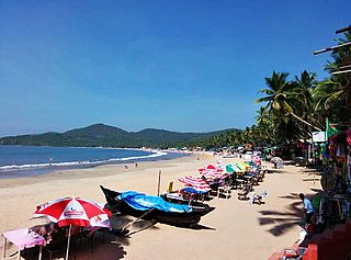
Valiacode is a small village of kozhikode district in nochad gramapanchayath. It is in Perambra assembly constituency and Vatakara Lok sabha constituency.

Kozhikode Metropolis in Kerala, India

Kozhikode, also known as Calicut, is a city in Kerala, India and the headquarters of the Kozhikode district. The Kozhikode metropolitan area is the second largest urban agglomeration in Kerala with a population of 2 million as of 2011. The city lies about 276 km south west of Bangalore, 235 km south of Mangalore and 525 km south west of Chennai.

Nochad is a village in Kozhikode district in the state of Kerala, India.

Perambra City in Kerala, India

Perambra is a major town in Koyilandy taluk of Kozhikode district in North Malabar region of Kerala state, India. There is a high demand from people to allow Perambra as a Taluk and Municipality. This is one of the 140 assembly constituencies in Kerala, and one of the 12 block Panchayats in Kozhikode district. Perambra lies almost at the centre of the district.

Contents

Education

Valiacode AUP school is an educational institution in Thamarassery educational district and is in the heart of Valiacode. This school conducts classes from LKG to Seventh. This school provides the opportunity to study for students from nearest areas like Nochad, Akkoopparambu, Edakkayil. Twenty nine teachers serve more than 600 pupils. This school also provides a great atmosphere to develop the extra curricular activities of the students.

School Institution for the education of students by teachers

A school is an educational institution designed to provide learning spaces and learning environments for the teaching of students under the direction of teachers. Most countries have systems of formal education, which is commonly compulsory. In these systems, students progress through a series of schools. The names for these schools vary by country but generally include primary school for young children and secondary school for teenagers who have completed primary education. An institution where higher education is taught, is commonly called a university college or university, but these higher education institutions are usually not compulsory.

Thamarassery Town in Kerala, India

Thamarassery, formerly known as Thazhmalachery, is a major town and bishopric in the Kozhikode district of Kerala, India, 30 km east of Kozhikode (Calicut) City and 29kms east of Koilandy. It lies on the Calicut - Wayanad - Mysore route.

Heart organ for the circulation of blood in animal circulatory systems

The heart is a muscular organ in most animals, which pumps blood through the blood vessels of the circulatory system. Blood provides the body with oxygen and nutrients, as well as assisting in the removal of metabolic wastes. In humans, the heart is located between the lungs, in the middle compartment of the chest.

It is next to the Pothujana vayanasala valiacode which is a great collection of various varieties of books which is the finding point of many students from the nearest areas.

Location

Valiacode is well connected with Nochad, Meppayyur and Perambra, the main towns of the region, by road. Perambra to Vatakara State Highway passes through the center of valiacode. The nearest airport is Calicut International Airport and the nearest railway station is Koyilandy.g

Vatakara Municipality in Kerala, India

Vatakara, also spelled Vadakara, is a coastal town in the Kozhikode district, state of Kerala, India. Spread over an area of 23.33 km2, the municipality of Vadakara is bordered by Mahe in the north, and Payyoli towards South. It is also the headquarters of Vatakara taluk, which consists of 22 panchayats. Historically, Vatakara has been known as Kadathanadu during the reign of Kolathiris and Zamorins, and later as part of North Malabar region of Malabar District in the state of Madras during British Raj. The historic Lokanarkavu temple, which is also famous through the Vadakkan Paatukal is situated in Vatakara.

Calicut International Airport airport in Malappuram, Kerala, India

Calicut International Airport, also known as Karipur Airport, is an international airport serving the cities of Kozhikode and Malappuram in Kerala, India. The airport opened on 13 April 1988. It is located in Karipur, about 28 km (17 mi) from Kozhikode and 25 km (16 mi) from Malappuram. The airport serves as an operating base for Air India Express. It was the twelfth-busiest airport in India in terms of overall passenger traffic. It is the third-busiest airport in Kerala after Kochi and Thiruvananthapuram. It was given international airport status on 2 February 2006.

Economy

People here are mainly engaged in agriculture mainly paddy, banana and tapioca. Coconut farming also is a main source of income. The canal from Peruvannamoozhi is a major attraction and a consolation for the farmers there. Lots of people from Valiacode work abroad such as in gulf countries, is one of the major income which is changing the face of the village nowadays.

Tapioca starch extracted from cassava root (Manihot esculenta)

Tapioca is a starch extracted from the storage roots of the cassava plant. This species is native to the north region and central-west region of Brazil, but its use spread throughout South America. The plant was carried by Portuguese and Spanish explorers to most of the West Indies and Africa and Asia. It is a perennial shrub adapted to the hot conditions of tropical lowlands. Cassava copes better with poor soils than many other food plants.

Coconut species of plant

The coconut tree is a member of the palm tree family (Arecaceae) and the only known living species of the genus Cocos. The term "coconut" can refer to the whole coconut palm, the seed, or the fruit, which botanically is a drupe, not a nut. The term is derived from the 16th-century Portuguese and Spanish word coco, meaning "head" or "skull" after the three indentations on the coconut shell that resemble facial features.

Canal Man-made channel for water

Canals, or navigations, are human-made channels, or artificial waterways, for water conveyance, or to service water transport vehicles.

Transportation

Valiacodevillage connects to other parts of India through Vatakara city on the west and Kuttiady town on the east. National highway No.66 passes through Vatakara and the northern stretch connects to Mangalore, Goa and Mumbai. The southern stretch connects to Cochin and Trivandrum. The eastern Highway going through Kuttiady connects to Mananthavady, Mysore and Bangalore. The nearest airports are at Kannur and Kozhikode. The nearest railway station is at Vatakara.

Kuttiady Town in Kerala, India

Kuttiady is a Town in the northern part of Kozhikode district in North Malabar region Kerala state, India. It is 24 km from Vatakara and 13 km from Permbra.

Mangalore Corporation City in Karnataka, India

Mangalore, officially known as Mangaluru, is the chief port city of the Indian state of Karnataka. It is located about 352 km (219 mi) west of the state capital, Bangalore, between the Arabian Sea and the Western Ghats mountain range. It is the second major city in Karnataka state in all aspects after the capital city Bangalore. It is the only city in Karnataka to have all modes of transport — Air, Road, Rail and Sea along with 5 other major cities in India. It is also known as the Gateway of Karnataka. It is the largest city in the Tulu Nadu region of Karnataka. Mangalore is the second best business destination in Karnataka after Bangalore & 13th best in India. The population of the urban agglomeration was 623,841, according to the provisional results of the 2011 national census of India.

Goa State in India

Goa is a state on the southwestern coast of India within the region known as the Konkan, separated from the Deccan highlands of the state of Karnataka by the Western Ghats. It is bounded by Maharashtra to the north and Karnataka to the east and south, with the Arabian Sea forming its western coast. It is India's smallest state by area and the fourth-smallest by population. Goa has the highest GDP per capita among all Indian states, two and a half times that of the country. It was ranked the best-placed state by the Eleventh Finance Commission for its infrastructure and ranked on top for the best quality of life in India by the National Commission on Population based on the 12 Indicators.

Related Research Articles

Villiappally village in Kerala, India

Villiappally is a census town in Kozhikode district in the Indian state of Kerala. Villiappally is the headquarters of Villiappally Panchayath, which contains two villages, Memunda and Villiappally mayyannur. There is a Vocational Higher Secondary School in this village.and 4 Lp school and 3 up school.Doctors Usman kakkat, vivek Kakkat and Afsal arafa are born in this village.

Thottilpalam Town in Kerala, India

Thottilpalam is a major town in north east of Kozhikode district, Kerala, in southwest India. It is under Nadapuram assembly constituency. State Highway 54 to Wayanadu district passes through this town. It is 29 km from Vatakara. Thottilpalam is the main town in Kavilumpara panchayath. Arjuna Award winner Tom Joseph is from the nearest village Poothampara.

Meppayur Census town in Kerala, India

Meppayur is an important place and town in Kozhikode district of Kerala state, South India.

Chakkittapara town in Kerala, India

Chakkittapara is a panchayat as well as a town in the Kozhikode district of Kerala state, India. Chakkittapara borders Wayanad district to the east. Administratively, Chakkittapara comes under the Perambra block panchayat and Koyilandy Taluk, containing 15 wards and destinations like Kulathuvayal, Peruvannamuzhi, Chempanoda, Poozhithode, Muthukadu, Koovapoyil, Narinada, Chempra, and Pannikkottoor.

Azhiyur village in Kerala, India

Azhiyur is a village in Vatakara taluk of Kozhikode district in the state of Kerala, India. Azhiyur is part of Greater Mahé Region. Mahé Railway Station is located in Azhiyur.

Eramala village in Kerala, India

Eramala is a village in Kozhikode district in the state of Kerala, India. Orkkatteri is the main town in the village. The village is also home to a popular annual celebration called Orkkatteri Chantha.

Maniyur Grama Panchayath in Kerala, India

Maniyur is a village in Kozhikode district in the state of Kerala, India.

Maruthonkara village in Kerala, India

Maruthonkara is a village and grama panchayat in Kozhikode district in the state of Kerala, India. The nearest town situated near by here is Kuttiyadi. Peruvannamuzhi, Thottilpalam, Chempanoda and Passukkadavu are near by places from here.

Thinoor is a village in Kozhikode district in the state of Kerala, India.

Puttad is a small village in KoyilandyTaluk near Perambra in Kozhikode district, Kerala, India.

Orkkatteri Town in Kerala, India

Orkkatteri is a small town in Kozhikode district in the North Malabar region of state of Kerala, India. This is the center town for Eramala grama panchayath.

Poozhithode gramam in Kerala, India

Poozhithode is a village located at the easternmost end of Calicut, Kerala, India. It is a hill country and is about 65 km from Calicut located in Chakittapara panchayath. Poozhithode has on its one side Kadunthara puzha and on the other side Wyanad forest.

Chembra is a village in Kozhikode district of Kerala state, India. Administratively, Chembra comes under the Chakkittapara panchayat, Perambra block panchayat and Koyilandy Taluk. Geographically it is close to Kulathuvayal, Chakkittapara, and Koorachundu.

Chathangottunada village in Kerala, India

Chathangottunada is a small village in Calicut district. It located in Kavilumpara panchayath. Wayanad Road goes through the town. A. J. John Memorial High School, one of the oldest education schools, is located here. Nearby towns include Thottilpalam and Kuttiyadi. The village's residents include Hindus, Christians and Muslims. The principal political parties are CPIM and the Indian National Congress.

Puliyavu is a village in Kozhikode (Calicut) district in the Indian state of Kerala. Puliyavu belongs to Chekkiad village office.

Muyippoth is the name of place, it is included in Cheruvannur Grama Panchayath, Koyilandy Thaluk. Forty percent of this area is paddy land. It is situated near the Kuttiady river. The settlements of Vadakara and Perambra are joining through it.

Kadiyangad is a village in Kozhikode district, Kerala.
References