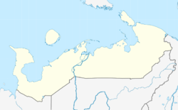
The Nenets Autonomous Okrug is a federal subject of Russia and an autonomous okrug of Arkhangelsk Oblast. Its administrative center is the town of Naryan-Mar. It has an area of 176,700 square kilometers (68,200 sq mi) and a population of 42,090 as of the 2010 Census, making it the least populous federal subject.

The Yamalo-Nenets Autonomous Okrug or Yamalia is a federal subject of Russia and an autonomous okrug of Tyumen Oblast. Its administrative center is the town of Salekhard, and its largest city is Novy Urengoy. The 2021 Russian Census recorded its population as 510,490.

Naryan-Mar is a sea and river port town and the administrative center of the Nenets Autonomous Okrug, Russia. The town is situated on the right bank of the Pechora River, 110 kilometers (68 mi) upstream from the river's mouth, on the Barents Sea. Naryan-Mar lies north of the Arctic Circle. Population: 21,658 (2010 Census); 18,611 (2002 Census); 20,182 (1989 Census); 17,000 (1973). About half of the population of Nenetsia lives in the city.

Amderma is a rural locality in Zapolyarny District of Nenets Autonomous Okrug, Russia, located on the coast of Kara Sea, near the Vaygach Island, 490 kilometers (300 mi) from Naryan-Mar, the administrative center of the autonomous okrug. Population: 541 (2010 Census); 647 (2002 Census).

Tarko-Sale is a town and the administrative center of Purovsky District in Yamalo-Nenets Autonomous Okrug, Russia. It is located on the Pyakupur River near its confluence with the Ayvasedapur river, 560 kilometers (350 mi) southeast of Salekhard the administrative center of the autonomous okrug. The population of Tarko-Sale was 20,398 (2010 Census); 18,517 (2002 Census); 17,400 (1989 Census).

Muravlenko is a town in Yamalo-Nenets Autonomous Okrug, Russia, located 480 kilometers (300 mi) southeast of Salekhard. Population: 33,391 (2010 Census); 35,926 (2002 Census).

Labytnangi is a town in Yamalo-Nenets Autonomous Okrug, Russia, located on the left bank of the Ob River, 20 kilometers (12 mi) northwest of Salekhard. Population: 26,936 (2010 Census); 27,304 (2002 Census); 31,501 (1989 Census).

Gubkinsky is a town in Yamalo-Nenets Autonomous Okrug, Russia, located on the left bank of the Pyakupur River, south of Salekhard. Population: 23,335 (2010 Census); 20,407 ; 9,676.

Zapolyarny District is an administrative and municipal district (raion), the only one in Nenets Autonomous Okrug, Russia. It encompasses all of the territory of the autonomous okrug, with the exception of the territory of the town of okrug significance of Naryan-Mar, the only other top-level administrative division of the autonomous okrug. The area of the district is approximately 170,000 square kilometers (66,000 sq mi). Its administrative center is the urban locality of Iskateley. Population: 20,432. The population of Iskateley accounts for 33.7% of the district's total population.

Purovsky District is an administrative and municipal district (raion), one of the seven in Yamalo-Nenets Autonomous Okrug of Tyumen Oblast, Russia. It is located in the center and south of the autonomous okrug. The area of the district is 108,400 square kilometers (41,900 sq mi). Its administrative center is the town of Tarko-Sale. Population: 51,280 ; 47,667 (2002 Census); 56,049 (1989 Census). The population of Tarko-Sale accounts for 39.8% of the district's total population.

Yamalsky District is an administrative and municipal district (raion), one of the seven in Yamalo-Nenets Autonomous Okrug of Tyumen Oblast, Russia. It is located in the north and northwest of the autonomous okrug. The area of the district is 117,410 square kilometers (45,330 sq mi). Its administrative center is the rural locality of Yar-Sale. Population: 16,310 ; 14,918 (2002 Census); 15,029 (1989 Census). The population of Yar-Sale accounts for 39.8% of the district's total population.

Bugrino is a village in the Nenets Autonomous Okrug, Russia, the only town of the municipality "Kolguevsky Village Council", in Kolguyev Island, Zapolyarny District. It had a population of 337 as of 2021.

Muzhi is a rural locality and the administrative center of Shuryshkarsky District of Yamalo-Nenets Autonomous Okrug, Russia, located on the bank of the Ob River. Population: 3,609 (2010 Census); 3,200 (2002 Census); 2,813 (1989 Census).

Kharp is an urban locality in the Priuralsky District of Yamalo-Nenets Autonomous Okrug, Russia, on the bank of the Sob River near the Polar Urals. Population: 6,413 (2010 Census); 7,278 (2002 Census); 5,381 (1989 Census).

Iskateley is an urban locality and the administrative center of Zapolyarny District of Nenets Autonomous Okrug, Russia. It is located on the right bank of the Pechora River, 6 kilometres (3.7 mi) from the center of the city of Naryan-Mar.

Aksarka is a rural locality and the administrative center of Priuralsky District of Yamalo-Nenets Autonomous Okrug, Russia. Population: 3,133 (2010 Census); 2,569 (2002 Census); 2,365 (1989 Census).

Pangody is an urban locality in Nadymsky District of Yamalo-Nenets Autonomous Okrug, Russia. Population: 10,805 (2010 Census); 10,868 (2002 Census); 12,635 (1989 Census).
Nes is a rural locality in Zapolyarny District, Nenets Autonomous Okrug, Russia. It had a population of 1,368 as of 2010, a decrease from its population of 1,446 in 2002.
Nelmin-Nos is a village in Zapolyarny District, Nenets Autonomous Okrug, Russia. It had a population of 916 as of 2010, a decrease from its population of 970 in 2002.

Karataika is a village in Zapolyarny District, Nenets Autonomous Okrug. It had a population of 544 as of 2010, a decrease from its population of 625 in 2002.


