Vasili, Famagusta

Last updated
Vasili
Βασίλι (Greek) Gelincik (Turkish)
Cyprus location map.svg
Red pog.svg
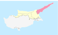
Vasili
Location in Cyprus
Coordinates: 35°28′21″N34°8′59″E / 35.47250°N 34.14972°E / 35.47250; 34.14972
Country ( de jure )Flag of Cyprus.svg  Cyprus
   District Famagusta District
Country ( de facto )Flag of the Turkish Republic of Northern Cyprus.svg  Northern Cyprus [1]
   District İskele District
Government
  MukhtarEsat Nurçin
Population
 (2011) [2]
  Total
496
Time zone UTC+2 (EET)
  Summer (DST) UTC+3 (EEST)

Vasili is a small village in the Famagusta District of Cyprus, near the villages Leonarisso and Lythragomi. It is under the de facto control of Northern Cyprus.

Climate [3]

Longitude34.1587576
Latitude35.4516433
Attitude/Elevation101.4m (332.68ft)
Annual high temperature23.19°C (73.74°F)
Annual low temperature19.35°C (66.83°F)
Average annual precip.14.36mm (0.57in)
Warmest monthAugust (31.4°C / 88.52°F)
Coldest MonthFebruary (12.4°C / 54.32°F)
Wettest MonthDecember (45.73mm / 1.8in)
Driest MonthJuly (0.06mm / 0.0in)
Number of days with rainfall (≥ 1.0 mm)31.79 days (8.71%)
Days with no rain333.21 days (91.29%)
Humidity62.4%

Related Research Articles

<span class="mw-page-title-main">Lefkoniko</span> Municipality in Famagusta District, Cyprus

Lefkoniko is a town in the Mesaoria Plain under the de facto control of Northern Cyprus, claimed by Cyprus. Lefkoniko is the birthplace of Cypriot national poet Vasilis Michaelides and is known for its lace.

Leonarisso is a village in the Famagusta District of Cyprus, located on the Karpass Peninsula. It is under the de facto control of Northern Cyprus.

<span class="mw-page-title-main">Peristeronopigi</span> Place in Famagusta District, Cyprus

Peristeronopigi or Pigi–Peristerona (Greek: Περιστερωνοπηγή;A village located in the Famagusta District of Cyprus, 6 km south of Lefkoniko, in the Mesaoria plain. Historically, Peristeronopigi consisted of two continuous villages: Peristerona in the south and Pigi in the north. Peristeronopigi is under the de facto control of Northern Cyprus. As of 2011, it had a population of 860.

Sinta is a village in the Famagusta District of Cyprus. It is under the de facto control of Northern Cyprus. The village was recorded as early as the early 13th century in papal documents.

Pyrga is a village in the Famagusta District of Cyprus, located 22 west of Famagusta on the main Nicosia-Famagusta highway. It is under the de facto control of Northern Cyprus. Today most of the village is used by the Turkish military as a military base.

Platani is a village in the Famagusta District of Cyprus, situated 9 kilometers north of Lefkoniko. Under the de facto control of Northern Cyprus, Platani is a Turkish Cypriot community with a population of 183 as of 2011. The village is renowned locally for its proximity to the stalactite cave known as "Incirli Mağra".

Limnia is a village in the Famagusta District of Cyprus, located just north of the city of Famagusta. It is under the de facto control of Northern Cyprus.

Sygkrasi or Syngrasis is a village in the Famagusta District of Cyprus, located 3 km east of Lapathos. It is under the de facto control of Northern Cyprus.

Arnadi is a village in Cyprus, located north of Famagusta. It is under the de facto control of Northern Cyprus.

Mandres is a village in the Famagusta District of Cyprus, located 12 km northwest of Trikomo. It is under the de facto control of Northern Cyprus.

<span class="mw-page-title-main">Monarga</span> Village in Famagusta District, Cyprus

Monarga is a small village in the Famagusta District of Cyprus, located 7 km northeast of Trikomo. It is under the de facto control of Northern Cyprus.

Gerani is a village in the Famagusta District of Cyprus, located 8 km (5.0 mi) northeast of Trikomo. It is under the de facto control of Northern Cyprus.

Ovgoros is a village in the Famagusta District of Cyprus, located northeast of Trikomo. It is under the de facto control of Northern Cyprus.

Vokolida is a village in the Famagusta District of Cyprus, located on the Karpas Peninsula. It is under the de facto control of Northern Cyprus.

<span class="mw-page-title-main">Koma tou Gialou</span> Village in Famagusta District, Cyprus

Koma tou Gialou is a village in the Famagusta District of Cyprus, located on the Karpas Peninsula. It is under the de facto control of Northern Cyprus, where it is part of the İskele District.

Vathylakas is a village in the Famagusta District of Cyprus, located on the Karpasia Peninsula, in the unrecognised, de facto state of Northern Cyprus.

Koilanemos is a village in the Famagusta District of Cyprus, located on the Karpas Peninsula. It is under the de facto control of Northern Cyprus.

Melanagra is a village in the Famagusta District of Cyprus, located on the Karpas Peninsula. It is under the de facto control of Northern Cyprus.

Koroveia is a village in the Famagusta District of Cyprus, located on the Karpas Peninsula. It is under the de facto control of Northern Cyprus.

Neta is a small village in the Famagusta District of Cyprus, located on the Karpas Peninsula. It is under the de facto control of Northern Cyprus.

References

  1. In 1983, the Turkish Republic of Northern Cyprus unilaterally declared independence from the Republic of Cyprus. The de facto state is not recognised by any UN state except Turkey.
  2. KKTC 2011 Nüfus ve Konut Sayımı [Northern Cyprus 2011 Population and Housing Census](PDF), Northern Cyprus State Planning Organization, 6 August 2013
  3. "Vasili, Famagusta, CY Climate Zone, Monthly Averages, Historical Weather Data". tcktcktck.org. Retrieved 2022-09-16.