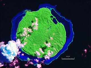
Fiji is a group of volcanic islands in the South Pacific, lying about 4,450 kilometres (2,765 mi) southwest of Honolulu and 1,770 km (1,100 mi) north of New Zealand. Of the 332 islands and 522 smaller islets making up the archipelago, about 106 are permanently inhabited. The total land size is 18,272 km2 (7,055 sq mi). It has the 26th largest Exclusive Economic Zone of 1,282,978 km2 (495,361 sq mi).

Vanua Levu, formerly known as Sandalwood Island, is the second largest island of Fiji. Located 64 kilometres to the north of the larger Viti Levu, the island has an area of 5,587.1 square kilometres (2,157.2 sq mi) and a population of 135,961 as of 2007.
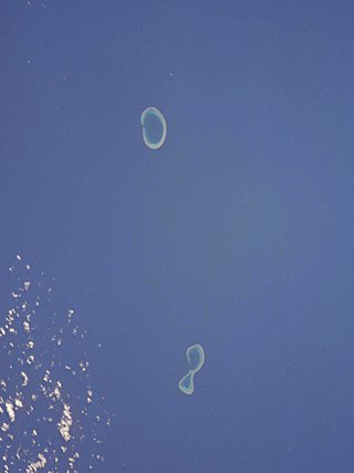
The Minerva Reefs are a group of two submerged atolls located in the Pacific Ocean between Fiji, Niue and Tonga. The islands are the subject of a territorial dispute between Fiji and Tonga, and in addition were briefly claimed by American Libertarians as the centre of a micronation, the Republic of Minerva.

The Eastern Division of Fiji is one of Fiji's four divisions. It consists of Kadavu Province, Lau Province, Lomaiviti Province and Rotuma.

Taveuni is the third-largest island in Fiji, after Viti Levu and Vanua Levu, with a total land area of 434 square kilometres. The cigar-shaped island, a massive shield volcano which rises from the floor of the Pacific Ocean, is situated 6.5 kilometres east of Vanua Levu, across the Somosomo Strait. It belongs to the Vanua Levu Group of islands and is part of Fiji's Cakaudrove Province within the Northern Division.
The Lau Islands of Fiji are situated in the southern Pacific Ocean, just east of the Koro Sea. Of this chain of about sixty islands and islets, about thirty are inhabited. The Lau Group covers a land area of 188 square miles, and had a population of 10,683 at the most recent census in 2007. While most of the northern Lau Group are high islands of volcanic origin, those of the south are mostly carbonate low islands.
Kaibu is an island in Fiji's Lau archipelago. A 22.4 kilometer-long reef encompasses Kaibu and the neighbouring island of Yacata, from which Kaibu is separated by a lagoon. The island, which has an area of about 2 square kilometers, is located 56 kilometers west of Vanua Balavu. Fishing, snorkeling, and water sports are among the tourist attractions of the island.
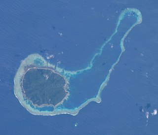
Kanacea (Kanathea) is a volcanic island with seven peaks in Fiji's Lau archipelago. It is 15 km west of Vanua Balavu. Covering an area of 12.48 square kilometres, it has a maximum elevation of 259 meters.

Vanua Balavu is the third largest island in Fiji's Lau archipelago, and the main island of the Northern Lau Group.

Wailagi Lala is the northernmost outpost of Fiji's Lau Islands. This tiny atoll, with an area of just 30 hectares and rising no more than 3 metres (10 ft) above mean sea level, is situated at 16.45° South and 179.6° West. It is the only true atoll in Fiji.
The Ringgold Isles are an archipelago in Fiji, forming an outlier group to Vanua Levu. The Budd, Nukusemanu, and Heemskercq Reefs form part of the group. The group is mostly uninhabited, but Qelelevu has a small village. In 2008 Pacific rats were eradicated from seven islands of the group in an endeavour facilitated by BirdLife International's Fiji Programme.

Qelelevu or Nggelelevu is a coral islet in Fiji, a member of the Ringgold Isles archipelago, which forms an outlier to the northern island of Vanua Levu.
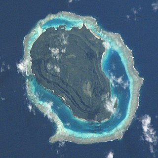
Tuvuca is a small island off Vanua Balavu in Fiji's Lau archipelago. It is a densely wooded and inhabited island and rises 800 feet above sea level at the highest point. There is only one village on the island, which has a population of around 180 people. There is a primary school. Tuvuca has untapped deposits of phosphate.

Sawana is a village on the Fijian island of Vanua Balavu, in the Lau archipelago and is part of the Tikina of Lomaloma.
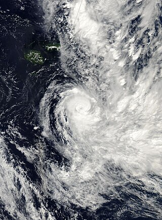
Tropical Cyclone Cliff was first noted as a weak tropical disturbance on April 1, 2007, within a trough of low pressure about 210 km (130 mi) to the southwest of Rotuma. Over the next couple of days the system drifted towards the southeast and Fiji, in an area of strong wind shear. During April 3, the system slightly accelerated, as it moved towards the south-southeast before the westerly wind shear around the system relaxed sufficiently to allow the depression to consolidate while it was located near Vanua Levu.

Wōdejebato is a Cretaceous guyot or tablemount in the northern Marshall Islands, Pacific Ocean. Wōdejebato is probably a shield volcano and is connected through a submarine ridge to the smaller Pikinni Atoll 74 kilometres (46 mi) southeast of the guyot; unlike Wōdejebato, Pikinni rises above sea level. The seamount rises for 4,420 metres (14,500 ft) to 1,335 metres (4,380 ft) depth and is formed by basaltic rocks. The name Wōdejebato refers to a sea god of Pikinni.

Horizon Guyot is a presumably Cretaceous guyot (tablemount) in the Mid-Pacific Mountains, Pacific Ocean. It is an elongated ridge, over 300 kilometres (190 mi) long and 4.3 kilometres (2.7 mi) high, that stretches in a northeast-southwest direction and has two flat tops; it rises to a minimum depth of 1,443 metres (4,730 ft). The Mid-Pacific Mountains lie west of Hawaii and northeast of the Line Islands.
Darwin Guyot is a volcanic underwater mountain top, or guyot, in the Mid-Pacific Mountains between the Marshall Islands and Hawaii. Named after Charles Darwin, it rose above sea level more than 118 million years ago during the early Cretaceous period to become an atoll, developed rudist reefs, and then drowned, perhaps as a consequence of sea level rise. The flat top of Darwin Guyot now rests 1,266 metres (4,154 ft) below sea level.
Vlinder Guyot is a guyot in the Western Pacific Ocean. It rises to a depth of 1,500 metres (4,900 ft) and has a flat top covering an area of 40 by 50 kilometres. On top of this flat top lie some volcanic cones, one of which rises to a depth of 551 metres (1,808 ft) below sea level. Vlinder Guyot has noticeable rift zones, including an older and lower volcano to the northwest and Oma Vlinder seamount south.


