Tuvana-i-Colo

Last updated

Tuvana-i-Colo
Tuvana Atolls ISS002-E-9616.jpg
Tuvana-i-Ra (left) and Tuvana-i-Colo (right)
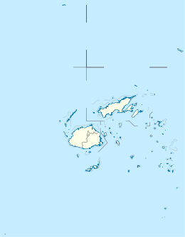
Fiji location map.svg
Red pog.svg
Tuvana-i-Colo
Geography
Coordinates 20°59′48″S178°44′17″W / 20.99667°S 178.73806°W / -20.99667; -178.73806 Coordinates: 20°59′48″S178°44′17″W / 20.99667°S 178.73806°W / -20.99667; -178.73806
Archipelago Lau Islands
Adjacent bodies of water Koro Sea
Total islands1
Area2.25 km2 (0.87 sq mi)
Length1.7 km (1.06 mi)
Width1.65 km (1.025 mi)
Administration
Fiji
Division Eastern
Province Lau Province
Demographics
PopulationUninhabited

Tuvana-i-Colo is an uninhabited atoll in the southeastern part of the island state of Fiji in the Pacific Ocean. It is the second most southern atoll of the Lau archipelago and represents Fiji's third most southern landmass. It is located about 25 km south of Ono-i-Lau, the southernmost inhabited Fijian atoll, and 8 kilometres east-northeast of the neighboring atoll Tuvana-i-Ra. It is completely surrounded by a fringing reef.

History

The island was sighted in 1820 by the Russian explorer Fabian Gottlieb von Bellingshausen and named "Siminov” (after the astronomer Ivan Mikhailovich Simonov who was on expedition with him). [1]

Related Research Articles

Kiribati Country in the western Pacific Ocean

Kiribati, officially the Republic of Kiribati, is a country in the central Pacific Ocean. The permanent population is just over 110,000 (2015), more than half of whom live on Tarawa atoll. The state comprises 32 atolls and one raised coral island, Banaba. They have a total land area of 800 square kilometres (310 sq mi) and are dispersed over 3.5 million square kilometres. In terms with its Exclusive Economic Zone in the Pacific, it straddles all three primary geographic regions; Banaba, the Gilbert Islands (Micronesia) and the Line and Phoenix Islands (Polynesia).

Atoll Ring-shaped coral reef

An atoll, sometimes called a coral atoll, is a ring-shaped coral reef including a coral rim that encircles a lagoon partially or completely. There may be coral islands or cays on the rim. The coral of the atoll often sits atop the rim of an extinct seamount or volcano which has eroded or subsided partially beneath the water. The lagoon forms over the volcanic crater or caldera while the higher rim remains above water or at shallow depths that permit the coral to grow and form the reefs. For the atoll to persist, continued erosion or subsidence must be at a rate slow enough to permit reef growth upward and outward to replace the lost height.

Melanesia subregion of Oceania

Melanesia is a subregion of Oceania extending from New Guinea island in the southwestern Pacific Ocean to the Arafura Sea, and eastward to Tonga.

Gilbert Islands Chain of sixteen atolls and coral islands in the Pacific Ocean

The Gilbert Islands are a chain of sixteen atolls and coral islands in the Pacific Ocean about halfway between Papua New Guinea and Hawaii. They form the main part of Kiribati.

Rotuma Island dependency of Fiji

Rotuma is a Fijian dependency, consisting of Rotuma Island and nearby islets. The island group is home to a large and unique indigenous ethnic group which constitutes a recognisable minority within the population of Fiji, known as "Rotumans". Its population at the 2017 census was 1,594, although many more Rotumans live on mainland Fijian islands, totaling 10,000.

Butaritari island

Butaritari is an atoll in the Pacific Ocean island nation of Kiribati. The atoll is roughly four-sided. The south and southeast portion of the atoll comprises a nearly continuous islet. The atoll reef is continuous but almost without islets along the north side. Bikati and Bikatieta islets occupy a corner of the reef at the extreme northwest tip of the atoll. Small islets are found on reef sections between channels on the west side. The lagoon of Butaritari is deep and can accommodate large ships, though the entrance passages are relatively narrow. It is the most fertile of the Gilbert Islands, with relatively good soils and high rainfall. Butaritari atoll has a land area of 13.49 km2 (5.21 sq mi) and a population of 4,346 as of 2010. During World War II, Butaritari was known by US forces as Makin Atoll, and was the site of the Battle of Makin. Locally, Makin is the name of a separate atoll three kilometers to the northeast of Butaritari.

Minerva Reefs two submerged atolls in the South Pacific Ocean, claimed by Fiji and Tonga

The Minerva Reefs are a group of two submerged atolls located in the Pacific Ocean south of Fiji and Tonga.

Enele Maʻafu Tongan chief

ʻEnele Maʻafuʻotuʻitonga, commonly known as Maʻafu, was a Pacific islander who held important titles in two countries in the Pacific. He was a traditional Tongan Prince and a Fijian chief nominated and installed by the Tovata chiefs of Lakeba and Vanua Balavu as 'Tui Lau' in 1869. This title was ratified by a wider council of Fijian chiefs and subsequently formalised under British colonial administration. In 1874, Maʻafu went to Fiji in an expedition to Vanua Balavu to investigate the killing of a preacher.

Lau Islands archipelago of Fiji

The Lau Islands of Fiji are situated in the southern Pacific Ocean, just east of the Koro Sea. Of this chain of about sixty islands and islets, about thirty are inhabited. The Lau Group covers a land area of 188 square miles, and had a population of 10,683 at the most recent census in 2007. While most of the northern Lau Group are high islands of volcanic origin, those of the south are mostly carbonate low islands.

Ogea Levu is a coral island on a barrier reef in Fiji's Southern Lau archipelago. With an area of 13.3 square kilometres, it is situated at 19.18° South and 178.47° West, 10 kilometres (6.2 mi) east of Fulaga. It has a maximum altitude of 82 metres (270 ft).

Ogea Driki is a coral atoll covering approximately 4 square kilometres in Fiji's Southern Lau Group. It is 2.7 kilometres (1.7 mi) south of Ogea Levu and 10 kilometres (6.2 mi) east of Fulaga.

Ono-i-Lau

Ono-i-Lau is a group of islands within a barrier reef system in the Fijian archipelago of Lau Islands. There are four central volcanic islands: Onolevu, Doi Lovoni and Ndavura, the uppermost parts of the volcanic edifice rising from the Lau Ridge slightly more than 1,000 metres below sea level and on which the reef and other islands are built. There are also three clusters of coral limestone islets, Yanuya and Mana on the barrier reef and Niuta. A sand cay, Udui, is not counted as one of the six “islands”.

Wailagi Lala island in Fiji

Wailagi Lala is the northernmost outpost of Fiji's Lau Islands. This tiny atoll, with an area of just 30 hectares and rising no more than 3 metres (10 ft) above mean sea level, is situated at 16.45° South and 179.6° West. It is the only true atoll in Fiji.

Nukumanu Islands archipelago

Nukumanu, formerly Tasman Islands, is an atoll of Papua New Guinea, located in the Southwestern Pacific Ocean, 4 degrees south of the equator.

Vatu Vara island in Fiji

Vatu Vara Island is a Fijian island in the northwest sector of the Lau Group of islands.

Funafuti Capital of Tuvalu

Funafuti is an atoll and the capital of the island nation of Tuvalu. It has a population of 6,320 people, making it the country's most populated atoll, with 60.15 percent of Tuvalu's population. It is a narrow sweep of land between 20 and 400 metres wide, encircling a large lagoon 18 km long and 14 km wide. The average depth in the Funafuti lagoon is about 20 fathoms. With a surface of 275 square kilometres (106.2 sq mi), it is by far the largest lagoon in Tuvalu. The land area of the 33 islets aggregates to 2.4 square kilometres (0.9 sq mi), less than one percent of the total area of the atoll. Cargo ships can enter Funafuti's lagoon and dock at the port facilities on Fongafale.

Polynesia Subregion of Oceania

Polynesia is a subregion of Oceania, made up of more than 1,000 islands scattered over the central and southern Pacific Ocean. The indigenous people who inhabit the islands of Polynesia are termed Polynesians, sharing many similar traits including language family, culture, and beliefs. Historically, they had a strong tradition of sailing and using stars to navigate at night. The largest country in Polynesia is New Zealand.

Lau Province is one of fourteen provinces of Fiji. Its capital is at Tubou, at the southern end of the island of Lakeba. The province forms part of the country's Eastern Division, and of the Tovata Confederacy, a traditional hierarchy of chiefs from northern and eastern Fiji.

Ivan Mikhailovich Simonov Russian astronomer

Ivan Mikhailovich Simonov (1794–1855) was a Russian astronomer and a geodesist.

Tuvana-i-Ra Fijian Atoll in the Lau Islands

Tuvana-i-Ra is an uninhabited atoll in the southeastern part of the island state of Fiji in the Pacific Ocean. It is the southernmost atoll of the Lau archipelago and represents Fiji's second-southernmost landmass; only the remote and uninhabited atoll Ceva-i-Ra lies slightly further south.

References

  1. Stoller, Marianne L (1959). "Te-moana-nui-o-Kiwa" (PDF). Expedition. 1 (3): 29. Retrieved 18 May 2020.