
Sacramento County is a county located in the U.S. state of California. As of the 2020 census, the population was 1,585,055. Its county seat is Sacramento, which has been the state capital of California since 1854.

Alameda County is a county located in the U.S. state of California. As of the 2020 census, the population was 1,682,353, making it the 7th-most populous county in the state and 21st most populous nationally. The county seat is Oakland. Alameda County is in the San Francisco Bay Area, occupying much of the East Bay region.

San Bernardino County, officially the County of San Bernardino, is a county located in the southern portion of the U.S. state of California, and is located within the Inland Empire area. As of the 2020 U.S. Census, the population was 2,181,654, making it the fifth-most populous county in California and the 14th-most populous in the United States. The county seat is San Bernardino.

In the United States, a county or county equivalent is an administrative or political subdivision of a state which consists of a geographic region with specific boundaries and usually some level of governmental authority. The term "county" is used in 48 states, while Louisiana and Alaska have functionally equivalent subdivisions called parishes and boroughs, respectively. The specific governmental powers of counties vary widely between the states, with many providing some level of services to civil townships, municipalities, and unincorporated areas. Certain municipalities are in multiple counties; New York City is uniquely partitioned into five counties, referred to at the city government level as boroughs. Some municipalities have been consolidated with their county government to form consolidated city-counties, or have been legally separated from counties altogether to form independent cities. Conversely, those counties in Connecticut, Rhode Island, eight of Massachusetts's 14 counties, and Alaska's Unorganized Borough have no government power, existing only as geographic distinctions.
Columbus is a consolidated city-county located on the west-central border of the U.S. state of Georgia. Columbus lies on the Chattahoochee River directly across from Phenix City, Alabama. It is the county seat of Muscogee County, with which it officially merged in 1970. Columbus is the second most populous city in Georgia, and fields the state's fourth-largest metropolitan area. At the 2020 census, Columbus had a population of 206,922, with 328,883 in the Columbus metropolitan area. The metro area joins the nearby Alabama cities of Auburn and Opelika to form the Columbus–Auburn–Opelika combined statistical area, which had an estimated population of 486,645 in 2019.

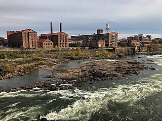
State College is a home rule municipality in Centre County, Pennsylvania, United States. It is a college town, dominated economically, culturally, and demographically by the presence of the University Park campus of Penn State University.

Wayanad is a district in the north-east of the Indian state of Kerala, with administrative headquarters at the municipality of Kalpetta. It is the only plateau in Kerala. The Wayanad Plateau forms a continuation of the Mysore Plateau, the southern portion of Deccan Plateau which links the Western Ghats with the Eastern Ghats. It is set high in the Western Ghats with altitudes ranging from 700 to 2100 meters. Vellari Mala, a 2,240 m (7,349 ft) high peak situated on the trijunction of Wayanad, Malappuram, and Kozhikode districts, is the highest point in Wayanad district. The district was formed on 1 November 1980 as the 12th district in Kerala, by carving out areas from Kozhikode and Kannur districts. An area of 885.92 km2 of the district is forested. Wayanad has three municipal towns—Kalpetta, Mananthavady and Sulthan Bathery. There are many indigenous tribes in this area. The Kabini River, a tributary of Kaveri River, originates at Wayanad. Wayanad district, along with the Chaliyar valley in neighbouring Nilambur in Malappuram district, is known for natural gold fields, which are also seen in other parts of the Nilgiri Biosphere Reserve. Chaliyar river, which is the fourth longest river of Kerala, originates on the Wayanad plateau. The historically important Edakkal Caves are located in Wayanad district.

The Districts of Pakistan are the third-order administrative divisions of Pakistan, below provinces and divisions, but forming the first-tier of local government. In total, there are 170 districts in Pakistan including the Capital Territory and the districts of Azad Kashmir and Gilgit Baltistan. These districts are further divided into Tehsils, Union Councils.

Ayodhya district is an administrative district of the Indian state of Uttar Pradesh. The city of Ayodhya is its administrative headquarters. The district occupies an area of 2,522 square kilometres (974 sq mi), and had a population of 2,470,996 in the 2011 census. Ayodhya district shares its borders with 6 districts of Uttar Pradesh. It is bordered by Gonda and Basti districts on the northern side, Amethi and Sultanpur districts on the south, and Ambedkar Nagar and Barabanki districts share the border on the east and west.
Colorado's 4th congressional district is a congressional district in the U.S. state of Colorado. Located in the eastern part of the state, the district encompasses most of the rural Eastern Plains as well as portions of the Colorado Front Range including Loveland, Highlands Ranch, Castle Rock, and Parker.

The 2020 United States census was the 24th decennial United States census. Census Day, the reference day used for the census, was April 1, 2020. Other than a pilot study during the 2000 census, this was the first U.S. census to offer options to respond online or by phone, in addition to the paper response form used for previous censuses.

Riverside County is a county located in the southern portion of the U.S. state of California. As of the 2020 census, the population was 2,418,185, making it the fourth-most populous county in California and the 10th-most populous in the United States. The name was derived from the city of Riverside, which is the county seat.

San Diego County, officially the County of San Diego, is a county in the southwestern corner of the U.S. state of California. As of the 2020 census, the population was 3,298,634, making it California's second-most populous county and the fifth-most populous in the United States. Its county seat is San Diego, the second-most populous city in California and the eighth-most populous city in the United States. It is the southwesternmost county in the 48 contiguous United States, and is a border county. It is also home to 18 Native American tribal reservations, the most of any county in the United States.

Jammu and Kashmir is a region administered by India as a union territory and consists of the southern portion of the larger Kashmir region, which has been the subject of a dispute between India and Pakistan since 1947 and between India and China since 1959. The Line of Control separates Jammu and Kashmir from the Pakistani-administered territories of Azad Kashmir and Gilgit-Baltistan in the west and north. It lies to the north of the Indian states of Himachal Pradesh and Punjab and to the west of Ladakh which is administered by India as a union territory.
