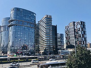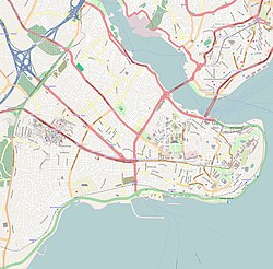
Üsküdar is a municipality and district of Istanbul Province, Turkey. Its area is 35 km2, and its population is 524,452 (2022). It is a large and densely populated district on the Anatolian (Asian) shore of the Bosphorus. It is bordered to the north by Beykoz, to the east by Ümraniye, to the southeast by Ataşehir and to the south by Kadıköy; with Karaköy, Kabataş, Beşiktaş, and the historic city center of Fatih facing it on the opposite shore to the west. Üsküdar has been a conservative cultural center of the Anatolian side of Istanbul since Ottoman times with its numerous historic landmark and little mosques and dergahs.

Boza, also bosa, is a fermented beverage originating from Central Asia and made in parts of Turkey, Central Asia, the Caucasus, and North Africa. It is a malt drink made by fermenting various grains: maize (corn) and wheat in Turkey. It's one of the oldest Turkic beverages. It has a thick consistency, a low alcohol content, and a slightly acidic sweet flavor.

Fatih is a municipality and district of Istanbul Province, Turkey. Its area is 15 km2, and its population is 368,227 (2022). It is home to almost all of the provincial authorities but not the courthouse. It encompasses the historical peninsula, coinciding with old Constantinople. In 2009, the district of Eminönü, which had been a separate municipality located at the tip of the peninsula, was once again remerged into Fatih because of its small population. Fatih is bordered by the Golden Horn to the north and the Sea of Marmara to the south, while the Western border is demarked by the Theodosian wall and the east by the Bosphorus Strait.

Bakırköy is a municipality and district in the European part of Istanbul Province, Turkey. Its area is 29 km2, and its population is 226,685 (2022). Bakırköy lies between the D.100 highway and the coast of the Sea of Marmara. Bakırköy has a large psychiatric hospital called "Bakırköy Ruh ve Sinir Hastalıkları Hastanesi", and is an important shopping and commercial center.

The large Fatih Mosque is an Ottoman mosque off Fevzi Paşa Caddesi in the Fatih district of Istanbul, Turkey. The original mosque was constructed between 1463 and 1470 on the site of the Church of the Holy Apostles. Seriously damaged in the 1766 earthquake, it was rebuilt in 1771 to a different design. It is named after the Ottoman sultan Mehmed the Conqueror, known in Turkish as Fatih Sultan Mehmed, who conquered Constantinople in 1453.

Zeyrek is a neighbourhood in the municipality and district of Fatih, Istanbul Province, Turkey. Its population is 12,863 (2022). It is a picturesque but poor neighbourhood. It takes its name from the huge and prominent Zeyrek Mosque which started life as a Byzantine church and sits on a plateau, overlooking the Golden Horn.

Kalenderhane Mosque is a former Eastern Orthodox church in Istanbul, converted into a mosque by the Ottomans. With high probability the church was originally dedicated to the Theotokos Kyriotissa. The building is sometimes referred to as Kalender Haneh Jamissi and St. Mary Diaconissa. This building represents one among the few extant examples of a Byzantine church with domed Greek cross plan.

Bodrum Mosque in Istanbul, Turkey, is a former Eastern Orthodox church converted into a mosque by the Ottomans. The church was known under the Greek name of Myrelaion.

Church-Mosque of Vefa is a former Eastern Orthodox church converted into a mosque by the Ottomans in Istanbul. The church was possibly dedicated to Hagios Theodoros, but this dedication is far from certain. The complex represents one of the most important examples of Comnenian and Palaiologan architecture of Constantinople.

Atik Mustafa Pasha Mosque is a former Eastern Orthodox church in Istanbul, converted into a mosque by the Ottomans. In Çember Sokak in the neighbourhood of Ayvansaray, in the district of Fatih, Istanbul, it lies just inside the walled city at a short distance from the Golden Horn, at the foot of the sixth hill of Constantinople.

The AqueductofValens was a Roman aqueduct system built in the late 4th century AD, to supply Constantinople – the capital of the Eastern Roman Empire. Construction of the aqueduct began during the reign of the Roman emperor Constantius II and was completed in 373 by the Emperor Valens. The aqueduct remained in use for many centuries. It was extended and maintained by the Byzantines and the Ottomans.

Hazret Süleyman Hilmi Tunahan was born in 1888 (1305AH), in the village of Ferhatlar, from the town of Hazergrad, in the province of Silistra, which today lies within Bulgaria. His father Hojazade (2) Osman Fawzi Efendi (1845_1928) was well know dar's al_Ām (3) of the time, who completed his studies in Istanbul. He taught for many years, at Satirli and Haci Paşa Madaris (4).His mother, was Hatije (Khadija) Hanım (5). His grandfather, Mahmud Efendi died aged nearly 110. He was known as Kaymak Hafiz.

İzmit is a municipality and the capital district of Kocaeli Province, Turkey. Its area is 480 km2, and its population is 376,056 (2022). The capital of Kocaeli Province, it is located at the Gulf of İzmit in the Sea of Marmara, about 100 km (62 mi) east of Istanbul, on the northwestern part of Anatolia. Kocaeli Province had a population of 2,079,072 inhabitants in 2022, of whom approximately 1.2 million lived in the largely urban İzmit City metro area made up of Kartepe, Başiskele, Körfez, Gölcük, Derince and Sapanca. Unlike other provinces in Turkey, apart from Istanbul, the whole province is included within the municipality of the metropolitan center.
The following is a timeline of the history of the town of Istanbul, Turkey.

The Cistern of Aetius was an important Byzantine water reservoir in the city of Constantinople. Once one of the largest Byzantine cisterns, it is now a football stadium in Istanbul. Since 1928 it has been known as Karagümrük stadyumu, 'Karagümrük stadium' or Vefa stadyumu, 'Vefa stadium', while in the Ottoman period it was known as the Turkish: Çukurbostan, lit. 'sunken garden'.

The following outline is provided as an overview of and topical guide to Istanbul:

Çukurcuma is a district of Beyoğlu, made up of the Kuloğlu and Firuzağa neighbourhoods. It lies south-east of İstiklal Caddesi in a valley, not far from Galatasaray Square and between the Tomtom and Cihangir neighbourhoods. The main thoroughfare is Çukurcuma Caddesi. The buildings largely date from the 19th century, although there has also been a lot of 20th-century development.

Sekbanbaşı Mosque was a mosque located in the Ottoman capital of Constantinople. It was originally a Byzantine church. According to the writings of Hafiz Hüseyin al-Ayvansarayî (Hadîkatü’l-cevâmi‘), the original Byzantine church had been converted by İbrahim Ağa, the lieutenant of the Ottoman sekban regiments (sekbanbaşı). The building was located in Kendir Sokağı, in the Kırkçeşme quarter, near the ancient aqueduct of Roman Emperor Valens.


