Anadoluhisarı, known historically as Güzelce Hisar is a medieval Ottoman fortress located in Istanbul, Turkey on the Anatolian (Asian) side of the Bosporus. The complex is the oldest surviving Turkish architectural structure built in Istanbul, and further gives its name to the neighborhood around it in the city's Beykoz district.

Üsküdar is a municipality and district of Istanbul Province, Turkey. Its area is 35 km2, and its population is 524,452 (2022). It is a large and densely populated district on the Anatolian (Asian) shore of the Bosphorus. It is bordered to the north by Beykoz, to the east by Ümraniye, to the southeast by Ataşehir and to the south by Kadıköy; with Karaköy, Kabataş, Beşiktaş, and the historic Sarayburnu quarter of Fatih facing it on the opposite shore to the west. Üsküdar has been a conservative cultural center of the Anatolian side of Istanbul since Ottoman times with its landmark as well as numerous tiny mosques and dergahs.

Dolmabahçe Palace located in the Beşiktaş district of Istanbul, Turkey, on the European coast of the Bosporus strait, served as the main administrative center of the Ottoman Empire from 1856 to 1887 and from 1909 to 1922.

Kartal is a municipality and district of Istanbul Province, Turkey. Its area is 38 km2, and its population is 483,418 (2022). It is located on the Asian side of the city, on the coast of the Marmara Sea between Maltepe and Pendik.

Eminönü, historically known as Pérama, is a predominantly commercial waterfront area of Istanbul within the Fatih district near the confluence of the Golden Horn with the southern entrance of the Bosphorus strait and the Sea of Marmara. It is located in the part of Istanbul known as the historical peninsula, connected to Karaköy via the Galata Bridge across the Golden Horn. It was administered as part of the Sultanahmet district from 1928 to 2009 when Sultanahmet was absorbed into Fatih. Eminönü, which was a district municipality until March 7, 2008, was abolished on this date and connected to Fatih district by law. It is completely located within the city wall, the historical core of the city, and forms one of the most vibrant areas of the central area.

Zeytinburnu is a municipality and district of Istanbul Province, Turkey. Its area is 12 km2, and its population is 292,616 (2022). It is a working-class area on the European side of Istanbul, Turkey, on the shore of the Marmara Sea just outside the walls of the ancient city, beyond the fortress of Yedikule. The mayor is Ömer Arısoy.

Fatih is a municipality and district of Istanbul Province, Turkey. Its area is 15 km2, and its population is 368,227 (2022). It is home to almost all of the provincial authorities but not the courthouse. It encompasses the historical peninsula, coinciding with old Constantinople. In 2009, the district of Eminönü, which had been a separate municipality located at the tip of the peninsula, was once again remerged into Fatih because of its small population. Fatih is bordered by the Golden Horn to the north and the Sea of Marmara to the south, while the Western border is demarked by the Theodosian wall and the east by the Bosphorus Strait.
Doğan Kuban was a Turkish architectural historian.

Afro-Turks are Turkish people of African Zanj descent, who trace their origin to the Ottoman slave trade like the Afro-Abkhazians. Afro-Turk population is estimated to be between 5,000 and 20,000 people. Afro-Turks are distinct from African immigrants in Turkey, which number around 1.5 million individuals as of 2017 according to state-owned Anadolu Agency.

Samatya is a quarter of the Fatih district of Istanbul. It is located along the Marmara Sea, and borders to the west on the neighborhood of Yedikule.

Ahmet Şimşirgil is a Turkish academic.

Yedikule Fortress is a fortified historic structure located in the Yedikule neighbourhood of Fatih, in Istanbul, Turkey.
Istanbul is known as the City on the Seven Hills. The city has inherited this denomination from Byzantine Constantinople which – consciously following the model of Rome – was built on seven hills too.

Balıklı is a quarter in Istanbul, Turkey. It belongs to the Zeytinburnu district, and is part of the Kazlıçeşme neighborhood. It is located along the Marmara Sea, and borders Istanbul's walled city on the east, between the gates of Yedikule and Silivri. Before the rapid increase of Istanbul's population in the 1970s, Balıklı was a rural quarter. The name of the quarter comes from the fishes present in the fountain of holy water situated now in the complex of the Church of St. Mary of the Spring, an important Eastern Orthodox sanctuary.

Edirnekapı is a quarter of Istanbul, Turkey. It is part of the district of Fatih and belongs to the walled city.

Kazlıçeşme is a neighbourhood in the municipality and district of Zeytinburnu, Istanbul Province, Turkey. Its population is 4,844 (2022). Chartered in 1957, it is the least populous neighborhood of Zeytinburnu. The locality took its name from the historic fountain with a relief goose figure below the fountain's inscription, which dates it back to Hijri year AH 953.

Büyükdere is a neighbourhood in the municipality and district of Sarıyer, Istanbul Province, Turkey. Its population is 8,586 (2022). It is situated on the European shore of the Bosphorus strait about 2 km (1.2 mi) southwest of Sarıyer. Its name means 'big stream' in Turkish, in reference to the river that used to flow into the Bosphorus here.

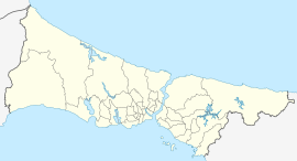
The following outline is provided as an overview of and topical guide to Istanbul:

The Lycus is a stream, now vaulted over, that flowed in Constantinople, which was important for historical reasons. The only waterway present within the walled city, it was covered in the 1950s to build the Vatan Caddesi avenue. The creek valley played a crucial role in the Fall of Constantinople in 1453.