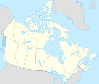
Jones Sound is a waterway in Qikiqtaaluk, Nunavut, Canada. It lies between Devon Island and the southern end of Ellesmere Island. At its northwestern end it is linked by several channels to Norwegian Bay; at its eastern end it opens via Glacier Strait into Baffin Bay. The hamlet of Grise Fiord was established on the south shore Ellesmere Island in 1953, partly to assert Canadian sovereignty in the high Arctic.

Adams Island is an uninhabited island in the Qikiqtaaluk Region of Nunavut, Canada. The island is located in Baffin Bay off the northeastern coast of Baffin Island in the Canadian Arctic Archipelago. Nearby are Dexterity Island (northeast), Dexterity Fiord and Baffin Island (east), Tromso Fiord (south), Paterson Inlet (west), Bergesen Island (northwest), and Isbjorn Strait (north).

One of the uninhabited Baffin Island offshore island groups in Cumberland Sound, the Kaigosuit Islands are located long the south side of Nettilling Fiord, and southwest of Pangnirtung. The Kaigosuiyat Islands run parallel to the south. Further south is Irvine Inlet. The Kaigosuits are part of the Qikiqtaaluk Region, in the Canadian territory of Nunavut.

One of the Baffin Island offshore island groups in Cumberland Sound, the Drum Islands are located on the southern side of the mouth of Kangilo Fiord, south of Iglunga, west of Pangnirtung, and north of the Saunik and Imigen islands. They are part of the Qikiqtaaluk Region, in the Canadian territory of Nunavut.
The uninhabited Marvin Islands are located in the Arctic Ocean across the mouth of Disraeli Fiord, in northern Ellesmere Island within the Quttinirpaaq National Park. Ward Hunt Island lies to the northwest. The island group is a part of the Qikiqtaaluk Region Nunavut, Canada.

Baumann Fiord is a natural inlet in the south-west of Ellesmere Island, Qikiqtaaluk Region, Nunavut in the Arctic Archipelago. To the west, it opens into Norwegian Bay. Hoved Island lies in the fiord.

Cañon Fiord is a natural inlet in the west of Ellesmere Island, Nunavut in the Arctic Archipelago. To the north, it opens into Greely Fiord and to the east lies the Agassiz Ice Cap.

Greely Fiord is a natural inlet in the west of Ellesmere Island, Qikiqtaaluk Region, Nunavut in the Arctic Archipelago. To the south lies the Cañon Fiord and the Agassiz Ice Cap. To the northwest is Borup Fiord and Tanquary Fiord is northeast.

Alexandra Fiord is a natural inlet on the Johan Peninsula of Ellesmere Island in the Qikiqtaaluk Region of Nunavut, Canada. To the east, it opens into Buchanan Bay.
Landslip Island is an island of the Canadian Arctic Archipelago in the territory of Nunavut. It lies at the mouth of Harbour Fiord on the Jones Sound, south of Ellesmere Island.
Bjarnason Island is an island of the Canadian Arctic Archipelago in the territory of Nunavut. It lies in the Arctic Ocean, north-west of Axel Heiberg Island, separated from it by Bukken Fiord to its north and Bunde Fiord to its south.

Akuglek Island is an uninhabited island in the Qikiqtaaluk Region of Nunavut, Canada. It is located in Davis Strait, southeast of Sakiak Fiord, off southeastern Baffin Island's Cumberland Peninsula. Angijak Island is to its northeast, Nuvuktik Island to its south. Other islands in the immediate vicinity include Kekertaluk Island and Kekertuk Island.
Wareham Island is an uninhabited island in the Qikiqtaaluk Region of Nunavut, Canada. It is located in the Cumberland Sound, off Baffin Island's Cumberland Peninsula, southwest of the mouth of Kumlien Fiord. Akulagok Island, Kekerten Island, Kekertukdjuak Island, Miliakdjuin Island, Tesseralik Island, and Tuapait Island are in the vicinity.

Iglunga Island is an uninhabited island in the Qikiqtaaluk Region of Nunavut, Canada. It is located in Baffin Island's Cumberland Sound, between Kangilo Fiord and Kangerk Fiord. Anarnittuq Island, Clear Passage Island, Imigen Island, Ivisa Island, the Kekertelung Islands, Nunatak Island, and Saunik Island are in the vicinity.

Clear Passage Island is an uninhabited island in the Qikiqtaaluk Region of Nunavut, Canada. It lies in Kangilo Fiord, the southern of Baffin Island's Cumberland Sound's two ends. The False Passage Peninsula lies northwest of the island. Anarnittuq Island, Iglunga Island, and Nunatak Island are in the vicinity.

Nunatak Island is an uninhabited island in the Qikiqtaaluk Region of Nunavut, Canada. It is located at the northern end of Baffin Island's Cumberland Sound, at the junction of Shark Fiord and Clearwater Fiord. Southeast is Kekertelung Island. Anarnittuq Island, Clear Passage Island, and Iglunga Island are also located within this vicinity.

Tanquary Fiord is a fjord on the north coast of the Arctic Archipelago's Ellesmere Island, Nunavut, Canada. It is located in the Quttinirpaaq National Park and extends 30 mi (48 km) in a north-westerly direction from Greely Fiord.

Borup Fiord is located on Ellesmere Island, Qikiqtaaluk Region, Nunavut Canada. The mouth of the fiord opens into Greely Fiord. To the west is Oobloyah Bay and to the north is the Neil Peninsula and the Neil Icecap. The eastern arm, known as Esayoo Bay leads to Borup Fiord Pass.

Kangiqtualuk Uqquqti formerly Sam Ford Fiord is an isolated, elongated Arctic fjord on Baffin Island's northeastern coast in the Qikiqtaaluk Region of Nunavut, Canada. The Inuit settlement of Pond Inlet is 320 km (200 mi) to the northwest and Clyde River is 80 km (50 mi) to the east.

Grise Fiord is a waterway on Ellesmere Island, Qikiqtaaluk Region, Nunavut, Canada. Grise Fiord means "pig inlet" in Norwegian. Otto Sverdrup from Norway named it so during an expedition around 1900 because he thought the walrus in the area sounded like pigs. It feeds into Jones Sound and out into Baffin Bay. The Inuit community of Grise Fiord, the northernmost civilian settlement in Canada, is located at the south end of the fiord.


