
The Grand River is a large river in Southwestern Ontario, Canada. It also lies along the western fringe of the Golden Horseshoe region of Ontario which overlaps the eastern portion of southwestern Ontario along the length of this river. From its source near Wareham, Ontario, it flows south through Grand Valley, Fergus, Elora, Waterloo, Kitchener, Cambridge, Paris, Brantford, Caledonia, and Cayuga before emptying into the north shore of Lake Erie south of Dunnville at Port Maitland. One of the scenic and spectacular features of the river is the falls and Gorge at Elora.

The Huron River is a 130-mile-long (210 km) river in southeastern Michigan, rising out of the Huron Swamp in Springfield Township in northern Oakland County and flowing into Lake Erie on the boundary between Wayne County and Monroe County. In addition to thirteen parks, game areas, and recreation areas, the river passes through the cities of Dexter, Ann Arbor, Ypsilanti, Belleville, Flat Rock and Rockwood.
Muncy Creek is a tributary of the West Branch Susquehanna River in Sullivan County and Lycoming County, in Pennsylvania, in the United States. It is approximately 34.5 miles (55.5 km) long. The watershed of the creek has an area of 216 square miles (560 km2). The creek's discharge averages 49 cubic feet per second (1.4 m3/s) at Sonestown, but can be up to a thousand times higher at Muncy. The headwaters of the creek are on the Allegheny Plateau. Rock formations in the watershed include the Chemung Formation and the Catskill Formation.
Kettle Creek is a creek in Elgin County in southwestern Ontario, Canada that empties into Lake Erie at Port Stanley. It drains an area of 520 square kilometres (200 sq mi). Dodd Creek is the major tributary.
The Lynn River is a fresh water river located in Norfolk County in Southwestern Ontario, Canada. It empties into Lake Erie at Port Dover.

The Credit River is a river in southern Ontario which flows from headwaters above the Niagara Escarpment near Orangeville and Caledon East to empty into Lake Ontario at Port Credit, Mississauga. It drains an area of approximately 1,000 square kilometres (390 sq mi). The total length of the river and its tributary streams is over 1,500 kilometres (930 mi).
Otter Creek may refer to some places in the United States:

Delhi refers to both a former township and unincorporated community located off of the junction of Ontario Highways 59 and 3. Delhi is known as the "Heart of Tobacco Country." Prior to 1880, this community was known for its lumber industry. One of the Communities in Norfolk County, Ontario, Delhi had a population of 4,240 at the time of the 2016 Census.

Bowman Creek is a tributary of the Susquehanna River in Luzerne County and Wyoming County, in Pennsylvania, in the United States. It is approximately 26 miles (42 km) long and flows through Ross Township and Lake Township in Luzerne County and Noxen Township, Monroe Township, and Eaton Township in Wyoming County. The watershed of the creek has an area of 120 square miles (310 km2). The creek is not designated as an impaired waterbody and its pH is close to neutral, although it has experienced some problems with acid rain. It has low concentrations of dissolved solids like calcium. The creek is relatively small in its upper reaches, but by Noxen, its width is 40 to 60 feet. It is also relatively shallow in many reaches. Rock formations in the watershed include the Catskill Formation, the Huntley Mountain Formation, Burgoon Sandstone, the Mauch Chunk Formation, the Pottsville Group, and the Pocono Formation. Soil associations in the creek's watershed include the Wellsboro-Morris-Oquaga association, the Oquaga-Lackawanna-Arnot association, the Mardin-Bath-Volusia association, and the Wyoming-Pope association.

Lake Erie Basin consists of Lake Erie and surrounding watersheds, which are typically named after the river, creek, or stream that provides drainage into the lake. The watersheds are located in the states of Indiana, Michigan, New York, Ohio, and Pennsylvania in the United States, and in the province of Ontario in Canada. The basin is part of the Great Lakes Basin and Saint Lawrence River Watershed, which feeds into the Atlantic Ocean. 80% of the lake's water flows in from the Detroit River, with only 9% coming from all of the remaining watersheds combined. A littoral zone serves as the interface between land and lake, being that portion of the basin where the lake is less than 15 feet (4.6 m) in depth.
Lake Erie Watershed is a major drainage catchment in northwestern Pennsylvania, consisting of lands with direct runoff and sub-watersheds with waterways that flow into Lake Erie and Presque Isle Bay from Crawford and Erie counties, as well as from New York. The watershed is part of the Lake Erie Basin.

South Branch Roaring Creek is a tributary of Roaring Creek in Columbia County and Northumberland County, Pennsylvania, in the United States. It is approximately 16.8 miles (27.0 km) long. The upper reaches of the creek are located in Weiser State Forest, between Big Mountain and Little Mountain. The creek is home to some trout and is considered a high-quality coldwater fishery. The Chemung Formation occurs in the creek's watershed. The watershed is 25 square miles in area.

Solomon Creek is a tributary of the Susquehanna River in Luzerne County, Pennsylvania, in the United States. It is approximately 8.8 miles (14.2 km) long and flows through Fairview Township, Hanover Township, and Wilkes-Barre. The creek is affected by acid mine drainage and has significant loads of iron, aluminum, and manganese. The creek's named tributaries are Spring Run, Sugar Notch Run, and Pine Creek. The Solomon Creek watershed is located in the Anthracite Valley section of the ridge-and-valley geographical province. Major rock formations in the watershed include the Mauch Chunk Formation, the Spechty Kopf Formation, and the Catskill Formation.
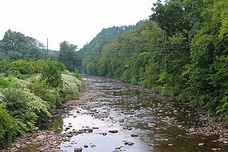
Nanticoke Creek is a watercourse in Haldimand County, Ontario. It is approximately 15 kilometres (9.3 mi) long, emptying into Lake Erie approximately 15 km west of the mouth of the Grand River. The creek drains approximately 180 square kilometres (69 sq mi).
The Long Point Region Conservation Area is an agency of the province of Ontario, Canada, formed to preserve the volume of flow, and purity, of the watercourses that flow into Lake Erie, near Long Point.
Kent Creek is a tributary of the Lynn River, one of the watersheds administered by the Long Point Region Conservation Authority. It is considered a cold-water stream, and hosts a population of Brook Trout. It drains 38.24 square kilometres (14.76 sq mi).
Davis Creek is a tributary of the Lynn River, which empties into Lake Erie, and Port Rowan. It drains 28.88 square kilometres (11.15 sq mi). Unlike nearby Kent Creek, Davis Creek is poorly covered by forests.

