
Olivenza or Olivença is a town in southwestern Spain, close to the Portugal–Spain border. It is a municipality belonging to the province of Badajoz, and to the wider autonomous community of Extremadura.

The War of the Oranges was a brief conflict in 1801 in which Spanish forces, instigated by the government of France, and ultimately supported by the French military, invaded Portugal. It was a precursor to the Peninsular Wars, resulting in the Treaty of Badajoz, the loss of Portuguese territory, in particular Olivenza, as well as ultimately setting the stage for the complete invasion of the Iberian Peninsula by French forces.
The following is a list of Portugal-related articles. Those interested in the subject can monitor changes to the pages by clicking on Related changes in the sidebar.

Alandroal is a municipality in the Portuguese district of Évora located on the eastern frontier with Spain along the right margin of the Guadiana River in the Central Alentejo region. It is located 341 metres (1,119 ft) above sea level, northeast of Évora and southeast of Estremoz. The population in 2011 was 5,843, in an area of 542.68 km².

Monsaraz is a civil parish (freguesia) of the municipality of Reguengos de Monsaraz, on the right margin of the Guadiana River in the Portuguese Alentejo region, near its border with Spain. The population in 2011 was 782, in an area of 88.29 km2.
Juromenha is a town in southeastern Portugal, near the border with Spain. It is part of Alandroal Municipality.
Vila Real is a city and municipality in northern Portugal.

San Felices de los Gallegos is a village and large municipality in the province of Salamanca, western Spain, part of the autonomous community of Castile and León. It is located 102 kilometers from the provincial capital city of Salamanca and has a population of 442 people, with a 2017 Wolfram Alpha estimate placing it at 427. It is situated within the Arribes del Duero Natural Park.

Táliga or Talega is a Spanish town and municipality located near the border with Portugal, in the province of Badajoz, in the Spanish autonomous community of Extremadura. Portugal considers Táliga, as well as neighbouring Olivenza, a de jure part of the Portuguese concelho of Olivenza, occupied by Spain since 1801..
Almendral is a municipality located in the province of Badajoz, Extremadura, Spain. According to the 2004 census (INE), the municipality has a population of 1352 inhabitants.

The Treaty of Badajoz was signed by Spain and Portugal on 6 June 1801. Portugal ceded the border town of Olivenza to Spain and closed its ports to British military and commercial shipping.

Portugal and Spain enjoy a friendly relationship. They are both members of the Ibero-American Summit, European Union, Eurozone, Schengen Area and NATO, and make up the vast majority of the Iberian Peninsula.

The Castle of Campo Maior is a medieval military fortification, in the civil parish of São João Bapista, municipality of Campo Maior, part of a first line of defense in the Portuguese Alentejo, oriented towards Spain, in conjunction with the military forts of Ouguela, Elvas, Olivença and Juromenha. It is a walled bulwark of the modern era, highlighted by a Renaissance-era window in the northern tower of the castle. It has been listed as a National monument since 1911.

The Castle of Terena is a castle in the civil parish of Terena in the municipality of Alandroal in the Portuguese subregion of Alentejo Central. Since 1946, it has been listed as a National monument.

Extremadurans are the native people of Extremadura, in the central-west of Spain.
Carolina Ana Trindade Coruche Mendes is a Portuguese football striker, who plays for SC Braga and the Portugal women's national football team.

The Bridge of Ajuda is a dilapidated bridge that crosses the Guadiana River between Elvas and Olivenza.
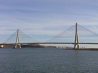
The Portugal–Spain border, also referred to as "The Stripe", is one of the oldest borders in the world. The current demarcation is almost identical to that defined in 1297 by the Treaty of Alcañices. The Portugal–Spain border is 1,214 km (754 mi) long, and is the longest uninterrupted border within the European Union, being free of border control since March 26, 1995, with the exception of a brief period during the COVID-19 pandemic. The border is not defined for 18 km (11 mi) between the Caia river and Ribeira de Cuncos, because of the disputed status of Olivenza/Olivença, which has been disputed between the two countries for two hundred years.

San Jorge de Alor is a village located on the disputed section of the Portugal–Spain border, near Olivenza.
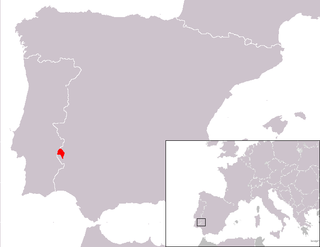
Oliventine Portuguese is the dialectal variety of the Portuguese language natively spoken in the municipalities of Olivença and Táliga, in Extremadura (Spain). Currently, the Portuguese of Olivença and Táliga is not recognized by Spain, which has administered this territory since the War of the Oranges in 1801. Portugal, however, does not recognize Spanish sovereignty over the region and claims it as its own.


