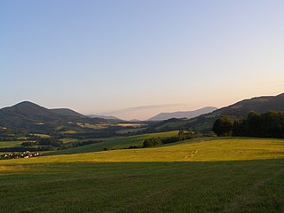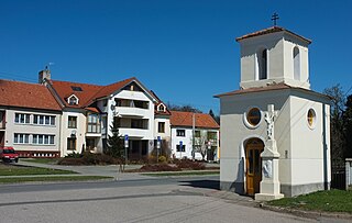
Zlín Region is an administrative unit of the Czech Republic, located in the south-eastern part of the historical region of Moravia. It is named after its capital Zlín. Together with the Olomouc Region it forms a cohesion area of Central Moravia. It is located in the eastern part of the Czech Republic, where the borders with Slovakia are formed by its eastern edge. It borders the South Moravian Region in the southwest, the Olomouc Region in the northwest and the Moravian-Silesian Region in the north. Culturally, the region is composed of parts of three traditional Moravian regions: Haná, the Moravian Slovakia and the Moravian Wallachia, as the city of Zlín lies roughly at their tripoint.

Uherské Hradiště is a town in the Zlín Region of the Czech Republic. It has about 25,000 inhabitants. The agglomeration with the two neighbouring towns of Staré Město and Kunovice has over 37,000 inhabitants.

Uherský Brod is a town in Uherské Hradiště District in the Zlín Region of the Czech Republic. It has about 16,000 inhabitants. The historic town centre is well preserved and is protected by law as an urban monument zone.

Bojkovice is a town in Uherské Hradiště District in the Zlín Region of the Czech Republic. It has about 4,400 inhabitants.

Luhačovice is a spa town in Zlín District in the Zlín Region of the Czech Republic. It has about 5,100 inhabitants. It is known for the largest spa in Moravia and for architecturally valuable buildings designed by the architect Dušan Jurkovič. The historic town centre with the spa infrastructure is well preserved and is protected by law as an urban monument zone.

Vlčnov is a municipality and village in Uherské Hradiště District in the Zlín Region of the Czech Republic. It has about 3,000 inhabitants. The municipality is known for viticulture and for the folklore festival Ride of the Kings, which is on the UNESCO Intangible Cultural Heritage List.

Fryšták is a town in Zlín District in the Zlín Region of the Czech Republic. It has about 3,800 inhabitants. The historic town centre is well preserved and is protected by law as an urban monument zone.

Uherské Hradiště District is a district in the Zlín Region of the Czech Republic. Its capital is the town of Uherské Hradiště.

Zlín District is a district in the Zlín Region of the Czech Republic. Its capital is the city of Zlín.

Hodonín District is a district in the South Moravian Region of the Czech Republic. Its capital is the town of Hodonín.

Moravian-Silesian Foothills are foothills and a geomorphological mesoregion of the Czech Republic.

Šumice is a municipality and village in Uherské Hradiště District in the Zlín Region of the Czech Republic. It has about 1,600 inhabitants.

Záhorovice is a municipality and village in Uherské Hradiště District in the Zlín Region of the Czech Republic. It has about 1,000 inhabitants.

Pozlovice is a market town in Zlín District in the Zlín Region of the Czech Republic. It has about 1,400 inhabitants.

The Slovak-Moravian Carpathians are the mountain ranges along the border of the Czech Republic and Slovakia. Before the Treaty of Trianon in 1920, it was known in Hungarian as Magyar-morva határhegység 'the Hungarian-Moravian border mountains'.

The Brno Highlands are highlands and a geomorphological macroregion of the Czech Republic. It is located mainly in the South Moravian Region, but it also extends into the Olomouc and Pardubice regions.

The Křižanov Highlands is a highland and a geomorphological mesoregion of the Czech Republic. It is located mostly in the Vysočina Region.

The Upper Morava Valley is a lowland and a geomorphological mesoregion of the Czech Republic. It is located in the Olomouc and Zlín regions. Its name is derived from the Morava river that forms the axis of the territory.

The Křemešník Highlands are highlands and a geomorphological mesoregion of the Czech Republic. It is located mainly in the Vysočina Region, but it also extends into the South Bohemian and Central Bohemian regions. With an area of 2,634 km2 (1,017 sq mi), it is the third largest mesoregion in the country.


