Vohipeno Ambohipeno | |
|---|---|
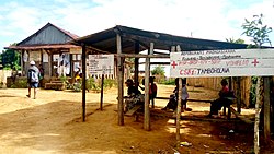 The health center in Tamboholava, a village of Vohipeno | |
 Vohipeno Location in Madagascar | |
| Coordinates: 22°21′S47°50′E / 22.350°S 47.833°E | |
| Country | |
| Region | Fitovinany |
| District | Vohipeno |
| Area | |
• Total | 70 km2 (27 sq mi) |
| Elevation | 6 m (20 ft) |
| Population (2018) [2] | |
• Total | 14,751 |
| • Ethnicities | Antemoro |
| Time zone | UTC3 (EAT) |
| Postal code | 321 |
Vohipeno is a rural municipality in Madagascar. It belongs to the district of Vohipeno, which is a part of the region of Fitovinany. The population of the commune was 14,751 in 2018.
Contents
In addition to primary schooling the town offers secondary education at both junior and senior levels. The town provides access to hospital services to its citizens. The majority 98% of the population of the commune are farmers. The most important crops are rice and coffee, while other important agricultural products are lychee and cassava. 1.6 percent of the population is employed in service industries, and 0.5 percent in fishing. [3]
