
Bojnice is a historical town in west Slovakia located on the Nitra river, near the city of Prievidza. The town is situated just below the Bojnice Castle. It has a population of around 5,000.

Zlaté Moravce is a town in south-western Slovakia.
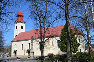
Púchov is an industrial town in the centre of Púchov District in Slovakia, with a population close to 18,000.

Nové Mesto nad Váhom is a town in the Trenčín Region of Slovakia.
Dudince is a spa town in southern Slovakia. It is the smallest town in Slovakia with only a population of around 1,400. It is known for its mineral water, hot springs and destination spas. It's located near the edge of the Banská Bystrica Region of Slovakia.

Bánovce nad Bebravou is a town in Slovakia, in the Trenčín Region.

Želiezovce is a town in Slovakia in the Nitra Region in the Levice District, near the Hron river.

Šamorín is a small town in western Slovakia, southeast of Bratislava.

Partizánske is a town in Trenčín Region, Slovakia.

Ducové is a municipality (village) situated in western Slovakia, near the spa town of Piešťany. It was part of the municipality Moravany nad Váhom from 1976 to 1992. The village lies under the Váh Inovec. According to the 2011 census, the municipality had 375 inhabitants. 365 of inhabitants were Slovaks and 10 others and unspecified.
Myjava is a town in Trenčín Region, Slovakia.

Šurany is a town and a railroad hub in the Nové Zámky District, Nitra Region, southern Slovakia.

Špania Dolina is a village and municipality in central Slovakia, near the city of Banská Bystrica. Although its permanent population does not exceed 200 people, it is a picturesque historic village situated 728 m above sea level and is surrounded by the Staré Hory and Veľká Fatra mountains. It has become a popular tourist recreation centre.
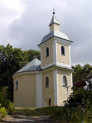
Nitrianska Blatnica is a municipality with 1,192 inhabitants in the Topoľčany District of the Nitra Region, Slovakia. In the hills above the village is a church of Saint George /rotunda svätého Juraja/, from 9th and 10th century, one of the oldest remaining church buildings in Slovakia.

Tlmače is a town and municipality in the Levice District in the Nitra Region of Slovakia.

Handlová is a town in the Prievidza District, Trenčín Region in the middle of Slovakia. It is made up of the three parts Handlová, Nová Lehota and Morovno.
Stará Turá is a town in the Trenčín Region in western Slovakia.

Nemšová is a town in the Trenčín District, Trenčín Region in northwestern Slovakia.
Nováky is a town in the Prievidza District, Trenčín Region in western Slovakia. Nováky Power Plant, a thermal power plant is located near the town.

Stupava is a town in western Slovakia. It is situated in the Malacky District, Bratislava Region.


