
Dębowiec is a village in the administrative district of Gmina Skierbieszów, within Zamość County, Lublin Voivodeship, in eastern Poland. It lies approximately 8 kilometres (5 mi) south of Skierbieszów, 9 km (6 mi) north-east of Zamość, and 75 km (47 mi) south-east of the regional capital Lublin.
Szorcówka is a village in the administrative district of Gmina Skierbieszów, within Zamość County, Lublin Voivodeship, in eastern Poland. It lies approximately 6 kilometres (4 mi) south-east of Skierbieszów, 17 km (11 mi) north-east of Zamość, and 78 km (48 mi) south-east of the regional capital Lublin.
Koniec is a village in the administrative district of Gmina Stary Zamość, within Zamość County, Lublin Voivodeship, in eastern Poland. It lies approximately 9 kilometres (6 mi) east of Stary Zamość, 9 km (6 mi) north of Zamość, and 71 km (44 mi) south-east of the regional capital Lublin.
Majdan Sitaniecki is a village in the administrative district of Gmina Stary Zamość, within Zamość County, Lublin Voivodeship, in eastern Poland. It lies approximately 9 kilometres (6 mi) north-east of Stary Zamość, 15 km (9 mi) north of Zamość, and 66 km (41 mi) south-east of the regional capital Lublin.
Udrycze is a village in the administrative district of Gmina Stary Zamość, within Zamość County, Lublin Voivodeship, in eastern Poland. It lies approximately 9 kilometres (6 mi) east of Stary Zamość, 9 km (6 mi) north of Zamość, and 71 km (44 mi) south-east of the regional capital Lublin.
Białobrzegi is a village in the administrative district of Gmina Zamość, within Zamość County, Lublin Voivodeship, in eastern Poland. It lies approximately 10 kilometres (6 mi) north-west of Zamość and 67 km (42 mi) south-east of the regional capital Lublin.
Borowina Sitaniecka is a village in the administrative district of Gmina Zamość, within Zamość County, Lublin Voivodeship, in eastern Poland. It lies approximately 7 kilometres (4 mi) north-east of Zamość and 74 km (46 mi) south-east of the regional capital Lublin.

Hubale is a village in the administrative district of Gmina Zamość, within Zamość County, Lublin Voivodeship, in eastern Poland. It lies approximately 8 kilometres (5 mi) south-west of Zamość and 76 km (47 mi) south-east of the regional capital Lublin.
Jatutów is a village in the administrative district of Gmina Zamość, within Zamość County, Lublin Voivodeship, in eastern Poland. It lies approximately 6 kilometres (4 mi) south-east of Zamość and 81 km (50 mi) south-east of the regional capital Lublin.
Lipsko-Polesie is a village in the administrative district of Gmina Zamość, within Zamość County, Lublin Voivodeship, in eastern Poland. It lies approximately 10 kilometres (6 mi) south-west of Zamość and 81 km (50 mi) south-east of the regional capital Lublin.
Płoskie is a village in the administrative district of Gmina Zamość, within Zamość County, Lublin Voivodeship, in eastern Poland. It lies approximately 6 kilometres (4 mi) west of Zamość and 74 km (46 mi) south-east of the regional capital Lublin.

Pniówek is a village in the administrative district of Gmina Zamość, within Zamość County, Lublin Voivodeship, in eastern Poland. It lies approximately 6 kilometres (4 mi) south-east of Zamość and 82 km (51 mi) south-east of the regional capital Lublin.
Sitaniec-Wolica is a village in the administrative district of Gmina Zamość, within Zamość County, Lublin Voivodeship, in eastern Poland. It lies approximately 6 kilometres (4 mi) north-west of Zamość and 71 km (44 mi) south-east of the regional capital Lublin.

Wieprzec is a village in the administrative district of Gmina Zamość, within Zamość County, Lublin Voivodeship, in eastern Poland. It lies approximately 10 kilometres (6 mi) south-west of Zamość and 79 km (49 mi) south-east of the regional capital Lublin.
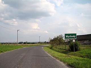
Wychody is a village in the administrative district of Gmina Zamość, within Zamość County, Lublin Voivodeship, in eastern Poland. It lies approximately 10 kilometres (6 mi) south-west of Zamość and 77 km (48 mi) south-east of the regional capital Lublin.

Wysokie is a village in the administrative district of Gmina Zamość, within Zamość County, Lublin Voivodeship, in eastern Poland. It lies approximately 6 kilometres (4 mi) north-west of Zamość and 71 km (44 mi) south-east of the regional capital Lublin.
Zarzecze is a village in the administrative district of Gmina Zamość, within Zamość County, Lublin Voivodeship, in eastern Poland. It lies approximately 10 kilometres (6 mi) south-west of Zamość and 79 km (49 mi) south-east of the regional capital Lublin.

Zawada is a village in the administrative district of Gmina Zamość, within Zamość County, Lublin Voivodeship, in eastern Poland. It lies approximately 10 kilometres (6 mi) south-west of Zamość and 79 km (49 mi) south-east of the regional capital Lublin.

Żdanówek is a village in the administrative district of Gmina Zamość, within Zamość County, Lublin Voivodeship, in eastern Poland. It lies approximately 7 kilometres (4 mi) south-west of Zamość and 78 km (48 mi) south-east of the regional capital Lublin.
Wólka Panieńska is a village in the administrative district of Gmina Zamość, within Zamość County, Lublin Voivodeship, in eastern Poland. It lies approximately 6 kilometres (4 mi) south-east of Zamość and 81 km (50 mi) south-east of the regional capital Lublin.


