Potoczek is a village in the administrative district of Gmina Adamów, within Zamość County, Lublin Voivodeship, in eastern Poland. It lies approximately 3 kilometres (2 mi) east of Adamów, 16 km (10 mi) south of Zamość, and 85 km (53 mi) south-east of the regional capital Lublin.
Księżostany is a village in the administrative district of Gmina Komarów-Osada, within Zamość County, Lublin Voivodeship, in eastern Poland. It lies approximately 16 kilometres (10 mi) south-east of Zamość and 92 km (57 mi) south-east of the regional capital Lublin.
Iłowiec is a village in the administrative district of Gmina Skierbieszów, within Zamość County, Lublin Voivodeship, in eastern Poland. It lies approximately 4 kilometres (2 mi) south-east of Skierbieszów, 16 km (10 mi) north-east of Zamość, and 75 km (47 mi) south-east of the regional capital Lublin.
Chomęciska Duże is a village in the administrative district of Gmina Stary Zamość, within Zamość County, Lublin Voivodeship, in eastern Poland. It lies approximately 2 kilometres (1 mi) south-east of Stary Zamość, 11 km (7 mi) north-west of Zamość, and 65 km (40 mi) south-east of the regional capital Lublin.
Krasne is a village in the administrative district of Gmina Stary Zamość, within Zamość County, Lublin Voivodeship, in eastern Poland. It lies approximately 8 kilometres (5 mi) north of Stary Zamość, 18 km (11 mi) north of Zamość, and 60 km (37 mi) south-east of the regional capital Lublin.
Stary Zamość is a village in Zamość County, Lublin Voivodeship, in eastern Poland. It is the seat of the gmina called Gmina Stary Zamość. It lies approximately 11 kilometres (7 mi) north-west of Zamość and 65 km (40 mi) south-east of the regional capital Lublin.
Białobrzegi is a village in the administrative district of Gmina Zamość, within Zamość County, Lublin Voivodeship, in eastern Poland. It lies approximately 10 kilometres (6 mi) north-west of Zamość and 67 km (42 mi) south-east of the regional capital Lublin.

Bortatycze is a village in the administrative district of Gmina Zamość, within Zamość County, Lublin Voivodeship, in eastern Poland. It lies approximately 8 kilometres (5 mi) north-west of Zamość and 69 km (43 mi) south-east of the regional capital Lublin.
Bortatycze-Kolonia is a village in the administrative district of Gmina Zamość, within Zamość County, Lublin Voivodeship, in eastern Poland. It lies approximately 7 kilometres (4 mi) north-west of Zamość and 70 km (43 mi) south-east of the regional capital Lublin.
Chyża is a village in the administrative district of Gmina Zamość, within Zamość County, Lublin Voivodeship, in eastern Poland. It lies approximately 3 kilometres (2 mi) north-west of Zamość and 74 km (46 mi) south-east of the regional capital Lublin.

Hubale is a village in the administrative district of Gmina Zamość, within Zamość County, Lublin Voivodeship, in eastern Poland. It lies approximately 8 kilometres (5 mi) south-west of Zamość and 76 km (47 mi) south-east of the regional capital Lublin.
Lipsko-Polesie is a village in the administrative district of Gmina Zamość, within Zamość County, Lublin Voivodeship, in eastern Poland. It lies approximately 10 kilometres (6 mi) south-west of Zamość and 81 km (50 mi) south-east of the regional capital Lublin.
Mokre is a village in the administrative district of Gmina Zamość, within Zamość County, Lublin Voivodeship, in eastern Poland. It lies approximately 5 kilometres (3 mi) south-west of Zamość and 77 km (48 mi) south-east of the regional capital Lublin.
Płoskie is a village in the administrative district of Gmina Zamość, within Zamość County, Lublin Voivodeship, in eastern Poland. It lies approximately 6 kilometres (4 mi) west of Zamość and 74 km (46 mi) south-east of the regional capital Lublin.
Skokówka is a village in the administrative district of Gmina Zamość, within Zamość County, Lublin Voivodeship, in eastern Poland. It lies approximately 4 kilometres (2 mi) south-west of Zamość and 78 km (48 mi) south-east of the regional capital Lublin.
Wierzchowiny is a village in the administrative district of Gmina Zamość, within Zamość County, Lublin Voivodeship, in eastern Poland. It lies approximately 13 kilometres (8 mi) south-west of Zamość and 80 km (50 mi) south-east of the regional capital Lublin.
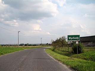
Wychody is a village in the administrative district of Gmina Zamość, within Zamość County, Lublin Voivodeship, in eastern Poland. It lies approximately 10 kilometres (6 mi) south-west of Zamość and 77 km (48 mi) south-east of the regional capital Lublin.
Zarzecze is a village in the administrative district of Gmina Zamość, within Zamość County, Lublin Voivodeship, in eastern Poland. It lies approximately 10 kilometres (6 mi) south-west of Zamość and 79 km (49 mi) south-east of the regional capital Lublin.

Zawada is a village in the administrative district of Gmina Zamość, within Zamość County, Lublin Voivodeship, in eastern Poland. It lies approximately 10 kilometres (6 mi) south-west of Zamość and 79 km (49 mi) south-east of the regional capital Lublin.
Wólka Panieńska is a village in the administrative district of Gmina Zamość, within Zamość County, Lublin Voivodeship, in eastern Poland. It lies approximately 6 kilometres (4 mi) south-east of Zamość and 81 km (50 mi) south-east of the regional capital Lublin.