Kakching is a town in the southeastern part of the Indian state of Manipur. It serves as the headquarters of Kakching district and is a major commercial hub in the state. In 2018, Kakching was declared as the cleanest city in North East India by the Swachh Bharat Mission of the Indian government.

Imphal East district is one of the 16 districts of Manipur state in northeastern India. In 2011, it was the second most populous district in the state, after Imphal West. In 2016, the Jiribam subdivision, which was an exclave at the western periphery of the state, was separated as an independent district.

Thoubal district is one of the sixteen districts of Manipur state in northeastern India. This district is bounded by Senapati district on the north, Ukhrul and Chandel districts on the east, Churchandpur and Bishnupur districts on the south and Imphal West and Imphal East districts on the west. The district occupies an area of 324 km2. The population as of 2011 is 286,687. Thoubal town is the district headquarters. This district is known for Khongjom, where the last battle of the independence of Manipur was fought in April 1891 against the British army.
Jiribam is a municipal council in the Jiribam district of the state of Manipur, India. It is one of the fastest-growing towns in Manipur.
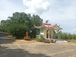
Kakching Khunou is an agricultural town in Kakching district in Manipur, India. Situated at a distance of 56 km from Imphal, it is surrounded by hillocks and agricultural land. Tarang Turel, a rivulet flowing down from the eastern hills, runs through the middle of the town serving as a natural spring. It is connected to other parts of the state by the Imphal -Sugnu state highway.
Mayang Imphal is a town and municipal council in Imphal West district in the Indian state of Manipur. Pin code of Mayang Imphal is 795132.
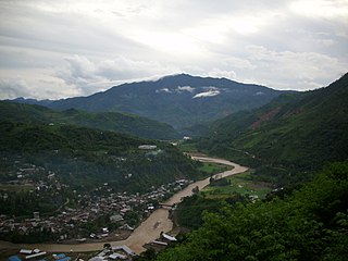
Sugnu is a municipality town at the southern tip of the Kakching district in Manipur, India. It is on the bank of the Manipur River, to the east of Churachandpur district, Chandel district to the east and Bishnupur district.

Thoubal is a town, a municipal council with 18 municipal wards and district Headquarters in Thoubal district in the Indian state of Manipur. The name 'Thoubal' comes from 'Athouba' meaning brave people symbolising the courageous people of the district. It is one of the larger towns of Manipur. It is idyllic and has many lakes and rivers, paddy fields, and gardens. It is also the window to South-East Asia as the Trans-Asian highway (AH1) passes through it. It is well connected with Imphal, Kakching, Moreh and Yairipok.
Wangjing is a town and a municipal council in Thoubal district in the Indian state of Manipur. It is about 6 km from district headquarters and an agricultural town in Thoubal district in the Indian state of Manipur. It is bordered by Heirok village in the east, Tentha village in the south-west, and on the other side by agricultural land. Wangjing River, a rivulet flowing down from the eastern hills, runs through the middle of the town, serving as a natural spring. It is connected to other parts of the state by the Imphal–Moreh national highway. It is the junction between Heirok and Tentha village.
Tentha is a village in Thoubal District in Manipur, India.
Khangabok is a village located about 25 km south of Imphal, in the state of Manipur, India. Its jurisdiction falls under the Thoubal District Division. Khangabok is one of the largest villages in Manipur in terms of area and population.
Tengnoupal is a hill town at the highest point of a road (NH-2) between Imphal and Moreh at the end of northwestern Myanmar; the ASEAN Highway passes through the village. It is the district headquarters of the recently reinstated Tengnoupal District and the administrative headquarters of yet to be formed Tengnoupal Autonomous District Council. The climate is cold all throughout the year and remains foggy during the rainy season. The village was founded by Pu Houlim Loikhom Mate and it is the largest village of the Kuki people in the district. The village due to its strategic location has seen many battles in the course of history including World War II.
Heirok is a town and a nagar panchayat in Thoubal district in the Indian state of Manipur.
Chingai is a village located north of Ukhrul in Ukhrul district, Manipur state, India. The village is one of the seven sub-divisional headquarters of Ukhrul district. The village partially connected by National Highway 150, Imphal-Kohima road via Jessami. Chingai is also one of the 60 Vidhan Sabha constituencies of Manipur and Khashim Vashum is the Member of Ligislative Assembly (MLA) elected from this constituency & Minister of 1.Animal Husbandry & Veterinary Dept. 2. Transportation dept. of government of Manipur.[ The village is flanked by Awang Kasom in the west, Khamasom in the south, Somrah Tract in the east and Kharasom in the north.
Phungyar is a small town located south of Kamjong in Kamjong district, Manipur state, India. It is also the name of a sub division of the district. The town is about 50 kilometers from Ukhrul and is partially connected by National Highway 150 that connects Imphal and Kohima via Ukhrul and Jessami. The town is flanked by Khambi in the south, Loushing in the north and alang in the west. Locally, the inhabitants speak common tangkhul language and native village dialect which belongs to the Tibeto-Burman language family.
Kakching district is one of the 16 districts of Manipur state in northeastern India. It was formedin 2016 from Thoubal district, prior to which it was a subdivision of the latter. The Kakching district is bounded by Thoubal district on the north, Ukhrul and Chandel districts on the east, Churchandpur and Bishnupur districts on the south and Imphal West and Imphal East districts on the west.
Noney, also known as Longmai, is a town located in the western part of Manipur, India. It is 63 kilometres (39 mi) west of Imphal, the capital of the state of Manipur. Its population is almost entirely made up of Rongmei Naga. Previously known as a village, recently has been declared as one of the new district headquarters of Manipur and is separated from the existing Tamenglong District and now comprises Haochong, Khoupum, Nungba and the Longmai subdivision.

Jiribam District is a district in the state of Manipur, India. It was created in December 2016 from the Imphal East district.
Wangoo is a village in the Kakching district of the Indian state of Manipur. It is situated approximately 64 km south of the state capital, Imphal. It has an area of 13.05 km2 with a population of 6134.
National Highway 137A, commonly referred to as NH 137A is a national highway in India. It is a spur road of National Highway 37. NH-137A traverses the state of Manipur in India. People of Manipur call the highway as Mayai Lambi.

