Wairaki Stream

Last updated

Wairaki Stream
Duck Creek
Arachnocampa luminosa 406366351.jpg
The Wairaki Stream in Lynfield, Auckland, New Zealand
Wairaki Stream
Route of the Wairaki Stream
Auckland Council 2019 Wards Outlined Blank.png
Red pog.svg
Mouth of Wairaki Stream
New Zealand (relief map).png
Disc Plain red.svg
Wairaki Stream (New Zealand)
Native nameWairaki
Location
Country New Zealand
Region Auckland Region
Physical characteristics
SourceWairaki / Lynfield Reserve
  coordinates 36°55′36″S174°43′19″E / 36.92672°S 174.72193°E / -36.92672; 174.72193
  elevation45 m (148 ft) [1]
Mouth Lynfield Cove
  coordinates
36°55′38″S174°42′41″E / 36.92729°S 174.71139°E / -36.92729; 174.71139
  elevation
0 m (0 ft)
Length2 km (1.2 mi)
Basin features
ProgressionWairaki Stream → Lynfield Cove → Blockhouse Bay → Manukau HarbourTasman Sea

Wairaki Stream is a stream in the suburb of Lynfield in Auckland, New Zealand. One of two named streams that flows into the Manukau Harbour from the Auckland isthmus, the stream is primarily surrounded by reserves, and is a home for native bird and plant species. During suburban development, the mouth of the stream was fed into a culvert, and a stone wall constructed in Lynfield Cove, where a park was developed on the reclaimed land. The beetle species Microscydmus lynfieldi was first discovered at Wairaki Stream.

Contents

Etymology

Wairaki Stream circa 1900-1919, prior to suburban development of Lynfield. Duck Creek (Wairaki Stream), Lynfield (cropped).jpg
Wairaki Stream circa 1900–1919, prior to suburban development of Lynfield.

Wairaki is the traditional Tāmaki Māori name for the stream. The name refers to the northerly flow of the upper section of the stream. [2] [1] Wairaki Stream is occasionally referred to by the name Duck Creek, and as the Waikaraki Stream. [3] [4]

In 2022, the Wairaki Stream Reserve was given two bilingual Māori language names: the lower section near Lynfield Cove was named Wairaki ki tai, while the upper section was named Wairaki ki uta. [5]

Geography

Wairaki Stream in 2 km (1.2 mi) in length, [6] and is fed by storm-water culverts from neighbouring residential properties. [3] The stream begins at Wairaki / Lynfield Reserve, southwest of Lynfield Shopping Centre. It flows northwards then westwards through the Wairaki Stream Reserve. [7] The final 100 m (330 ft) of the stream flows through a culvert, entering the Manukau Harbour at Lynfield Cove. [8] [3]

The Wairaki Stream is primarily formed from Waitemata Group sandstone. [1] The southern Auckland isthmus is thought to have been podocarp-broadleaf forest before the arrival of people, and by 1910 the area was covered in "mixed bush" and mānuka bush. [1] Alongside Anns Creek, the Wairaki Stream is only one of two named streams that flows into the Manukau Harbour from the Auckland isthmus. [7]

Biodiversity

The majority of the stream is forested with New Zealand native bush, and the area is home to numerous native bird species. [6] The neighbouring reserve is home to a mix of exotic species, including river sheoak, Mexican cypress and camphor laurel, with native species including silver fern, māhoe, māpou, pigeonwood, hangehange and kawakawa. [3] Large native trees are uncommon along the stream banks, however some areas feature kānuka and regenerating kahikatea trees. [3] The mouth of the stream is home to species of wetland plants, primarily exotic species as well as native New Zealand species including Juncus prismatocarpus and Typha orientalis . [3]

Microscydmus lynfieldi , one of the smallest beetle species in the world, was discovered at the Wairaki Stream in 1975. [8] [9] The beetle species Notoptenidium oblongum was also first discovered here. [10]

The stream is home to New Zealand longfin eels and banded kōkopu. [6] [1]

History

The Wairaki Stream was visited by missionary William Colenso on 4 February 1842, during which he noticed the abundance of Alseuosmia macrophylla along the stream. [8] For much of its history, the stream mouth was a muddy and rocky area. [4]

The Wairaki Stream catchment was sold to the Crown as a part of an 1841 land purchase from Ngāti Whātua, while the southern was sold as a part of a private land sale in 1845. The northern catchment became property of John Logan Campbell from 1852 to 1910. In 1908, most of area immediately adjacent to the Wairaki Stream was set aside as a reserve, [1] with the wider area to the north used as farmland in the early 20th century. [11] [1]

The suburb of Lynfield was developed in the 1950s, [12] [13] during which many of the reserves surrounding the stream were enlarged. [1] During the 1960s, the Auckland City Council constructed a stone wall at the mouth of the creek and backfilled the tidal section of Wairaki Stream, creating a grassy recreation area. [1] [14]

A local volunteer group, the Friends of Wairaki Stream (FOWS), was established in 2018 in order to undertake conservation work on the stream. [15] [16]

During the 2023 Auckland Anniversary Weekend floods, significant amounts of debris filled up the Wairaki Stream valley. [17] In August 2024, 50 t (49 long tons; 55 short tons) of debris were lifted out by helicopter from the stream. [18]

Since 2013, feasibility studies have investigated options for removing the culvert and daylighting the mouth of the Wairaki Stream. [1]

See also

Related Research Articles

<span class="mw-page-title-main">Manukau Harbour</span> Harbour in Auckland, New Zealand

The Manukau Harbour is the second largest natural harbour in New Zealand by area. It is located to the southwest of the Auckland isthmus, and opens out into the Tasman Sea.

<span class="mw-page-title-main">Epsom, New Zealand</span> Suburb in Auckland, New Zealand

Epsom is a suburb of Auckland, New Zealand. It is located in the centre of the Auckland isthmus between Mount Eden and Greenlane, south of Newmarket, and 5 km (3.1 mi) south of the Auckland City Centre.

<span class="mw-page-title-main">Waitematā Harbour</span> Harbour in Auckland, New Zealand

Waitematā Harbour is the main access by sea to Auckland, New Zealand. The harbour forms the northern and eastern coasts of the Auckland isthmus and is crossed by the Auckland Harbour Bridge. It is matched on the southern side of the city by the shallower waters of the Manukau Harbour.

<span class="mw-page-title-main">Whau River</span> River in Auckland, New Zealand

The Whau River is an estuarial arm of the southwestern Waitemata Harbour within the Auckland metropolitan area in New Zealand. It flows north for 5.7 kilometres (3.5 mi) from its origin at the confluence of the Avondale Stream and Whau Stream to its mouth between the Te Atatū Peninsula and the long, thin Rosebank Peninsula in Avondale. It is 800 metres (2,600 ft) at its widest and 400 metres (1,300 ft) wide at its mouth.

<span class="mw-page-title-main">Māngere</span> Suburb in Auckland, New Zealand

Māngere is a major suburb in South Auckland, New Zealand, located on mainly flat land on the northeastern shore of the Manukau Harbour, to the northwest of Manukau City Centre and 15 kilometres south of the Auckland city centre. It is the location of Auckland Airport, which lies close to the harbour's edge to the south of the suburb.

<span class="mw-page-title-main">Lynfield, New Zealand</span> Suburb in Auckland, New Zealand

Lynfield is a suburb of Auckland, New Zealand. It is under the local governance of Auckland Council. The suburb is located on the southwestern Auckland isthmus bordering the Manukau Harbour, much of which is densely forested with native forest. Lynfield was developed for suburban housing in the late 1950s and 1960s, modelled after American-style suburbs.

<span class="mw-page-title-main">Waikōwhai</span> Suburb in Auckland, New Zealand

Waikōwhai is an Auckland suburb, under the local governance of the Auckland Council. Waikōwhai has the largest block of native forest left on the Auckland isthmus. The block was considered the too infertile for farming and subsequently not cleared but given to the Wesley Mission. Today the forest block hosts a valuable sample of Auckland's original fauna and flora. Waikōwhai Walkway extends for 10 km (6.2 mi) linking Onehunga to Lynfield Cove.

<span class="mw-page-title-main">Hillsborough, Auckland</span> Suburb in Auckland, New Zealand

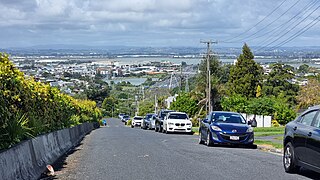
Hillsborough is a suburb of Auckland, New Zealand. It is under the local governance of the Auckland Council. Hillsborough is a leafy suburb of 20th-century houses. The area is serviced by two shopping areas; Onehunga and Three Kings. The area is served by secondary schools Mount Roskill Grammar School and Marcellin College.

<span class="mw-page-title-main">Wesley, New Zealand</span> Suburb in Auckland, New Zealand

Wesley is a suburb of Auckland, New Zealand, located in the south-west of the Auckland isthmus. The area is a part of the Oakley Creek catchment, and in the 19th and early 20th centuries was primarily swampland owned by the Weslayan Mission. The New Zealand Government developed Wesley as a state housing area in the 1940s and 1950s.

<span class="mw-page-title-main">Māngere Mountain</span> Volcanic cone in Auckland, New Zealand

Māngere Mountain, also known by the names Te Pane-o-Mataaho and Te Ara Pueru, is a volcanic cone in Māngere, Auckland. Located within Māngere Domain, it is one of the largest volcanic cones in the Auckland volcanic field, with a peak 106 metres (348 ft) above sea level. It was the site of a major pā and many of the pā's earthworks are still visible. It has extensive panoramic views of Auckland from its location in the southeastern portion of the city's urban area.

<span class="mw-page-title-main">Auckland isthmus</span> Narrow landstrip in Auckland, New Zealand

The Auckland isthmus, also known as the Tāmaki isthmus, is a narrow stretch of land on the North Island of New Zealand in the Auckland Region, and the location of the central suburbs of the city of Auckland, including the CBD. The isthmus is located between two rias : the Waitematā Harbour to the north, which opens to the Hauraki Gulf / Tīkapa Moana and Pacific Ocean, and the Manukau Harbour to the south, which opens to the Tasman Sea. The isthmus is the most southern section of the Northland Peninsula.

<span class="mw-page-title-main">Oakley Creek</span> Creek in New Zealand

Oakley Creek is a creek in Auckland, New Zealand. While heavily human-modified, it has a number of important ecological features, such as having the only natural waterfall on the Auckland isthmus.

<span class="mw-page-title-main">Āwhitu Peninsula</span> Place in Auckland, New Zealand

The Āwhitu Peninsula is a long peninsula in the North Island of New Zealand, extending north from the mouth of the Waikato River to the entrance to Manukau Harbour.

<span class="mw-page-title-main">Te Waiohua</span> Māori iwi in New Zealand

Te Waiohua or Te Wai-o-Hua is a Māori iwi (tribe) confederation that thrived in the early 17th century. The rohe was primarily the central Tāmaki Makaurau area and they had pā at Te Tātua a Riukiuta, Puketāpapa, Te Ahi-kā-a-Rakataura, Maungakiekie, Maungawhau, Tītīkōpuke, Ōhinerau, Rangitotoiti, Taurarua, Rarotonga, Ōtāhuhu, Te Pane o Mataaoho, Ihumātao, Matukutūreia and Matukutūruru, until the 1740s, when the paramount Waiohua chief, Kiwi Tāmaki, was defeated by the Ngāti Whātua hapū, Te Taoū. The descendants of the Waiohua confederation today include, Ngāti Te Ata Waiohua and Te Ākitai Waiohua.

<span class="mw-page-title-main">Puketāpapa (local board area)</span> Local board area in Auckland, New Zealand

Puketāpapa is a local government area in Auckland, in New Zealand's Auckland Region. It is governed by the Puketāpapa Local Board and Auckland Council, and is located within the council's Albert-Eden-Puketāpapa Ward.

<span class="mw-page-title-main">Hillsborough Cemetery</span> Cemetery in Auckland, New Zealand

Hillsborough Cemetery is a large cemetery located in the Auckland isthmus suburb of Hillsborough.

<span class="mw-page-title-main">Little Muddy Creek (New Zealand)</span> River in the Auckland Region, New Zealand

The Little Muddy Creek is a river of the Auckland Region of New Zealand's North Island. It flows south from its source in Titirangi, meets the tributaries Waituna Stream and Waiohua Creek which run through the suburbs of Waima and Woodlands Park, before reaching the Manukau Harbour.

<span class="mw-page-title-main">Papakura Stream</span> Stream in South Auckland, New Zealand

The Papakura Stream, also known as the Papakura Creek, is a major stream in South Auckland, in the Auckland Region of New Zealand's North Island. It flows south-west from near the Brookby to the Pahurehure Inlet of the Manukau Harbour. The stream forms the border between Manurewa and Papakura.

<span class="mw-page-title-main">Puhinui Creek</span> River in Auckland Region, New Zealand

The Puhinui Creek, also known as the Puhinui Stream or Te Puhinui, is a major stream in South Auckland, in the Auckland Region of New Zealand's North Island. It flows westwards from Totara Park through Manukau, then southwest at Wiri to the Manukau Harbour.

<span class="mw-page-title-main">Shoal Bay, New Zealand</span> Bay in the Waitematā Harbour

Shoal Bay is a bay of the Waitematā Harbour in Auckland, New Zealand. It is located on the North Shore.

References

  1. 1 2 3 4 5 6 7 8 9 10 Boffa Miskell (29 July 2022). Wairaki Catchment Strategy: Report prepared by Boffa Miskell for Auckland Council (PDF) (Report). Auckland Council . Retrieved 23 September 2024.
  2. "Story of Wairaki". Auckland Council . Retrieved 23 September 2024.
  3. 1 2 3 4 5 6 Wilcox, Mike; Warden, Jack (1 June 2018). "Botany of the Lynfield Coast, Manukau Harbour, Auckland" (PDF). Auckland Botanical Society Journal. 73: 57–66. Retrieved 23 September 2024.
  4. 1 2 Pishief, Elizabeth; Shirley, Brendan (August 2015). "Waikōwhai Coast Heritage Study" (PDF). Auckland Council . Retrieved 14 February 2023.
  5. "Traditional Māori names return to Puketāpapa parks". OurAuckland. Auckland Council. 23 September 2022. Retrieved 23 September 2024.
  6. 1 2 3 "Locals lead the charge to protect Wairaki Stream". OurAuckland. Auckland Council. 13 November 2018. Retrieved 21 February 2023.
  7. 1 2 "Place name detail: Wairaki Stream". New Zealand Gazetteer. New Zealand Geographic Board . Retrieved 23 September 2024.
  8. 1 2 3 Kuschel, G. (1990). Beetles in a suburban environment: A New Zealand case study.: The identity and status of Coleoptera in the natural and modified habitats of Lynfield, Auckland (1974–1989) (PDF). DSIR Plant Protection Report. Vol. 3. ISBN   0-477-02596-X. Wikidata   Q120031137.
  9. Franz, H. (1977). "Neue Scydmaeniden (Coleoptera) aus Neuseeland, von Samoa den Tonga-Inseln und Cook-Inseln" (PDF). Koleopterologische Rundschau (in German). 53: 15–25. ISSN   0075-6547. Wikidata   Q130344952.
  10. Johnson, Colin (July 1982). "An introduction to the Ptiliidae (Coleoptera) of New Zealand". New Zealand Journal of Zoology. 9 (3): 333–376. doi:10.1080/03014223.1982.10423865. ISSN   0301-4223. Wikidata   Q54555390.
  11. Truttman, Lisa (9 March 2013). "Lynfield, or Linfield?". Timespanner. Retrieved 21 February 2023.
  12. "Land for New Township". Press. Vol. C, no. 29522. 25 May 1961. p. 15. Retrieved 21 February 2023 via Papers Past.
  13. Reidy, Jade (2013). Not Just Passing Through: the Making of Mt Roskill (2nd ed.). Auckland: Puketāpapa Local Board. pp. 122–124. ISBN   978-1-927216-97-2. OCLC   889931177. Wikidata   Q116775081.
  14. Glen, A. W. (November 2006). "Notes on some features of the Manukau coastline, from Green Bay to Onehunga". Blockhouse Bay Historical Society. Archived from the original on 25 May 2010.
  15. "Wairaki Stream conservation progresses". Beacon Community News. 1 August 2020. Retrieved 21 February 2023.
  16. "About". Friends of Wairaki Stream. 12 August 2020. Retrieved 21 February 2023.
  17. "Chopper action makes space for water". OurAuckland. Auckland Council. 15 July 2024. Retrieved 23 September 2024.
  18. "Wairaki Stream sheds 50 tonnes". OurAuckland. Auckland Council. 16 August 2024. Retrieved 23 September 2024.