Lynfield, New Zealand

Last updated

Lynfield
Halsey Drive in Lynfield, New Zealand (cropped).jpg
Halsey Drive in Lynfield
Lynfield, New Zealand
Coordinates: 36°55′38″S174°43′21″E / 36.927109°S 174.722412°E / -36.927109; 174.722412
CountryNew Zealand
City Auckland
Local authority Auckland Council
Electoral ward Albert-Eden-Puketāpapa ward
Local board Puketāpapa Local Board
Area
[1]
  Land252 ha (623 acres)
Population
 (June 2023) [2]
  Total8,560
New Windsor Mount Roskill Mount Roskill
Blockhouse Bay
Pfeil oben.svg
Pfeil links.svgLynfieldPfeil rechts.svg
Pfeil unten.svg
Waikōwhai
(Manukau Harbour)(Manukau Harbour)(Manukau Harbour)

Lynfield is a suburb of Auckland, New Zealand. It is under the local governance of Auckland Council. The suburb is located on the southwestern Auckland isthmus bordering the Manukau Harbour, much of which is densely forested with native forest. Lynfield was developed for suburban housing in the late 1950s and 1960s, modelled after American-style suburbs.

Contents

Etymology

The name Lynfield was first used in the area in the early 20th century, when Australian Albert William Irvine established a poultry farm on Pah Road in Epsom, later moving to land owned by Sir Alfred Bankart in the southwestern Auckland isthmus in 1913. [3] Irvine named the farm after Lindfield, New South Wales, which was the birthplace of his wive. [4] Before Lynfield College opened in 1958, parents and teachers chose the name Lynfield, due to the Linfield poultry farm, owned by , adjacent to the school grounds. [5] The college's name was adopted for the modern suburb, which developed south of the school. [4] [5]

Geography

Lynfield is a peninsula of the southern Auckland isthmus bounded by the Manukau Harbour. It is bordered by Lynfield Cove in the west and Wattle Bay in the east. [4] [6] [7]

The Wairaki Stream (also known as Duck Creek) flows through Lynfield, entering the Manukau Harbour at Lynfield Cove. [6] [8]

History

Scenes from the Linfield poultry farm in the 1910s Profitable poultry raising scenes on a well-known Auckland farm.jpg
Scenes from the Linfield poultry farm in the 1910s

The area has been settled by Tāmaki Māori iwi hapū and since at least the 13th century. [9] By the early 18th century, the area was within the rohe of Waiohua. After the defeat of Kiwi Tāmaki, the paramount chief of the iwi, the area became part of the rohe of Ngāti Whātua (modern-day Ngāti Whātua Ōrākei). [9] [10]

In 1910, Sir Alfred Bankart purchased an allotment of land between White Swan Road and the Wairaki Stream, naming his purchase the Gilletta Estate, and subdividing the area between 1919 and 1922. [3] In 1913, farmer Albert William Irvine moved Linfield Poultry Farm from Pah Road in Epsom to the estate, after needing to upscale his business. [3] [11] By the next year, Irvine had moved the farm north to Boundary Road in Mount Roskill, but the name remained associated with the modern-day area. [3]

In 1911, the Crown endowed the land to the Auckland Harbour Board, who developed the area into suburban housing in the late 1950s and 1960s. [12] Town planner Robert Terence Kennedy was consulted to develop the suburb, who modelled the area after American-style suburbs. The area features one major road, Halsey Drive, which winds around the development. The suburb is bisected by the Avenue, which was developed as a Parisian-style boulevard. The developers chose to name the streets after luxury cruise liners that stopped in Auckland. [5]

The Auckland Harbour Board initially offered the houses as rental properties, available on 21-year leases. Residents protested their lack of ability to purchase their homes, and in 1968 presented a 150-member petition to the Harbour Board. In 1974, the board agreed to let residents purchase their properties, due to the harbour board experiencing a shortage of funds. [5]

The suburb's first shop was a Four Square which opened in 1965. Suburban housing continued to be built in the area until the late 1970s. [5]

Demographics

Lynfield covers 2.52 km2 (0.97 sq mi) [1] and had an estimated population of 8,560 as of June 2023, [2] with a population density of 3,397 people per km2.

Historical population
YearPop.±% p.a.
20066,570    
20136,762+0.41%
20187,503+2.10%
Source: [13]

Lynfield had a population of 7,503 at the 2018 New Zealand census, an increase of 741 people (11.0%) since the 2013 census, and an increase of 933 people (14.2%) since the 2006 census. There were 2,247 households, comprising 3,753 males and 3,750 females, giving a sex ratio of 1.0 males per female, with 1,272 people (17.0%) aged under 15 years, 1,803 (24.0%) aged 15 to 29, 3,504 (46.7%) aged 30 to 64, and 927 (12.4%) aged 65 or older.

Ethnicities were 31.1% European/Pākehā, 4.6% Māori, 6.7% Pacific peoples, 61.3% Asian, and 3.5% other ethnicities. People may identify with more than one ethnicity.

The percentage of people born overseas was 57.6, compared with 27.1% nationally.

Although some people chose not to answer the census's question about religious affiliation, 29.4% had no religion, 31.3% were Christian, 0.1% had Māori religious beliefs, 22.0% were Hindu, 7.6% were Muslim, 2.1% were Buddhist and 3.0% had other religions.

Of those at least 15 years old, 2,328 (37.4%) people had a bachelor's or higher degree, and 651 (10.4%) people had no formal qualifications. 1,080 people (17.3%) earned over $70,000 compared to 17.2% nationally. The employment status of those at least 15 was that 3,285 (52.7%) people were employed full-time, 846 (13.6%) were part-time, and 219 (3.5%) were unemployed. [13]

Individual statistical areas
NameArea (km2)PopulationDensity (per km2)HouseholdsMedian ageMedian income
Lynfield North0.943,0303,22386134.0 years$30,600 [14]
Lynfield South1.584,4732,8311,38636.6 years$36,200 [15]
New Zealand37.4 years$31,800

Landmarks and amenities

143 White Swan Road, a 1910s farmhouse which has since been developed as an early learning centre Old House at Lynfield (14508383456).jpg
143 White Swan Road, a 1910s farmhouse which has since been developed as an early learning centre
The Lynfield Shopping Centre 20230124 075315 Lynfield Shopping Centre.jpg
The Lynfield Shopping Centre

Education

Lynfield College 20220820 173755 Lynfield College.jpg
Lynfield College

Lynfield College is a secondary school for years 9–13 with a roll of 1803. [26] The school was established in 1958. [27]

Halsey Drive School and Marshall Laing School are contributing primary schools for years 1–6 with rolls of 373 and 547 students, respectively. [28] [29] Marshall Laing School was established in 1962, and is named after the son of George Laing (of Laingholm), on the site of farmland previously owned by Marshall Laing. [30] Halsey Drive School was established in 1968. [30]

All these schools are coeducational. Rolls are as of April 2023. [31]

Notable residents

Local government

The first local government in the area was the Mt Roskill Highway Board, that formed on 7 August 1868 to administer and fund the roads in the area. In 1883, the Highway Board became the Mt Roskill Road Board. [32] The Lynfield area was a part of the Mt Roskill Borough between 1947 and 1989, after which it was amalgamated into Auckland City. On 1 November 2010, the Auckland Council was formed as a unitary authority governing the entire Auckland Region, [33] and Wesley become a part of the Puketāpapa local board area, administered by the Puketāpapa Local Board. The Puketāpapa local board area forms a part of the Albert-Eden-Puketāpapa ward, which votes for two members of the Auckland Council. The Albert-Eden-Puketāpapa ward is represented by counsellors Christine Fletcher and Julie Fairey.

Related Research Articles

<span class="mw-page-title-main">Three Kings, New Zealand</span> Suburb in Auckland, New Zealand

Three Kings is a suburb of Auckland, New Zealand that is built around the Te Tātua-a-Riukiuta volcano. It is home to an ethnically diverse population of about 3,500 people.

<span class="mw-page-title-main">Mount Albert, New Zealand</span> Suburb in Auckland, New Zealand

Mount Albert is an inner suburb of Auckland, New Zealand, which is centred on Ōwairaka / Mount Albert, a local volcanic peak which dominates the landscape. By 1911, growth in the area had increased to the point where Mount Albert was declared an intdependent borough, which was later absorbed into Auckland. The suburb is located 7 kilometres (4.3 mi) to the southwest of the Auckland City Centre.

<span class="mw-page-title-main">Mount Roskill</span> Suburb in Auckland, New Zealand

Mount Roskill is a suburban area in the city of Auckland, New Zealand. It is named for the volcanic peak Puketāpapa.

<span class="mw-page-title-main">New Windsor, New Zealand</span> Suburb in Auckland, New Zealand

New Windsor, founded in 1865, is a suburb of Auckland, New Zealand. It is located 10 kilometres (6.2 mi) from the Auckland city centre, between Mount Albert, Blockhouse Bay, Mt Roskill and Avondale.

<span class="mw-page-title-main">Waikōwhai</span> Suburb in Auckland, New Zealand

Waikōwhai is an Auckland suburb, under the local governance of the Auckland Council. Waikōwhai has the largest block of native forest left on the Auckland isthmus. The block was considered the too infertile for farming and subsequently not cleared but given to the Wesley Mission. Today the forest block hosts a valuable sample of Auckland's original fauna and flora. Waikōwhai Walkway extends for 10 km (6.2 mi) linking Onehunga to Lynfield Cove.

<span class="mw-page-title-main">Hillsborough, Auckland</span> Suburb in Auckland, New Zealand

Hillsborough is a suburb of Auckland, New Zealand. It is under the local governance of the Auckland Council. Hillsborough is a leafy suburb of 20th-century houses. The area is serviced by two shopping areas; Onehunga and Three Kings. The area is served by secondary schools Mount Roskill Grammar School and Marcellin College.

<span class="mw-page-title-main">Wesley, New Zealand</span> Suburb in Auckland, New Zealand

Wesley is a suburb of Auckland, New Zealand, located in the south-west of the Auckland isthmus. The area is a part of the Oakley Creek catchment, and in the 19th and early 20th centuries was primarily swampland owned by the Weslayan Mission. The New Zealand Government developed Wesley as a state housing area in the 1940s and 1950s.

<span class="mw-page-title-main">Waikowhai Intermediate School</span> State, co-educational, intermediate school

Waikowhai Intermediate School is a coeducational intermediate school located in Mount Roskill, Auckland, New Zealand. It serves the areas of Mount Roskill, Waikōwhai, Lynfield, Māngere Bridge and Blockhouse Bay. The current principal is David King.

<span class="mw-page-title-main">Wattle Downs</span> Suburb in Auckland, New Zealand

Wattle Downs is a suburb of Auckland, New Zealand.

<span class="mw-page-title-main">Rita Fatialofa-Paloto</span> New Zealand netball and softball player

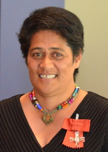
Rita Taimalietane Fatialofa-Patolo is a Samoan sportsperson who played netball and softball for New Zealand.

<span class="mw-page-title-main">Lynfield College</span> State coed secondary, years 9–13 school

Lynfield College is a secondary education provider in Lynfield, Auckland, New Zealand. It celebrated its 50th anniversary in 2008.

<span class="mw-page-title-main">Dominion Road</span>

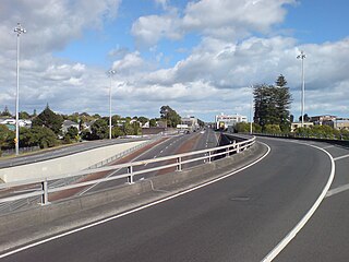
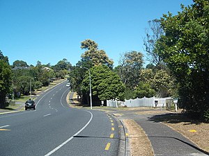
Dominion Road is an arterial road in Auckland, New Zealand, running north–south across most of the Auckland isthmus. It is a major public transport route that carries 50,000 bus passengers each week, making it one of the few roads in Auckland on which similar or greater numbers of people travel by public transport than by private car.

Iva Lewis Ropati is a New Zealand former professional rugby league footballer who played in the 1980s and 1990s, and high school principal. He played at representative level for New Zealand, Auckland and Taranaki, and at club level for the Otahuhu Leopards, the Te Atatu Roosters, the Mangere East Hawks, the Sheffield Eagles, Featherstone Rovers, Oldham, the Parramatta Eels, the Auckland Warriors and the Manurewa Marlins, as a centre.

Alex Metzger is a former association football player who represented New Zealand at international level.

<span class="mw-page-title-main">Oakley Creek</span> Creek in New Zealand

Oakley Creek is a creek in Auckland, New Zealand. While heavily human-modified, it has a number of important ecological features, such as having the only natural waterfall on the Auckland isthmus.

<span class="mw-page-title-main">Puketāpapa Local Board</span> Local board of Auckland Council in New Zealand

The Puketāpapa Local Board is one of the 21 local boards of the Auckland Council, and is one of the two boards overseen by the council's Albert-Eden-Puketāpapa ward councilors.

Rachel Nash is a New Zealand actress who has appeared in many local films and television series over the years in New Zealand. She has had several guest roles in Shortland Street, as well as appearances in Mercy Peak, Outrageous Fortune, Legend of the Seeker and The Cult. More recently she has been starring as Ingrid, reincarnated with the Norse goddess Snotra in The Almighty Johnsons.

<span class="mw-page-title-main">Puketāpapa (local board area)</span> Local board area in Auckland, New Zealand

Puketāpapa is a local government area in Auckland, in New Zealand's Auckland Region. It is governed by the Puketāpapa Local Board and Auckland Council, and is located within the council's Albert-Eden-Puketāpapa Ward.

<span class="mw-page-title-main">Hillsborough Cemetery</span> Cemetery in Auckland, New Zealand

Hillsborough Cemetery is a large cemetery located in the Auckland isthmus suburb of Hillsborough.

References

  1. 1 2 "ArcGIS Web Application". statsnz.maps.arcgis.com. Retrieved 17 July 2022.
  2. 1 2 "Population estimate tables - NZ.Stat". Statistics New Zealand . Retrieved 25 October 2023.
  3. 1 2 3 4 Truttman, Lisa (9 March 2013). "Lynfield, or Linfield?". Timespanner. Retrieved 21 February 2023.
  4. 1 2 3 "Lynfield". New Zealand Gazetteer. Land Information New Zealand. Retrieved 14 February 2023.
  5. 1 2 3 4 5 Reidy 2013, pp. 122–124.
  6. 1 2 "Lynfield Cove". New Zealand Gazetteer. Land Information New Zealand. Retrieved 14 February 2023.
  7. "Wattle Bay". New Zealand Gazetteer. Land Information New Zealand. Retrieved 14 February 2023.
  8. "Wairaki Stream". New Zealand Gazetteer. Land Information New Zealand. Retrieved 14 February 2023.
  9. 1 2 Pishief, Elizabeth; Shirley, Brendan (August 2015). "Waikōwhai Coast Heritage Study" (PDF). Auckland Council . Retrieved 14 February 2023.
  10. Kāwharu, Hugh (2001). Land and Identity in Tāmaki: a Ngāti Whātua Perspective (PDF) (Speech). Hillary Lecture. Auckland, New Zealand: Auckland War Memorial Museum. Archived from the original (PDF) on 2 November 2021. Retrieved 26 January 2018.
  11. "Poultry". Auckland Star . Vol. XLIV, no. 66. 18 March 1913. p. 2. Retrieved 21 February 2023 via Papers Past.
  12. "Land for New Township". Press. Vol. C, no. 29522. 25 May 1961. p. 15. Retrieved 21 February 2023 via Papers Past.
  13. 1 2 "Statistical area 1 dataset for 2018 Census". Statistics New Zealand. March 2020. Lynfield North (139600) and Lynfield South (140900).
  14. 2018 Census place summary: Lynfield North
  15. 2018 Census place summary: Lynfield South
  16. 1 2 Mathews & Mathews Architects; Truttman, Lisa (February 2014). Puketapapa - Mt Roskill Heritage Survey 2013 (PDF) (Report). Auckland Council . Retrieved 12 February 2023.
  17. "Mt Roskill Childcare, Auckland". Bright Beginnings Early Learning Centre. Retrieved 21 February 2023.
  18. "Who We Are". Lynfield Community Church. Retrieved 21 February 2023.
  19. Fagan, Josh (25 September 2016). "Indian students plan last stand protest to avoid deportation from New Zealand". Stuff . Retrieved 21 February 2023.
  20. "Club History". Lynfield Tennis Club. Retrieved 21 February 2023.
  21. "Waikōwhai Walkway: Manukau coastal walk". Auckland Council . Retrieved 21 February 2023.
  22. Janssen, Peter (January 2021). Greater Auckland Walks. New Holland Publishers. p. 117. ISBN   978-1-86966-516-6. Wikidata   Q118136068.
  23. "Locals lead the charge to protect Wairaki Stream". OurAuckland. Auckland Council. 13 November 2018. Retrieved 21 February 2023.
  24. "Wairaki Stream conservation progresses". Beacon Community News. 1 August 2020. Retrieved 21 February 2023.
  25. "About". Friends of Wairaki Stream. Retrieved 21 February 2023.
  26. Education Counts: Lynfield College
  27. "Overview and History". Lynfield College. Retrieved 13 August 2020.
  28. Education Counts: Halsey Drive School
  29. Education Counts: Marshall Laing School
  30. 1 2 Reidy, Jade (2013). Not Just Passing Through: the Making of Mt Roskill (2nd ed.). Auckland: Puketāpapa Local Board. p. 162. ISBN   978-1-927216-97-2. OCLC   889931177. Wikidata   Q116775081.
  31. "New Zealand Schools Directory". New Zealand Ministry of Education. Retrieved 12 December 2022.
  32. Reidy 2013, pp. 36–37.
  33. Blakeley, Roger (2015). "The planning framework for Auckland 'super city': an insider's view". Policy Quarterly. 11 (4). doi: 10.26686/pq.v11i4.4572 . ISSN   2324-1101.

Bibliography