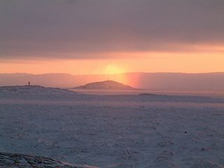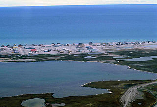
Iqaluit, meaning "place of fish", is the capital of the Canadian territory of Nunavut, its largest community, and its only city. It was known as Frobisher Bay from 1942 to 1987, after the large bay on the coast of which the city is situated, when the traditional Inuktitut name was restored.

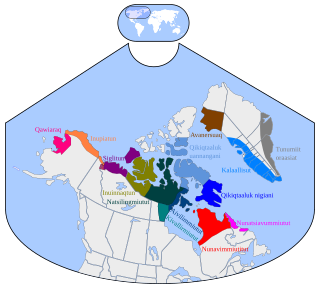
The Inuit languages are a closely related group of indigenous American languages traditionally spoken across the North American Arctic and to some extent in the subarctic in Labrador. The related Yupik languages are spoken in western and southern Alaska and in the far east of Russia, but are severely endangered in Russia today and spoken only in a few villages on the Chukchi Peninsula. The Inuit live primarily in three countries: Greenland, Canada, and the United States.

Frobisher Bay is an inlet of the Labrador Sea in the Qikiqtaaluk Region of Nunavut, Canada. It is located in the southeastern corner of Baffin Island. Its length is about 230 km (140 mi) and its width varies from about 40 km (25 mi) at its outlet into the Labrador Sea to roughly 20 km (12 mi) towards its inner end.

Inuinnaqtun, is an indigenous Inuit language of Canada and a dialect of Inuvialuktun. It is related very closely to Inuktitut, and some scholars, such as Richard Condon, believe that Inuinnaqtun is more appropriately classified as a dialect of Inuktitut. The governments of the Northwest Territories and Nunavut recognise Inuinnaqtun as an official language in addition to Inuktitut. The Official Languages Act of Nunavut, passed by the Senate of Canada on June 11, 2009, recognized Inuinnaqtun as one of the official languages of Nunavut.

Nunavut is a federal electoral district in Nunavut, Canada, that has been represented in the House of Commons of Canada since 1979. Before 1997, it was known as Nunatsiaq, and was one of two electoral districts in Northwest Territories.

Inuktitut, also Eastern Canadian Inuktitut, is one of the principal Inuit languages of Canada. It is spoken in all areas north of the tree line, including parts of the provinces of Newfoundland and Labrador, Quebec, to some extent in northeastern Manitoba as well as the Northwest Territories and Nunavut. It is one of the aboriginal languages written with Canadian Aboriginal syllabics.

Hall Beach is an Inuit settlement within the Qikiqtaaluk Region of Nunavut, Canada, approximately 69 km (43 mi) south of Igloolik.

Auyuittuq National Park is a national park located on Baffin Island's Cumberland Peninsula, in the Qikiqtaaluk Region of Nunavut, the largest political subdivision of Canada. The park was initially known as Baffin Island National Park when it was established in 1972, but the name was changed in 1976 to its current name to better reflect the region and its history. It features many terrains of Arctic wilderness, such as fjords, glaciers, and ice fields. Although Auyuittuq was established in 1972 as a national park reserve, it was upgraded to a full national park in 2000.

CBC North is the Canadian Broadcasting Corporation's radio and television service in Northern Canada. It began operations in 1958 as the CBC Northern Service with radio broadcasts. It took over CFYK, a community-run station in Yellowknife, Northwest Territories, which began broadcasting in 1948. CFYK had been opened by the Royal Canadian Signal Corps.

Taloyoak or Talurjuaq, formerly known as Spence Bay until 1 July 1992; is located on the Boothia Peninsula, Kitikmeot, in Nunavut Canada. The community is served only by air and by annual supply sealift. Taloyoak may mean "large blind", referring to a stone caribou blind or a screen used for caribou hunting. The community is situated 460 km (290 mi) east of the regional centre of Cambridge Bay, 1,224 km (761 mi) northeast of Yellowknife, Northwest Territories. Taloyoak is the northernmost community in mainland Canada.

Kugaaruk, formerly known as Pelly Bay until 3 December 1999, is located on the shore of Pelly Bay, just off the Gulf of Boothia, Simpson Peninsula, Kitikmeot, in Canada's Nunavut territory. Access is by air by the Kugaaruk Airport and by annual supply sealift. Kugaaruk means "little stream", the traditional name of the brook that flows through the hamlet.

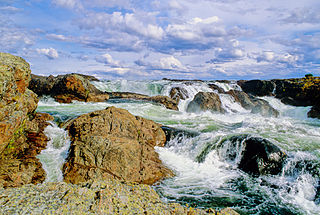
The Kazan River, is a Canadian Heritage River located in Nunavut, Canada. The Dene name for the river was Kasba-tue meaning "white partridge river." The name was apparently changed to Kazan in the late 19th century due to the influence of Order of Mary Immaculate missionaries. The river headwaters are in northern Saskatchewan at Kasba Lake, and it flows north for about 1000 km (621 mi) before emptying into Baker Lake, on the opposite side of the mouth of the Thelon River. Along its course the river flows through several lakes, including Ennadai Lake and Yathkyed Lake, over the Kazan Falls, down a red sandstone gorge and through both boreal forest and tundra. It is the last section of the river, below Ennadai Lake, that is above the timber line and is designated a Canadian Heritage River.

Nunavut is the newest, largest, and most northerly territory of Canada. It was separated officially from the Northwest Territories on April 1, 1999, via the Nunavut Act and the Nunavut Land Claims Agreement Act, though the boundaries had been drawn in 1993. The creation of Nunavut resulted in the first major change to Canada's political map since the incorporation of the province of Newfoundland in 1949.

The Baffin Mountains are a mountain range running along the northeastern coast of Baffin Island and Bylot Island, Nunavut are part of the Arctic Cordillera. The ice-capped mountains are some of the highest peaks of eastern North America, reaching a height of 1,525–2,146 metres (5,003–7,041 ft) above sea level. While they could be considered a single mountain range as they are separated by bodies of water to make Baffin Island, this is not true, as they are closely related to the other mountain ranges that make the much larger Arctic Cordillera mountain range.

The Nunavut Court of Justice is the superior court and territorial court of the Canadian territory of Nunavut. It is administered from the Nunavut Justice Centre in Iqaluit. It was established on April 1, 1999 as Canada's only "unified" or single-level court with the consent of Canada, the Office of the Interim Commissioner of Nunavut and Nunavut Tunngavik Inc. the Inuit Land Claims representative organization. Prior to the establishment of Nunavut as a separate territory justice was administered through two courts, the Territorial Court of the Northwest Territories and the Supreme Court of the Northwest Territories.
Hat Island is an uninhabited island located in the Qikiqtaaluk Region of Nunavut, Canada. It is situated in Eureka Sound at the confluence of Bay Fjord, east of Ellesmere Island's Raanes Peninsula, and 19.6 km (12.2 mi) west of Stor Island. It is a member of the Sverdrup Islands group and the Canadian Arctic Archipelago. It is also a member of the Queen Elizabeth Islands and the Canadian Arctic Archipelago.

Sam Ford Fiord is an isolated, elongated Arctic fjord on Baffin Island's northeastern coast in the Qikiqtaaluk Region of Nunavut, Canada. The Inuit settlement of Pond Inlet is 320 km (200 mi) to the northwest and Clyde River is 80 km (50 mi) to the east.

Eglinton Fiord is a fjord on Baffin Island's northeastern coast in the Qikiqtaaluk Region of Nunavut, Canada. The Inuit settlement of Pond Inlet is 355 km (221 mi) to the northwest and Clyde River is 55 km (34 mi) to the east.


