Simbach is a market town and municipality in the district of Dingolfing-Landau, Bavaria, Germany. As of 2020, it had a population of around 4,000 and an area of 51.23 km².

Harburg is a town in the Donau-Ries district, in Swabia, Bavaria, Germany. It is situated on the river Wörnitz and on the southeastern edge of the Ries meteorite crater in the UNESCO Global Geopark Ries.

Mantel is a municipality located in the district of Neustadt an der Waldnaab in Bavaria, Germany. It is known as a Markt, a town that was historically granted 'market rights'. The town was first mentioned in official documents in 1212, and in 1945 it was incorporated into the municipality of Rupprechtsreuth. As part of the regional reform in Bavaria, parts of the dissolved municipality of Hütten were added to it in 1972. The town's population fell by 77 people, 2.8%, to 2728 between 1988 and 2018. Mantel is best known for its nature preserve, Naturwaldreservat Gscheibte Loh, as well as its castle, Schloss Steinfels.
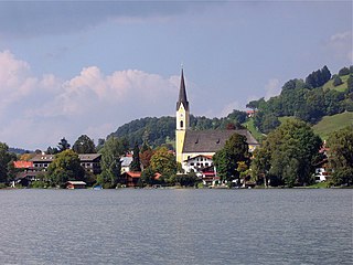
Schliersee is a small town (Markt) and a municipality in the district of Miesbach in Bavaria in Germany. It is named after the nearby Lake Schliersee. It comprises the districts Schliersee (town), Westenhofen, Neuhaus, Fischhausen, Josefsthal and Spitzingsee.

Oettingen in Bayern is a town in the Donau-Ries district, in Swabia, Bavaria, Germany. It is situated 29 km (18 mi) northwest of Donauwörth, and 14 km (8.7 mi) northeast of Nördlingen.

Zusmarshausen is a municipality in the district of Augsburg, Bavaria, Germany. The 1648 Battle of Zusmarshausen took place here.

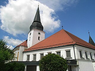
Hahnbach is a municipality in the district of Amberg-Sulzbach in Bavaria in Germany. There are living at the moment about 5000 people. The most important districts are: Fronbergsiedlung, Friedhofsiedlung, Süd 3, Markt. About 2000 of the 5000 people are not living in Hahnbach by itself, they are living in villages like Dürnsricht or Iber, which are in the area of Hahnbach. SSince 2014, the Mayor of Hahnbach is Bernhard Lindner (CSU). The CSU is the most popular party in Hahnbach, at the last election they got more than 75% of the votes, at place two was the SPD with at least 20% of the votes. The most important objects of interest are the Amberger Tor and the Fahrraddenkmal, which shows a biker holding his bike. The church in Hahnbach is called St. Jakobus Church. The sports team is called SV Hahnbach.
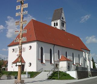
Biberbach is a municipality in the northern part of the district of Augsburg in Bavaria in Germany. A famous baroque pilgrimage church is located on the hill above the village.

Gößweinstein is a municipality in the district of Forchheim in Bavaria in Germany. It lies within the region known as Franconian Switzerland.

Pretzfeld is a municipality in the district of Forchheim in Bavaria in Germany.

Wilhermsdorf is a municipality in the district of Fürth in Bavaria in Germany. As of 2020 it has a population of 5,479. It is twinned with Feld am See in Austria and Jahnsdorf, also in Germany.

Langquaid is a municipality in the district of Kelheim in Bavaria in Germany.

Markt Erlbach is a municipality in the district of Neustadt (Aisch)-Bad Windsheim in Bavaria in Germany.
Stadtlauringen is a municipality in the district of Schweinfurt in Bavaria, Germany.

Babenhausen is a municipality in the district of Unterallgäu in Bavaria, Germany. It is seat of a municipal association with Egg an der Günz, Kettershausen, Kirchhaslach, Oberschönegg and Winterrieden. The view of Babenhausen is dominated by the Fugger Castle, a local attraction with a museum, and the Sankt Andreas Church. It is the seat of the Fuggers, a merchant family from Augsburg which played an important role during the Middle Ages and the Renaissance.

Erkheim is a municipality in the district of Unterallgäu in Bavaria, Germany.

Markt Berolzheim is a municipality in the Weißenburg-Gunzenhausen district, in Bavaria, Germany.

Auhausen is a municipality in the Swabian district Donau-Ries in Bavaria in Germany. The municipality is within the Oettingen central administrative body. Auhausen was the site of the 1608 meeting that formed the Protestant Union, also known as the Union of Auhausen. Schloss Hirschbrunn, a castle owned by the House of Oettingen-Spielberg, is in Auhausen.
Markt Rettenbach is a municipality and market town in the district of Unterallgäu in Bavaria, Germany.

Markt Wald is a municipality in the district of Unterallgäu in Bavaria, Germany.


