Wallington Town Hall

Last updated

Wallington Town Hall
Former Wallington town hall geograph-3360622-by-Marathon.jpg
Wallington Town Hall
LocationWoodcote Road, Wallington
Coordinates 51°21′28″N0°09′00″W / 51.3578°N 0.1500°W / 51.3578; -0.1500 Coordinates: 51°21′28″N0°09′00″W / 51.3578°N 0.1500°W / 51.3578; -0.1500
Built1934
Architect Robert Atkinson
Architectural style(s) Georgian style
Listed Building – Grade II
Designated24 April 2008
Reference no.1392569
Sutton London UK location map.svg
Red pog.svg
Shown in Sutton

Wallington Town Hall is a municipal building in Woodcote Road, Wallington, London. It is a Grade II listed building. [1]

History

In the early 20th century Beddington and Wallington Urban District Council was based at 37 Manor Road, the former offices of Wallington Parish Council. [2] After rapid population growth in the area, civic leaders decided to procure a purpose-built town hall: the site chosen for the new building was "Sunny Bank", a house on Woodcote Road, Wallington, which was bought in 1929. [3]

The foundation stone for the new building was laid by Mr W. J. Mallinson DL on 12 May 1934. [3] It was designed by Robert Atkinson in the Georgian style, built by Perry (Ealing) Ltd and was officially opened by the Member of Parliament for Mitcham, Sir Richard Meller, on 21 September 1934. [3] [4] The design involved a symmetrical main frontage with eleven bays facing onto Woodcote Road; the central section of five bays featured a three-bay porch with fluted pilasters; there was a central window and balcony with wrought-iron railings on the first floor with the borough coat of arms carved by the sculptor, Eric Aumonier, above; there was a copper-clad clock tower with a weather vane at roof level. [1] The clock was designed and manufactured by Gillett & Johnston of Croydon. [1] [5] The landscaping around the building incorporated a garden of remembrance [6] and a flagpole, which was erected in a prominent position in front of the building. [7] The principal room was a double-height council chamber; the interior made extensive use of walnut paneling and the double-flight staircase, which was made from black and white marble, was decorated in an art deco style. [8] Pevsner noted that the "romanticism of Sweden and Holland in the 1920s is represented, surprisingly prettily and pleasantly, by Wallington Town Hall". [9]

The building went on to become the headquarters of the Municipal Borough of Beddington and Wallington when the area became a municipal borough in 1936. [10] It ceased to be the local seat of government when the enlarged London Borough of Sutton was formed in 1965. [11] After being used as the local registrar's office in the late 1960s and the 1970s, it was converted into a courthouse by dividing the council chamber into two courtrooms, one above the other, in 1980. [3] After the courts moved out in April 1999, the building was then converted for educational use and became part of Sutton College in October 2005. [12] [13]

Related Research Articles

Beddington Human settlement in England

Beddington is a suburban settlement in the London Borough of Sutton on the boundary with the London Borough of Croydon. Beddington is formed from a village of the same name which until early the 20th century still included land which became termed entirely as Wallington. The latter was in the 13th century shown on local maps as Hakebrug, and named after a bridge on the River Wandle. The locality has a landscaped wooded park at Beddington Park – also known as Carew Manor; and a nature reserve and sewage treatment works in the centre and to the north of its area respectively. The population of Beddington according to the 2011 census is 21,044.

Carshalton Human settlement in England

Carshalton is a town, with a historic village centre, in south London, England, within the London Borough of Sutton. It is situated 9.5 miles (15.3 km) south-southwest of Charing Cross, in the valley of the River Wandle, one of the sources of which is Carshalton Ponds in the middle of the village. Prior to the creation of Greater London in 1965, Carshalton was in the administrative county of Surrey.

Waddon Human settlement in England

Waddon is a neighbourhood in the London Borough of Croydon, at the western end of the town of Croydon. The area borders the London Borough of Sutton.

Wallington, London Human settlement in England

Wallington is a town in the London Borough of Sutton, in South London, England. It is 9.7 miles (15.6 km) south south-west of Charing Cross. Before the Municipal Borough of Beddington and Wallington merged into the London Borough of Sutton in Greater London in 1965, it was part of the county of Surrey. Wallington is a post town in the SM postcode area.

London Borough of Sutton London borough in United Kingdom

The London Borough of Sutton is a London borough in south-west London, England and forms part of Outer London. It covers an area of 43 km2 (17 sq mi) and is the 80th largest local authority in England by population. It borders the London Borough of Croydon to the east, the London Borough of Merton to the north and the Royal Borough of Kingston upon Thames to the north-west; it also borders the Surrey boroughs of Epsom and Ewell and Reigate and Banstead to the west and south respectively. The local authority is Sutton London Borough Council. Its principal town is the eponymous Sutton.

Coulsdon and Purley Urban District

Coulsdon and Purley Urban District was a local government district in northeast Surrey from 1915 to 1965. The local authority was Coulsdon and Purley Urban District Council. The former area of the district is now mostly part of the London Borough of Croydon in Greater London, with parts in the Tandridge District and the Borough of Reigate and Banstead in Surrey.

A232 road

The A232 is a road running west-east across South London, which connects the A24 in Ewell with the A224 Orpington bypass.

Municipal Borough of Sutton and Cheam

Sutton and Cheam was a local government district in north east Surrey, England from 1882 to 1965.

Municipal Borough of Beddington and Wallington

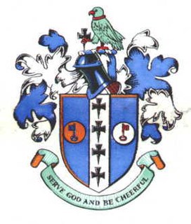
Beddington and Wallington was, from 1915 to 1965, a local government district in north east Surrey, England. It formed part of the London suburbs, lying within the Metropolitan Police District and the London Passenger Transport Area. In 1965 it was abolished on the creation of Greater London.

Beddington can refer to:

Wallington was an ancient hundred in the northeast of the historic county of Surrey, England. The majority of its area has been absorbed by the growth of London; with its name currently referring to the district of Wallington. Its former area now corresponds to the London Borough of Sutton, the majority of the London Borough of Croydon and parts of the London Borough of Merton as well as parts of the Districts of Epsom and Ewell, Reigate and Banstead and Tandridge in Surrey.

Wallington High School for Girls Grammar school in Wallington, Greater London, England

Wallington High School for Girls is an all-girls selective grammar school in the London Borough of Sutton, England, specialising in STEM subjects and Languages.

Sir Richard James Meller was a British barrister and Conservative politician.

Woodcote Green is an area in the London Borough of Sutton, located in the south-east of the borough south of Wallington. At the 2011 Census the population of the area was included in the Beddington South ward of Sutton Council.

Croydon Town Hall Municipal building in London, England

Croydon Town Hall is a council building in Katherine Street, Croydon which serves as headquarters for Croydon London Borough Council. It is a Grade II listed building.

Lewisham Town Hall Municipal building in London, England

Lewisham Town Hall is a municipal building in Catford Road, Lewisham, London. The oldest part of the facility, the curved municipal offices, which is the headquarters of Lewisham London Borough Council, is a Grade II listed building.

Mitcham Vestry Hall Municipal building in London, England

Mitcham Vestry Hall is a municipal building in London Road, Mitcham, London. It is a locally listed building.

East Barnet Town Hall Municipal building in London, England

East Barnet Town Hall is a former municipal building in Station Road, East Barnet, London, England. The town hall, which was the headquarters of East Barnet Urban District Council, is a locally listed building.

Carshalton Council Offices Municipal building in London, England

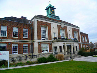
The Carshalton Council Offices is a former municipal building on The Square, Carshalton, London. The structure, which was briefly the headquarters of Carshalton Urban District Council before becoming a public library, is a Grade II listed building.

References

  1. 1 2 3 Historic England. "Wallington Town Hall, Sutton (1392569)". National Heritage List for England . Retrieved 3 May 2020.
  2. "Beddington and Wallington Urban District Council". Exploring Surrey's Past. Archived from the original on 3 March 2016. Retrieved 15 April 2009.
  3. 1 2 3 4 "Wallington Town Hall". London Borough of Sutton. Archived from the original on 8 June 2011. Retrieved 15 April 2009.
  4. "Wallington's New Town Hall - opened by Sir Richard Meller, MP". You Tube. 21 September 1934. Retrieved 21 September 2020.
  5. "A clock tower and weather vane set against a blue sky, in Wallington, Surrey". Alamy. Retrieved 21 September 2020.
  6. "Sutton Remembers". The Sutton and Croydon Guardian. 8 November 2007. Retrieved 25 April 2020.
  7. "Council Meeting". London Borough of Sutton. 28 June 2016. Retrieved 25 April 2020.
  8. "Art Deco" (PDF). City Themes. Retrieved 25 April 2020.
  9. Nairn, Ian; Pevsner, Nikolaus; Cherry, Bridget (1982). The Buildings of England: Surrey. Pevsner Architectural Guide. p. 73. ISBN   978-0140710212.
  10. "No. 34262". The London Gazette . 6 March 1936. p. 1459.
  11. "Local Government Act 1963". Legislation.gov.uk. Retrieved 25 April 2020.
  12. "Wallington". Sutton College. Retrieved 25 April 2020.
  13. "Wallington". Hidden London. Retrieved 25 April 2020.