Walmersley

Last updated

Walmersley
Walmersley Post Office - geograph.org.uk - 1751990.jpg
Walmersley Post Office
Greater Manchester UK location map 2.svg
Red pog.svg
Walmersley
Location within Greater Manchester
Metropolitan borough
Metropolitan county
Region
Country England
Sovereign state United Kingdom
Post town BURY
Postcode district BL9
Police Greater Manchester
Fire Greater Manchester
Ambulance North West
UK Parliament
List of places
UK
England
Greater Manchester
53°37′00″N2°18′00″W / 53.6166°N 2.3°W / 53.6166; -2.3

Walmersley is a suburban village in the Metropolitan Borough of Bury, Greater Manchester, England.

Contents

History

Historically in Lancashire, the name Walmersley is said to be derived from Old English, and translates as Waldmer's wood, or clearing. [1]

Once a rural village in the wilds, in recent decades, it has become a northern suburb of Bury. Old stone cottages remain in the area, but much of the district's housing is of post-war construction.

The A56 (Walmersley Road) links Walmersley with Bury to the south and Shuttleworth, Ramsbottom and Edenfield to the north. Before this 'new' road was built the road north from Bury followed the line of Walmersley Old Road. The old 'coach road' went through Baldingstone and Nangreaves and onto Hardern Moor and beyond to Shuttleworth and Edenfield. Junctions led to the then thriving mills in Deeply Vale and Birtle Dene. Deeply Vale has more contemporary fame as the location of the Deeply Vale Festivals. The old road was one of the many roads in east Lancashire constructed by John Metcalf, perhaps better known as Blind Jack Metcalf, a civil engineer from Knaresborough. [2]

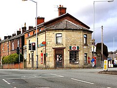
The Walmersley conservation area was designated in November 2003. It covers Christ Church, its churchyard, the former school and school master's house, together with the adjacent Spur Petroleum site which contains the former Walmersley Brewery buildings. The whole site is an excellent record of a small but important part of Walmersley, and illustrates generally well preserved elements of stone built ecclesiastical and industrial architecture from the mid to late 19th century. Some of these buildings were severely damaged in a fire, suspected to have been deliberate by one party or another...this is disputed especially by those wanting to develop the land. New residential buildings have now been erected on the Spur site with the retention and reuse of some of the older buildings.

Administrative history

Walmersley was historically part of the ancient parish of Bury. The parish contained several townships, one of which was called "Walmersley cum Shuttleworth". This township became a civil parish in 1866. From 1872 the Walmersley area was included in the Bury improvement commissioners' district and from 1883 Shuttleworth was included in the Ramsbottom local government district. [3] In 1894 the parish of Walmersley cum Shuttleworth was reduced to just cover the rural parts outside the two urban authorities, with Walmersley itself being added to the parish of Bury and Shuttleworth being added to Ramsbottom. [4] The parish of Walmersley cum Shuttleworth after 1894 therefore did not include either of the villages included in its name. The parish was abolished in 1933, being added to Ramsbottom. [5]

Landmarks

Christ Church, Walmersley located on Walmersley Road. In 1838 the Walmersley ecclesiastical parish was formed by sub-dividing the ancient, larger Bury parish. A church was built beside what was then the 'new' road but in 1883 the present church, a neo-gothic design by Maxwell and Tuke was built. [6] The east window of the first church was preserved and built into the new building. Amongst other buildings Maxwell & Tuke designed Blackpool Tower and, in 1894, the Technical School, Broad Street, Bury now housing the Fusilier Museum, which is dedicated to the Lancashire Fusiliers.

Baldingstone House, [7] probably the oldest property in the area, was built in about 1615. In the 17th century the house was home of the Kay family. [8] Indeed, it is believed the house was built by Richard Kay a blacksmith with a smithy at Baldingstone. Richard was married to Alice Kay, from Sheephey, Shuttleworth whose brother Robert was the father of John Kay, the inventor of the flying shuttle.

Related Research Articles

<span class="mw-page-title-main">Chorlton-cum-Hardy</span> Human settlement in England

Chorlton-cum-Hardy is a suburban area of Manchester, England, three miles (4.8 km) southwest of the city centre. Chorlton ward had a population of 14,138 at the 2011 census, and Chorlton Park 15,147.

<span class="mw-page-title-main">Bury, Greater Manchester</span> Market town in Greater Manchester, England

Bury is a market town on the River Irwell in the Metropolitan Borough of Bury, Greater Manchester, England. which had a population of 81,101 in 2021 while the wider borough had a population of 193,846.

<span class="mw-page-title-main">Ashton-in-Makerfield</span> Town in North West England

Ashton-in-Makerfield is a market town in the Metropolitan Borough of Wigan, Greater Manchester, England, 4 miles (6.4 km) south of Wigan. In 2011, it had a population of 28,762.

<span class="mw-page-title-main">Borough of Rossendale</span> Borough and non-metropolitan district in Lancashire, England

Rossendale is a local government district with borough status in Lancashire, England. The council is based in Bacup and the largest town is Rawtenstall. The borough also includes the towns of Haslingden and Whitworth, along with several villages and surrounding rural areas. The borough is located in and named after the Rossendale Valley, being the upper part of the valley of the River Irwell.

<span class="mw-page-title-main">Withington</span> Human settlement in England

Withington is a suburb of Manchester, Greater Manchester, England. Historically part of Lancashire, it lies 4 miles (6.4 km) from Manchester city centre, about 0.4 miles (0.6 km) south of Fallowfield, 0.5 miles (0.8 km) north-east of Didsbury and also 1 mile (1.6 km) east of Chorlton-cum-Hardy. Withington has a population of just over 14,000 people, reducing at the 2011 census to 13,422.

<span class="mw-page-title-main">Padiham</span> Town in Lancashire, England

Padiham is a town and civil parish on the River Calder, about three miles (5 km) west of Burnley, Lancashire, England. It forms part of the Borough of Burnley. Originally by the River Calder, it is edged by the foothills of Pendle Hill to the north-west and north-east. The United Kingdom Census 2011 gave a parish population of 10,098, estimated in 2019 at 10,138.

<span class="mw-page-title-main">Whitefield, Greater Manchester</span> Town in Greater Manchester, England

Whitefield is a town in the Metropolitan Borough of Bury, Greater Manchester, England. It lies on undulating ground above the Irwell Valley, along the south bank of the River Irwell, 3 miles (4.8 km) southeast of Bury, and 5 miles (8.0 km) northwest of Manchester. Prestwich and the M60 motorway lie just to the south.

<span class="mw-page-title-main">Farnworth</span> Human settlement in England

Farnworth is a town in the Metropolitan Borough of Bolton, Greater Manchester, England, 2 miles (3.2 km) southeast of Bolton, 4 miles south-west of Bury (7 km), and 8 miles (12.9 km) northwest of Manchester.

<span class="mw-page-title-main">Castleton, Greater Manchester</span> Human settlement in England

Castleton is an area of Rochdale, Greater Manchester, England, 1.2 miles (1.9 km) south-southwest of Rochdale town centre and 8 miles (13 km) north-northeast of the city of Manchester.

<span class="mw-page-title-main">Ramsbottom</span> Town in Lancashire, England

Ramsbottom is a market town in the Metropolitan Borough of Bury, Greater Manchester, England. The population at the 2011 census was 17,872.

<span class="mw-page-title-main">Prestwich</span> Town in Greater Manchester

Prestwich is a town in the Metropolitan Borough of Bury, Greater Manchester, England, 3.3 miles (5.3 km) north of Manchester city centre, 3.1 miles (5 km) north of Salford and 4.7 miles (7.6 km) south of Bury.

<span class="mw-page-title-main">Tottington, Greater Manchester</span> Human settlement in England

Tottington is a town in the Metropolitan Borough of Bury in Greater Manchester, England, on the edge of the West Pennine Moors.

<span class="mw-page-title-main">Edenfield</span> Human settlement in England

Edenfield is a village within the Rossendale borough of Lancashire, England. Lying on the River Irwell, it is around 1.25 miles (2.0 km) north of Ramsbottom, 2.5 miles (4.0 km) south of Rawtenstall, and 6.0 miles (9.7 km) west of Norden, and has a total population of 2,080, reducing to 2,053 at the 2011 Census.

<span class="mw-page-title-main">Greenmount, Greater Manchester</span> Human settlement in England

Greenmount is a village in Tottington in the West Pennine Moors, in the northern part of the Metropolitan Borough of Bury, in Greater Manchester, England.

<span class="mw-page-title-main">Stoneclough</span> Human settlement in England

Stoneclough is a suburban area of Kearsley in the Metropolitan Borough of Bolton, Greater Manchester, England. It is located 3.7 miles (6 km) south-east of Bolton, 4 miles (6 km) south-west of Bury and 7.9 miles (13 km) north-west of Manchester. It is located on the banks of the River Irwell to the southeast of Bolton.

<span class="mw-page-title-main">Newhey</span> Human settlement in England

Newhey is a village near the town of Milnrow in the Metropolitan Borough of Rochdale, in Greater Manchester, England. It lies at the foot of the South Pennines, by Junction 21 of the M62 motorway and on the River Beal, 3 miles (4.8 km) east-southeast of Rochdale, 10 miles (16.1 km) northeast of Manchester.

<span class="mw-page-title-main">Halliwell, Greater Manchester</span> Human settlement in England

Halliwell is predominantly a residential area of Bolton, Greater Manchester, England. It gives its name to an electoral ward of the wider Metropolitan Borough of Bolton. The population of this ward taken at the 2011 census was 13,929. Halliwell lies about 2 miles (3.2 km) to the north west of Bolton town centre and is bounded by Tonge Moor to the east and Heaton to the south west. Smithills Hall to the north is within the ancient township. It lies on the lower south facing slopes of the West Pennine Moors.

<span class="mw-page-title-main">Shuttleworth, Greater Manchester</span> Hamlet in Greater Manchester, England

Shuttleworth is a hamlet at the northeastern extremity of the Metropolitan Borough of Bury, in Greater Manchester, England. It lies amongst the South Pennines, 4.3 miles (6.9 km) north of Bury and 0.9 miles (1.4 km) south of Edenfield; Scout Moor Wind Farm lies to the immediate east. Effectively a suburb of Ramsbottom, the M66 motorway divides Shuttleworth from the main core of that town.

Ramsbottom Urban District was, from 1894 to 1974, a local government district of the administrative county of Lancashire, England. Its area was coterminate with Ramsbottom, spanning an area of the Rossendale Valley north of the County Borough of Bury.

<span class="mw-page-title-main">Bedford, Greater Manchester</span> One of three townships that merged to form Leigh, England

Bedford, a suburb of Leigh, Greater Manchester is one of three ancient townships, Bedford, Pennington and Westleigh, that merged in 1875 to form the town of Leigh. Historically, Bedford was in Lancashire.

References

  1. Walmersley cum Shuttleworth, A Key to English Place-Names, Institute for Name-Studies, retrieved 29 July 2008. Retrieved on 29 July 2008.
  2. Black Jack
  3. "Greater Manchester Gazetteer". Greater Manchester County Record Office. Archived from the original on 18 July 2011. Retrieved 16 October 2023.
  4. Annual Report of the Local Government Board. London. 1895. p. 259. Retrieved 16 October 2023.{{cite book}}: CS1 maint: location missing publisher (link)
  5. "Walmersley cum Shuttleworth Township / Civil Parish". A Vision of Britain through Time. GB Historical GIS / University of Portsmouth. Retrieved 16 October 2023.
  6. '1846 Before and AfterA Historical Guide to the Ancient Parish of Bury', the Reverend Arthur J. Dobb DA (Manc), Vicar of Bircle, published 1970,
  7. English Heritage Images of England - photo of Baldingstone House
  8. Kay Family Association UK