Adelaide is the capital city of South Australia, the state's largest city and the fifth-most populous city in Australia. "Adelaide" may refer to either Greater Adelaide or the Adelaide city centre. The demonym Adelaidean is used to denote the city and the residents of Adelaide. The Traditional Owners of the Adelaide region are the Kaurna people. The area of the city centre and surrounding Park Lands is called Tarndanya in the Kaurna language.

Murray Bridge is a city in the Australian state of South Australia, located 78 kilometres (48 mi) east-southeast of the state's capital city, Adelaide, and 77 kilometres (48 mi) north of the town of Meningie. The city had an urban population of approximately 18,779 in June 2018, making it the fifth most populous city in the state after Adelaide, Mount Gambier, Gawler and Whyalla.

North Terrace is one of the four terraces that bound the central business and residential district of Adelaide, the capital city of South Australia. It runs east–west, along the northern edge of "the square mile". The western end continues on to Port Road, and the eastern end continues across the Adelaide Parklands as Botanic Road.

Norwood is a suburb of Adelaide, about 4 km (2.5 mi) east of the Adelaide city centre. The suburb is in the City of Norwood Payneham & St Peters, whose predecessor was the oldest South Australian local government municipality.
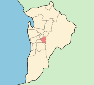
The City of Burnside is a local government area in the South Australian city of Adelaide stretching from the Adelaide Parklands into the Adelaide foothills with an area of 2,753 hectares. It was founded in August 1856 as the District Council of Burnside, the name of a property of an early settler, and was classed as a city in 1943. The LGA is bounded by Adelaide, Adelaide Hills Council, Campbelltown, Mitcham, Norwood Payneham and St Peters and Unley.
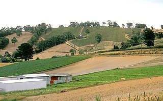
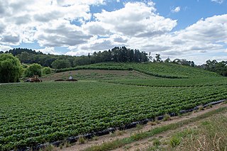
O'Halloran Hill is a suburb in the south of Adelaide, South Australia, situated on the hills south of the O'Halloran Hill Escarpment, which rises from the Adelaide Plains and located 18 km from the city centre via the Main South Road. The suburb is split between the Cities of Marion and Onkaparinga, and it neighbours Happy Valley, Hallett Cove, Trott Park and Darlington. It includes a large area of farmland and commercial vineyards known as the Glenthorne Estate.
Carey Gully is a small town in the Adelaide Hills region of South Australia.
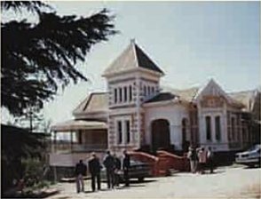
Scotch College is an independent, Uniting Church, co-educational, day and boarding school, located on two adjacent campuses in Torrens Park and Mitcham, inner-southern suburbs of Adelaide, South Australia.

Semaphore is a northwestern suburb of Adelaide in the Australian state of South Australia. It is located on the Gulf St Vincent coastline of the Lefevre Peninsula about 14 kilometres (8.7 mi) from the Adelaide city centre.

Anzac Highway is an 8.7-kilometre-long (5.4 mi) main arterial road heading southwest from the city of Adelaide, the capital of South Australia, to the beachside suburb of Glenelg.

Memorial Drive Park, more generally referred to as "Memorial Drive", is a tennis venue, located adjacent to the Adelaide Oval, in the park lands surrounding the centre of Adelaide, South Australia. Memorial Drive took its name from the winding avenue, known as War Memorial Drive, which separates the venue from the River Torrens.
Adelaide has two city ring routes, that loop around the Adelaide city centre and North Adelaide, known as the Inner and Outer Ring Routes.

Park 12, is one of the 29 Parks that make up the Adelaide Park Lands. It consists of 55.5 hectares bounded by North Terrace, Frome Road, Sir Edwin Smith Avenue and King William Road
Golden Grove is an outer north-eastern suburb of Adelaide, South Australia and is within the City of Tea Tree Gully local government area. It is adjacent to Wynn Vale, Surrey Downs, Greenwith, Yatala Vale, Fairview Park, and Salisbury East.

North Adelaide is a predominantly residential precinct and suburb of the City of Adelaide in South Australia, situated north of the River Torrens and within the Adelaide Park Lands.
The Australian Open Series is a selection of tennis tournaments held annually prior to the start of the Australian Open in Melbourne. In 2023, there are five official Australian Open Series tournaments held across Australia in preparation for the first Grand Slam of the year, as designated by Tennis Australia.
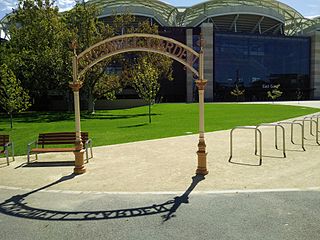
The Creswell Gardens are located in the Adelaide Park Lands between the Adelaide Oval, War Memorial Drive, King William Road and St Peter's Cathedral. They were established in 1909 and named after South Australian sportsman John Creswell. The gardens contain a number of Adelaide's landmark features.