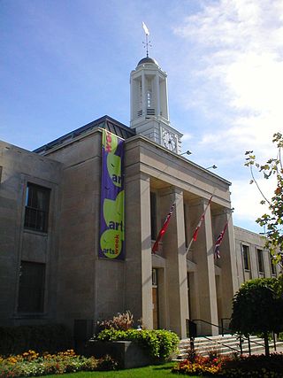
Peterborough is a city on the Otonabee River in Ontario, Canada, about 125 kilometres northeast of Toronto. According to the 2021 Census, the population of the City of Peterborough was 83,651. The population of the Peterborough Census Metropolitan Area (CMA), which includes the surrounding Townships of Selwyn, Cavan Monaghan, Otonabee-South Monaghan, and Douro-Dummer, was 128,624 in 2021. In 2021, Peterborough ranked 32nd among the country's 41 census metropolitan areas according to the CMA in Canada. The current mayor of Peterborough is Jeff Leal.

Coboconk, often shortened to Coby, is a community in the city of Kawartha Lakes, in the south-central portion of the Canadian province of Ontario. The village lies at the junction of Highway 35 and former Highway 48, on the northern tip of Balsam Lake, the highest point on the Trent–Severn Waterway. Coboconk has a prominent role in the logging, limestone, and tourism industries of the Kawartha Lakes region over the past 150 years.

The City of Kawartha Lakes is a unitary municipality in Central Ontario, Canada. It is a municipality legally structured as a single-tier city; however, Kawartha Lakes is the size of a typical Ontario county and is mostly rural. It is the second largest single-tier municipality in Ontario by land area.

The Oak Ridges Moraine is an ecologically important geological landform in the Mixedwood Plains of south-central Ontario, Canada. The moraine covers a geographic area of 1,900 square kilometres (730 sq mi) between Caledon and Rice Lake, near Peterborough. One of the most significant landforms in southern Ontario, the moraine gets its name from the rolling hills and river valleys extending 160 km (99 mi) east from the Niagara Escarpment to Rice Lake, formed 12,000 years ago by advancing and retreating glaciers during the last glaciation period. Below the approximately 200 metre thick glacial derived sediments of the moraine lies thick bedrock successions of Precambrian rocks and up to 200 metres of Ordovician aged rock, capped by a regional unconformity of erosion and non-deposition to the Quaternary period. Rivers and lakes scatter the landscape and are important for creating habitat for the rich diversity of species of animals, trees and shrubbery. These are also the supply of fresh water to aquifers in the moraine through complex subterranean connections. Construction development nearby, and with expansion of communities around the moraine in need of potable water, it is a contested site in Ontario, since it stands in the path of major urban development. Conservation of the moraine is thus an important step for keeping aquifers in a safe drinkable condition while also protecting the natural ecosystems surrounding and within the moraine. This region has been subject to multiple decades of scientific research to study the origins of formation, and how early communities used the land. A larger focus currently is how to source potable water without removing the aquifer entirely.
The Kawartha Lakes (/kə'wɔrθɐ/) are a chain of lakes in south-central Ontario, Canada that form the upper watershed of the Trent River. The lakes are located on the boundary between the Paleozoic limestone regions of the Golden Horseshoe, and the Precambrian granite Canadian Shield of northern and central Ontario.
The Municipality of Trent Lakes is a lower-tier township in the rural, mostly wooded northern section of Peterborough County, Ontario, Canada. The municipality has a primarily cottage and tourist industry based economy but has grown year round residency due to its commute distance to the Greater Toronto Area.

The Crowe River is a river in the counties of Haliburton, Hastings, Northumberland and Peterborough in southern Ontario, Canada. It is in the Lake Ontario drainage basin and is a tributary of the Trent River.

The Elora Gorge is a popular tourist attraction located at the western edge of Elora, Ontario, Canada, which is 25 km north from the city of Guelph.
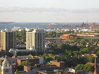
Hamilton is located on the western end of the Niagara Peninsula and wraps around the westernmost part of the Lake Ontario. Most of the city including the downtown section lies along the south shore. Situated in the geographic centre of the Golden Horseshoe, it lies roughly midway between Toronto and Buffalo. The two major physical features are Hamilton Harbour marking the northern limit of the city and the Niagara Escarpment running through the middle of the city across its entire breadth, bisecting the city into 'upper' and 'lower' parts.

The Eramosa Karst is a provincially significant Earth Science Area of Natural and Scientific Interest in Ontario, Canada, located in Stoney Creek, a constituent community of the City of Hamilton, and immediately south of the Niagara Escarpment.
The Fleetwood Kames is a 939 hectare provincially significant Earth Science Area of Natural and Scientific Interest in Ontario, Canada. The topographical feature is located on the north slope of the Oak Ridges Moraine, in the city of Kawartha Lakes. Part of the parcel, known as Fleetwood Creek, is owned by the Ontario Heritage Foundation.

Cedars of Lebanon State Park is a state park in Wilson County, Tennessee, in the southeastern United States. It consists of 900 acres (364 ha) situated amidst the 9,420-acre (3,810 ha) Cedars of Lebanon State Forest. The park and forest are approximately 10 miles (16 km) south of Lebanon, Tennessee.
Silver Lake is a small lake in the city of Kawartha Lakes in Central Ontario, Canada. Located near the community of Coboconk, it is the lowest lake on the Gull River, a drainage basin that supplies water at its mouth to Balsam Lake at the top of the Trent-Severn Waterway. Like many other lakes in the Kawarthas, Silver Lake lies in a depression formed between the Precambrian granite to the north, and the Ordovician limestone to the south.
Ganaraska Region is a region located in Ontario, Canada, stretching along the shore of Lake Ontario for approximately 45 kilometres (28 mi) and about 15 kilometres (9.3 mi) wide. It contains watersheds, covering an area of 700 square kilometres (270 sq mi) from Wilmot Creek in Clarington to eastside of Cobourg and from the southern shore of Rice Lake down to Lake Ontario. This expansive area includes seven municipalities in whole or in part: Township of Cavan Monaghan, Town of Cobourg, Township of Alnwick/Haldimand, Township of Hamilton, Municipality of Port Hope, City of Kawartha Lakes, Municipality of Clarington.
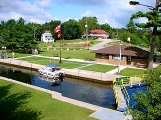
King's Highway 36, commonly referred to as Highway 36, was a provincially maintained highway in the Canadian province of Ontario. The highway connected Highway 7 and Highway 35 in Lindsay with Highway 28 in Burleigh Falls, providing access to recreational cottages along the northern shore of several of the Kawartha lakes as well as to multiple communities, including Bobcaygeon. Today it is known as Kawartha Lakes City Road 36 and Peterborough County Road 36.
The Indian River is a river in Peterborough County in Central Ontario, Canada. It is in the Great Lakes Basin, and is a tributary of Rice Lake.

Gould Lake Conservation Area is a rural conservation area located in the Canadian Shield northwest of the community of Sydenham in the Township of South Frontenac, Frontenac County, in eastern Ontario, Canada. The area was created to manage water resources, preserve wildlife habitat, and provide recreational and educational opportunities, and is managed by the Cataraqui Region Conservation Authority. The conservation area contains much of Gould Lake.
The Otonabee Region Conservation Authority (ORCA), sometimes shortened to Otonabee Conservation, is a conservation authority in Ontario, Canada. Established in 1959 and based in Peterborough, its member municipalities include Asphodel-Norwood, Cavan-Monaghan, Douro-Dummer, City of Kawartha Lakes, Otonabee–South Monaghan, City of Peterborough, Selwyn, and Trent Hills. Major watercourses within the watershed administered by ORCA include the Otonabee, Indian, and Ouse rivers, and Baxter, Cavan, Jackson, Miller and Squirrel creeks.

Burleigh Falls is both a geological feature and a small community in Peterborough County, Ontario, Canada. The falls form the boundary between the municipality of North Kawartha to the north and the municipality of Selwyn to the south.

Little Lake is a small lake on the Otonabee River in the city of Peterborough, Ontario, Canada. The lake is in the downtown of the city and is used for fishing, swimming, boating, and for various special events. The lake lies on the water route from Lake Ontario to the Kawartha Lakes. The area around the lake was first settled by Europeans around the start of the 19th century. Steam- and water-powered saw mills were built on the lake and on the river upstream to prepare lumber for shipment overseas. Sawdust and other debris from the mills polluted the lake, killed the fish and clogged up the navigable channels. The smell was so noxious it drove residents near the lake to move. These problems were resolved by the end of the century, when the lake became a hub on the new Trent-Severn Waterway from Lake Ontario to Lake Huron. However, industries attracted by cheap hydroelectric power, such as General Electric used the lake for disposal of industrial chemicals for many years. The pollutants seems to be mostly contained in the sediment, and the lake is now considered safe for recreational use.
