
Toczyski Podborne is a village in the administrative district of Gmina Jabłonna Lacka, within Sokołów County, Masovian Voivodeship, in east-central Poland. It lies approximately 5 kilometres (3 mi) north of Jabłonna Lacka, 18 km (11 mi) north-east of Sokołów Podlaski, and 103 km (64 mi) east of Warsaw.
Toczyski Średnie is a village in the administrative district of Gmina Jabłonna Lacka, within Sokołów County, Masovian Voivodeship, in east-central Poland. It lies approximately 5 kilometres (3 mi) north of Jabłonna Lacka, 17 km (11 mi) north-east of Sokołów Podlaski, and 102 km (63 mi) east of Warsaw.
Buczyn Szlachecki is a village in the administrative district of Gmina Kosów Lacki, within Sokołów County, Masovian Voivodeship, in east-central Poland. It lies approximately 11 kilometres (7 mi) south-east of Kosów Lacki, 13 km (8 mi) north of Sokołów Podlaski, and 90 km (56 mi) east of Warsaw.
Skrzeszew E is a village in the administrative district of Gmina Repki, within Sokołów County, Masovian Voivodeship, in east-central Poland.
Skwierczyn-Dwór is a village in the administrative district of Gmina Repki, within Sokołów County, Masovian Voivodeship, in east-central Poland.
Skwierczyn-Wieś is a village in the administrative district of Gmina Repki, within Sokołów County, Masovian Voivodeship, in east-central Poland.
Wasilew Szlachecki is a village in the administrative district of Gmina Repki, within Sokołów County, Masovian Voivodeship, in east-central Poland. It lies approximately 21 kilometres (13 mi) east of Sokołów Podlaski and 108 km (67 mi) east of Warsaw.
Żółkwy is a village in the administrative district of Gmina Repki, within Sokołów County, Masovian Voivodeship, in east-central Poland. It lies approximately 12 kilometres (7 mi) east of Sokołów Podlaski and 99 km (62 mi) east of Warsaw.
Pieńki Suchodolskie is a village in the administrative district of Gmina Sabnie, within Sokołów County, Masovian Voivodeship, in east-central Poland.
Sabnie is a village in Sokołów County, Masovian Voivodeship, in east-central Poland. It is the seat of the gmina called Gmina Sabnie. It lies approximately 13 kilometres (8 mi) north of Sokołów Podlaski and 95 km (59 mi) east of Warsaw.
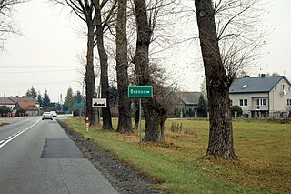
Brzozów is a village in the administrative district of Gmina Sokołów Podlaski, within Sokołów County, Masovian Voivodeship, in east-central Poland. It lies approximately 6 kilometres (4 mi) west of Sokołów Podlaski and 83 km (52 mi) east of Warsaw.
Dolne Pole is a village in the administrative district of Gmina Sokołów Podlaski, within Sokołów County, Masovian Voivodeship, in east-central Poland. It lies approximately 8 kilometres (5 mi) south-west of Sokołów Podlaski and 81 km (50 mi) east of Warsaw.
Dziegietnia is a village in the administrative district of Gmina Sokołów Podlaski, within Sokołów County, Masovian Voivodeship, in east-central Poland. It lies approximately 4 kilometres (2 mi) south-east of Sokołów Podlaski and 89 km (55 mi) east of Warsaw.
Justynów is a village in the administrative district of Gmina Sokołów Podlaski, within Sokołów County, Masovian Voivodeship, in east-central Poland. It lies approximately 9 kilometres (6 mi) south-west of Sokołów Podlaski and 79 km (49 mi) east of Warsaw.
Kostki is a village in the administrative district of Gmina Sokołów Podlaski, within Sokołów County, Masovian Voivodeship, in east-central Poland. It lies approximately 10 kilometres (6 mi) north-west of Sokołów Podlaski and 86 km (53 mi) east of Warsaw.
Krasnodęby-Rafały is a village in the administrative district of Gmina Sokołów Podlaski, within Sokołów County, Masovian Voivodeship, in east-central Poland. It lies approximately 7 kilometres (4 mi) south-east of Sokołów Podlaski and 93 km (58 mi) east of Warsaw.
Krasów is a village in the administrative district of Gmina Sokołów Podlaski, within Sokołów County, Masovian Voivodeship, in east-central Poland. It lies approximately 7 kilometres (4 mi) south-west of Sokołów Podlaski and 82 km (51 mi) east of Warsaw.
Przywózki is a village in the administrative district of Gmina Sokołów Podlaski, within Sokołów County, Masovian Voivodeship, in east-central Poland. It lies approximately 6 kilometres (4 mi) south-west of Sokołów Podlaski and 84 km (52 mi) east of Warsaw.
Węże is a village in the administrative district of Gmina Sokołów Podlaski, within Sokołów County, Masovian Voivodeship, in east-central Poland. It lies approximately 10 kilometres (6 mi) south-west of Sokołów Podlaski and 80 km (50 mi) east of Warsaw and Minsk.
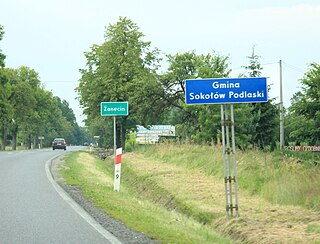
Żanecin is a village in the administrative district of Gmina Sokołów Podlaski, within Sokołów County, Masovian Voivodeship, in east-central Poland. It lies approximately 3 kilometres (2 mi) south of Sokołów Podlaski and 88 km (55 mi) east of Warsaw.


