Wasp, Tennessee

Last updated

Wasp, Tennessee
USA Tennessee location map.svg
Red pog.svg
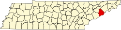
Wasp
Location within the state of Tennessee
Coordinates: 35°51′16″N82°55′56″W / 35.85444°N 82.93222°W / 35.85444; -82.93222 Coordinates: 35°51′16″N82°55′56″W / 35.85444°N 82.93222°W / 35.85444; -82.93222
Country United States
State Tennessee
County Cocke
Elevation
[1]
2,828 ft (862 m)
Time zone UTC-5 (Eastern (EST))
  Summer (DST) UTC-4 (EDT)
GNIS feature ID1327317 [1]

Wasp was a community located in Cocke County, in the U.S. state of Tennessee. [1] Situated in the upper Wolf Creek Valley in the rugged eastern part of the county, Wasp thrived as an Appalachian agrarian community in the late 19th and early 20th centuries. In the 1930s, the United States Forest Service purchased Wasp and its surrounding homesteads as part of an initiative to restore the Wolf Creek watershed (which had been logged), and the community was abandoned. Today, the ruins of Wasp have been designated a "Historically Significant" area, and are maintained by the Cherokee National Forest. The ruins of Wasp provide a rare instance of the preservation of a complete early 20th-century Appalachian community's archaeological remains. [2]

The remains of Wasp are located at just over 2,500 feet (760 m) above sea level in the western Bald Mountains a few miles east of Del Rio. Wolf Creek flows northward through the former community en route to its mouth along the French Broad River near the community of Wolf Creek. A crudely maintained network of forest service roads pass through Wasp, connecting it with U.S. Route 70 in the French Broad valley to the north and the Round Mountain campground near Lemon Gap to the south. The Appalachian Trail crosses the 4,300-foot (1,300 m) summit of Walnut Mountain just south of Wasp, and a spur trail connects the A.T.'s Walnut Mountain shelter with the upper Wolf Creek Valley.

Although located just south of the French Broad Valley which was an oft-used 18th-century migration route the Wolf Creek area likely remained unsettled until the mid-19th century. After the U.S. Civil War, railroad companies attempted to complete a line through the French Broad Valley to connect Newport and Hot Springs, but ran into numerous financial and engineering obstacles. By 1870, the Tennessee half of the line reached only to the community of Wolf Creek, where passengers were transferred to a stagecoach that carried them up the valley to Hot Springs. In subsequent years, railroad company employees moved into the Wolf Creek Valley. [3] Wasp was probably established around 1890, and by the early 1900s had its own post office, school, mission house, and gristmill. The U.S. Forest Service began acquiring the upper Wolf Creek Valley in 1935. At present, the deteriorated schoolhouse and mission house remain, along with the cemetery and the ruins of several farmsteads. [2] * 5/4/18. A satellite view of the community of Wasp shows no trace of the ruins of any of the things mentioned here. A ground search shows the area to be heavily logged where the structures were said to be. No foundations, buildings, chimneys or one stone is left upon another of any of the things that were said to be present in this entry.

Related Research Articles

Newport, Tennessee City and county seat of Cocke County, Tennessee, United States

Newport is a city in and the county seat of Cocke County, Tennessee, United States. The population was 6,945 at the 2010 census, down from 7,242 at the 2000 census. The estimated population in 2018 was 6,801. It is located along the Pigeon River.

French Broad River River in North Carolina and Tennessee, United States

The French Broad River is a river in the U.S. states of North Carolina and Tennessee. It flows 218 miles (351 km) from near the town of Rosman in Transylvania County, North Carolina, into Tennessee, where its confluence with the Holston River at Knoxville forms the beginning of the Tennessee River. The river flows through the counties of Transylvania, Buncombe, Henderson, and Madison in North Carolina, and Cocke, Jefferson, Sevier, and Knox in Tennessee. It drains large portions of the Pisgah National Forest and the Cherokee National Forest.

Great Smoky Mountains American mountain range along North Carolina/Tennessee border

The Great Smoky Mountains are a mountain range rising along the Tennessee–North Carolina border in the southeastern United States. They are a subrange of the Appalachian Mountains, and form part of the Blue Ridge Physiographic Province. The range is sometimes called the Smoky Mountains and the name is commonly shortened to the Smokies. The Great Smokies are best known as the home of the Great Smoky Mountains National Park, which protects most of the range. The park was established in 1934, and, with over 11 million visits per year, it is the most visited national park in the United States.

Tellico River River in the United States of America

The Tellico River is a river in the Blue Ridge Mountains of western North Carolina and eastern Tennessee. It rises in the westernmost mountains of North Carolina, and then flows through Monroe County, Tennessee, before joining the Little Tennessee River under the Tellico Reservoir. With a length of 52.8 miles (85.0 km), it is a major tributary of the Little Tennessee River, and is one of the primary streams draining the Unicoi Mountains.

Hiwassee River River in the United States of America

The Hiwassee River has its headwaters on the north slope of Rocky Mountain in Towns County in the northern area of the State of Georgia. It flows northward into North Carolina before turning westward into Tennessee, flowing into the Tennessee River a few miles west of what is now State Route 58 in Meigs County, Tennessee. The river is about 147 miles (237 km) long.

Unicoi Mountains Mountain range in North Carolina, United States

The Unicoi Mountains are a mountain range rising along the border between Tennessee and North Carolina in the southeastern United States. They are part of the Blue Ridge Mountain Province of the Southern Appalachian Mountains. The Unicois are located immediately south of the Great Smoky Mountains and immediately west of the Cheoah Mountains. Most of the range is protected as a national forest, namely the Cherokee National Forest on the Tennessee side and the Nantahala National Forest on the North Carolina side— although some parts have been designated as wilderness areas and are thus more strictly regulated.

U.S. Route 25E is the eastern branch of U.S. Route 25 from Newport, Tennessee, where US 25 splits into US 25E and US 25W, to North Corbin, Kentucky, where the two highways rejoin. The road, however, continues as US 25E for roughly 2 miles (3.2 km) until it joins Interstate 75 in the Laurel County community of North Corbin at exit 29. The entire route serves as a arterial expressway for long-distance travelers and truckers connecting central Appalachia to the Great Lakes and Eastern Seaboard regions of the U.S. via access to Interstate highways.

Western North Carolina Geographic region of the U.S. state of North Carolina

Western North Carolina is the region of North Carolina which includes the Appalachian Mountains; it is often known geographically as the state's Mountain Region. It contains the highest mountains in the Eastern United States, with 125 peaks rising to over 5,000 feet in elevation. Mount Mitchell at 6,684 feet, is the highest peak of the Appalachian Mountains and mainland eastern North America. Western North Carolina is sometimes included with upstate South Carolina as the "Western Carolinas", which is counted as a single media market. The population of the region, as measured by the 2010 U.S. Census, is 1,473,241, which is approximately 15% of North Carolina's total population.

Great Indian Warpath Part of network of trails in eastern North America used by Native Americans

The Great Indian Warpath (GIW)—also known as the Great Indian War and Trading Path, or the Seneca Trail—was that part of the network of trails in eastern North America developed and used by Native Americans which ran through the Great Appalachian Valley. The system of footpaths extended from what is now upper New York to deep within Alabama. Various Indians traded and made war along the trails, including the Catawba, numerous Algonquian tribes, the Cherokee, and the Iroquois Confederacy. The British traders' name for the route was derived from combining its name among the northeastern Algonquian tribes, Mishimayagat or "Great Trail", with that of the Shawnee and Delaware, Athawominee or "Path where they go armed".

The Sugarlands Valley in the north-central Great Smoky Mountains

The Sugarlands is a valley in the north-central Great Smoky Mountains, located in the Southeastern United States. Formerly home to a string of small Appalachian communities, the valley is now the location of the Great Smoky Mountains National Park headquarters and the Sugarlands Visitor Center. Lying just south of Gatlinburg, the Sugarlands is one of the park's most popular access points.

Joyce Kilmer-Slickrock Wilderness

Joyce Kilmer-Slickrock Wilderness, created in 1975, covers 17,394 acres (70 km2) in the Nantahala National Forest in western North Carolina and the Cherokee National Forest in eastern Tennessee, in the watersheds of the Slickrock and Little Santeetlah Creeks. It is named after Joyce Kilmer, author of "Trees." The Little Santeetlah and Slickrock watersheds contain 5,926 acres (23.98 km2) of old growth forest, one of the largest tracts in the United States east of the Mississippi River.

Cosby, Tennessee Census-designated place in Tennessee, United States

Cosby is a census-designated place (CDP) and unincorporated community in Cocke County in the U.S. state of Tennessee. The population of the Cosby CDP according to the 2020 census was 807. The community has given its name to the northeastern section of the Great Smoky Mountains National Park, which forms its southern boundary. Cosby's zip code also extends to into Sevier County, and borders the town of Pittman Center.

Del Rio, Tennessee Unincorporated community in Tennessee, United States

Del Rio is an unincorporated community in Cocke County, Tennessee, United States. Although it is not a census-designated place, the ZIP Code Tabulation Area for the ZIP Code (37727) that serves Del Rio had a population of 2,138, according to the 2000 census.

Oconaluftee (Great Smoky Mountains) River in North Carolina, USA

Oconaluftee Archeological District is within the eponymous river valley in the Great Smoky Mountains of North Carolina, located in the Southeastern United States. Formerly a historic Cherokee village, followed by an Appalachian community, were located at this site along the Oconaluftee River. Now the site serves as the main entrance to the North Carolina side of the Great Smoky Mountains National Park.

Sugarland Mountain Trail

The Sugarland Mountain Trail is an American hiking trail, in the Great Smoky Mountains National Park of Sevier County, Tennessee. The trail traverses Sugarland Mountain, a massive ridge running perpendicular to the main crest of the Smokies and effectively dividing the park's north-central section from its northwestern section. Sugarland Mountain is flanked by the deep upper valleys of two of the park's major watersheds— the West Fork of the Little Pigeon River and Little River. The trail passes through several forest types, including deciduous forest at lower elevations, heaths ("hells") along the mountain's backbone formations, and a stand of Southern Appalachian spruce-fir forest in the upper elevations. Occasional breaks in the foliage allow for views of Mount Le Conte and Sevier County to the east and Blanket Mountain and the ridges above Elkmont to the west.

Chilhowee (Cherokee town) Cherokee village site in Blount and Monroe Counties, Tennessee

Chilhowee was a prehistoric and historic Native American site in present-day Blount and Monroe counties in Tennessee, in what were the Southeastern Woodlands. Although now submerged by the Chilhowee Lake impoundment of the Little Tennessee River, the Chilhowee site was home to a substantial 18th-century Overhill Cherokee town. It may have been the site of the older Creek village "Chalahume" visited by Spanish explorer Juan Pardo in 1567. The Cherokee later pushed the Muscogee Creek out of this area.

Alexander Alan Arthur was a Scottish-born engineer and entrepreneur active primarily in the southeastern United States in the latter half of the 19th century. Flamboyant, charismatic, and energetic, Arthur used his prominent American and European financial connections to fund numerous business ventures, most of which were overly ambitious and ultimately failed. A proponent of economic advancement in what became known as the New South, Arthur played a primary role in the development of the Cumberland Gap area, and in the course of his endeavors established the cities of Middlesboro, Kentucky and Harrogate, Tennessee. The community of Arthur, Tennessee, is named for him.

The Hunting Camp Creek Wilderness is an area protected by the Eastern Wilderness Act of Congress to maintain its present, natural condition. As part of the wilderness system, it helps to preserve a variety of natural life forms and contributes to a diversity of plant and animal gene pools. Over half of the ecosystems in the United States exist within designated wilderness.

Broad Run, a wildland in the George Washington and Jefferson National Forests of western Virginia, has been recognized by the Wilderness Society as a special place worthy of protection from logging and road construction. The Wilderness Society has designated the area as a "Mountain Treasure".

The East Tennessee Crossing Byway is a 83-mile (134 km) National Scenic Byway in the U.S. state of Tennessee. Established in 2009, it is one of the newest byways in the National Scenic Byway system. The scenic byway traverses mostly along an unsigned concurrency of U.S. Route 25E/State Route 32 (US 25E/SR 32) in East Tennessee.

References

  1. 1 2 3 U.S. Geological Survey Geographic Names Information System: Wasp, Tennessee
  2. 1 2 United States Forest Service, Environment Assessment Wolf Creek. November 2003, pp. 2, 6, 75. Retrieved: May 31, 2009. Large PDF file.
  3. Rolfe Godshalk (editor), Newport (Newport, Tennessee: Clifton Club, 1970), pp. 89-90.