Related Research Articles

Dodge City Regional Airport is three miles east of Dodge City, in Ford County, Kansas. It is used for general aviation and is subsidized by the Essential Air Service program.
Garden City Regional Airport is nine miles southeast of Garden City, in Finney County, Kansas, United States. It sees one scheduled airline, subsidized by the federal government's Essential Air Service program at a cost of $2,919,026.

Liberal Mid-America Regional Airport is two miles west of Liberal, in Seward County, Kansas. It is used for general aviation and is subsidized by the Essential Air Service program. Formerly Liberal Municipal Airport, it hosts the Mid-America Air Museum.

Drake Field is a public airport three miles south of Fayetteville, in Washington County, Arkansas. It is also known as Fayetteville Executive Airport and was formerly Fayetteville Municipal Airport.
Emporia Municipal Airport is a city-owned public-use airport, located five miles south of Emporia, in Lyon County, Kansas.

Hutchinson Municipal Airport is a city-owned public airport three miles east of Hutchinson, in Reno County, Kansas, United States.
Springdale Municipal Airport is a public use airport in Washington County, Arkansas, United States. It is owned by the City of Springdale and located one nautical mile (2 km) southeast of its central business district. This airport is included in the National Plan of Integrated Airport Systems for 2011–2015, which categorized it as a general aviation facility.
Newton City-County Airport is three miles east of Newton, in Harvey County, Kansas. It is owned by the City of Newton and Harvey County.

Arlington Municipal Airport is five miles south of Arlington, in Tarrant County, Texas. The airport is at the intersection of Interstate 20 and South Collins Road; it is a reliever airport for Dallas/Fort Worth International Airport and Dallas Love Field.
Baker City Municipal Airport is three miles north of Baker City, in Baker County, Oregon, United States. The National Plan of Integrated Airport Systems for 2011–2015 categorized it as a general aviation facility.

Prineville Airport is a public use airport located three nautical miles southwest of the central business district of Prineville, in Crook County, Oregon, United States. According to the FAA's National Plan of Integrated Airport Systems for 2009–2013, it is classified as a general aviation airport.
Delaware County Regional Airport is in Delaware County, Indiana three miles northwest of Muncie. Owned by the Delaware County Airport Authority, it was formerly Delaware County Airport and Johnson Field. The National Plan of Integrated Airport Systems for 2011–2015 categorized it as a general aviation facility.

Strother Field is a public airport in Cowley County, Kansas, six miles southwest of Winfield and north of Arkansas City. The airport is jointly owned by the two cities. The National Plan of Integrated Airport Systems for 2011–2015 categorized it as a general aviation facility.
Independence Municipal Airport is six miles southwest of Independence, in Montgomery County, Kansas. The National Plan of Integrated Airport Systems for 2011–2015 categorized it a general aviation facility.
Allen County Airport is a county-owned public-use airport located three nautical miles (6 km) southeast of the central business district of Iola, in Allen County, Kansas, United States.
New Castle Municipal Airport is a small municipal airport located in Union Township, Lawrence County, Pennsylvania serving Lawrence County, Pennsylvania, part of the Pittsburgh metropolitan area. Union Township is an outskirt of New Castle, Pennsylvania hence the name. The airport is located four nautical miles northwest of the central business district of New Castle. The airport is a public-owned airport and is controlled by the Lawrence County Airport Authority.
Dyersburg Regional Airport is two miles south of Dyersburg, in Dyer County, Tennessee, United States. It was formerly Dyersburg Municipal Airport.
Hutchinson County Airport is a county-owned, public-use airport two miles north of Borger, Texas. The FAA's National Plan of Integrated Airport Systems for 2011–2015 categorized it as a general aviation facility.
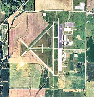
Pratt Regional Airport is a public airport five miles north of Pratt, in Pratt County, Kansas. Previously known as Pratt Industrial Airport, it is on the site of the former Pratt Army Airfield.
Mettel Field is a public airport three miles north of Connersville, in Fayette County, Indiana. It is owned by the Connersville Board of Aviation Commissioners. The National Plan of Integrated Airport Systems for 2011–2015 categorized it as a general aviation facility.