The Wetterau Limes is the name given in the field of historical research to that part of the Upper Germanic-Rhaetian Limes which enclosed the region that became known later as the Wetterau in the German state of Hesse.
Contents


The Wetterau Limes is the name given in the field of historical research to that part of the Upper Germanic-Rhaetian Limes which enclosed the region that became known later as the Wetterau in the German state of Hesse.
During the two campaigns of the Roman Emperor Domitian against the Chatti (83 and 85 AD), the Romans began to cut swathes of open ground through the dense forests of today's Hesse, in order to prevent their columns from being ambushed (e.g. at the Battle of the Teutoburg Forest).
On the crest of the Taunus mountain range, such a swathe served as a supply and surveillance route. After the end of the Chatti Wars, the Romans began to secure these conquered regions east of the Rhine with a limes - a line of forts, fortlets, watchtowers and palisades. [1] The forest road was guarded by wooden watchtowers to ensure continuous observation. This ensured that the southern slopes of the Taunus mountains and the fertile and strategically important Wetterau became part of the Roman Empire. In addition to the establishment of this frontier, Domitian turned the two Germanic military territories of Upper and Lower Germanian into Roman provinces. In spite of this rather modest conquest, he was subsequently celebrated in Rome with great pomp as a triumphator and coins were minted with the ambitious claim Germania capta ("Germania is conquered"). The propaganda nature of this policy is also evinced by the fact that in the very narrow province of Upper Germania (Germania superior) there were hardly any Germani, the area was populated almost entirely by Celts.
The long-held conviction that the Neckar-Odenwald Limes was erected at the same time as the Wetterau Limes, immediately after the Chatti wars, is now regarded as having been rejected. Although there were Roman military outposts on the eastern side of the Rhine from the seventies, the border running along the Odenwald-Neckar Line to Donnstetten (see Lautertal Limes) is now dated by most sources as having not been erected before 98 AD.
The state of preservation of the limes is poor due to the heavy agricultural use of the Wetterau. Only a few sections on the foothills of the Taunus, at Echzell, Limeshain and east of Hanau are visible above ground. In the early days of limes research, this situation meant that the eastern Wetterau section remained undiscovered; it was assumed that a stretch of the limes ran through the Vogelsberg instead. This was not disproved until the 1880s by excavations of the Hanauer Geschichtsverein under Albert Duncker and Georg Wolff. [2]
Like the other sections of the Upper German-Raetian Limes, the Wetterau Limes was gradually reinforced and expanded. Particularly in the eastern Wetterau the dates when the individual forts were first built are not uniform. It is clear that there was initially a defensive line from Oberflorstadt via Heldenbergen and Hanau-Mittelbuchen to Hanau-Salisberg [3] The forts on the line further east from Marköbel via Rückingen to Großkrotzenburg were probably not built until the time of Trajan. The neighbouring Taunus line was reinforced in the second half of the second century by the numerus forts of Holzhausen, Kleiner Feldberg and Kapersburg.
The further expansion of the limes defences to the north of the Wetterau was in order to protect its fertile soils on the one hand and to meet the high demand for the supply of the troops stationed on the limes and legion camps in Mainz (Mogontiacum). Archaeobotanical studies have calculated that an annual requirement of 3,034 tons of grain (excluding seed production) and 10,371 tons of hay were required to supply for the north-facing bulge of the limes in the Wetterau. [4]
The end of the Wetterau Limes came in the year 259-260 AD, when Rome abandoned all areas to the east of the Rhine (the Limesfall or "fall of the limes"). Thus, for example, the pottery trade, once flourishing in the Wetterau, largely came to a standstill. Imports of pottery from the Rhineland dominate archaeological collections from the second third of the 3rd century. Even bricks found in the area do not seem to have been fired as they used to be. More and more often, (sometimes damaged) older building material was used instead. Hypocaust heating was replaced by much simpler heating pipe systems. [5] From the border area, however, there are also other interesting finds which shed further light on the later period of the limes. This includes the treasure of Ober-Florstadt, which was probably concealed during the course of Germanic invasions in AD 233. In 1603, the inscription of a collegium iuventutis was discovered in the area around Altenstadt Roman Fort. [6] This may have been a unit set up to act as a local militia. Kapersburg Roman Fort was considerably reduced during its last days. [7] There is also evidence of a local unit, a numberus nidensium, which was presumably raised in the civitas capital of Nida-Heddernheim. [8]
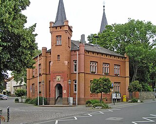
The following museums have a permanent exhibition on the Wetterau Limes or individual sites along it:

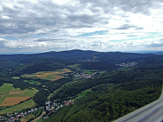
The Taunus is a mountain range in Hesse, Germany, located north west of Frankfurt and north of Wiesbaden. The tallest peak in the range is Großer Feldberg at 878 m; other notable peaks are Kleiner Feldberg and Altkönig.

Germania Superior was an imperial province of the Roman Empire. It comprised an area of today's western Switzerland, the French Jura and Alsace regions, and southwestern Germany. Important cities were Besançon (Vesontio), Strasbourg (Argentoratum), Wiesbaden, and Germania Superior's capital, Mainz (Mogontiacum). It comprised the Middle Rhine, bordering on the Limes Germanicus, and on the Alpine province of Raetia to the south-east. Although it had been occupied militarily since the reign of Augustus, Germania Superior was not made into an official province until c. 85 AD.

Neu-Anspach is a town in the Hochtaunuskreis in Hesse, Germany.

The Saalburg is a Roman fort located on the main ridge of the Taunus, northwest of Bad Homburg, Hesse, Germany. It is a cohort fort, part of the Limes Germanicus, the Roman linear border fortification of the German provinces. The Saalburg, located just off the main road roughly halfway between Bad Homburg and Wehrheim is the most completely reconstructed Roman fort in Germany. Since 2005, as part of the Upper Limes, it forms part of a UNESCO World Heritage site. In the modern numbering system for the limes, it is ORL 11.
The Limes Germanicus, or 'Germanic Limes', is the name given in modern times to a line of frontier fortifications that bounded the ancient Roman provinces of Germania Inferior, Germania Superior and Raetia, dividing the Roman Empire and the unsubdued Germanic tribes from the years 83 to about 260 AD. The frontier used either a natural boundary such as a river or typically an earth bank and ditch with a wooden palisade and watchtowers at intervals, and a system of linked forts was built behind them.
Wehrheim is a municipality in Hesse, Germany some 30 km (20 mi) north of Frankfurt am Main.
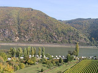
The Wetterau is a fertile undulating tract, watered by the Wetter, a tributary of the Nidda River, in the western German state of Hesse, between the hilly province Oberhessen and the north-western Taunus mountains.

Lich is a town in the district of Gießen, in Hesse, Germany. It is situated 12 km southeast of Gießen. Lich has a population of around 13,000.

The Mattiaci were by Tacitus recorded as an ancient Germanic tribe and related to the Chatti, their Germanic neighbors to the east. There is no clear definition of what the tribe's name meant. The Dictionary of Greek and Roman Geography suggests that the name is derived from a combination of 'matte', meaning 'a meadow', and 'ach', signifying water or a bath.
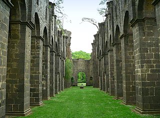
Arnsburg Abbey is a former Cistercian monastery near Lich in the Wetterau, Hesse, Germany. It was founded by monks from Eberbach Abbey in 1174. Although heavily damaged in the Thirty Years' War it was rebuilt later in the 17th century and prospered in the 18th century, when much of the abbey was rebuilt in Baroque style.

The Augsburg Victory Altar is the name given to a Roman altar of the victory goddess Victoria, which was set up on the occasion of the victory of a Roman army over the tribe of the Juthungi near the Rhaetian provincial capital Augusta Vindelicorum. The mention of the rebel emperor Postumus dates the creation of the altar to 11 September 260. The stone is kept in the Römisches Museum Augsburg.

The Upper Germanic-Rhaetian Limes, or ORL, is a 550-kilometre-long section of the former external frontier of the Roman Empire between the rivers Rhine and Danube. It runs from Rheinbrohl to Eining on the Danube. The Upper Germanic-Rhaetian Limes is an archaeological site and, since 2005, a UNESCO World Heritage Site. Together with the Lower Germanic Limes it forms part of the Limes Germanicus.
The Aresaces were Belgic tribe. They were closely related to, and probably originally part of, the Treveri. They inhabited the left bank of the Rhine in the Mainz-Bingen area, which was once the easternmost part of Treveran territory.

The Neckar-Odenwald Limes is a collective term for two, very different early sections of the Upper Germanic-Rhaetian Limes, a Roman defensive frontier line that may have been utilised during slightly different periods in history. The Neckar-Odenwald Limes consists of the northern Odenwald Limes (Odenwaldlimes), a cross-country limes with camps, watchtowers and palisades, which linked the River Main with the Neckar, and the adjoining southern Neckar Limes (Neckarlimes), which in earlier research was seen as a typical 'riverine limes', whereby the river replaced the function of the palisade as an approach obstacle. More recent research has thrown a different light on this way of viewing things that means may have to be relativized in future. The resulting research is ongoing.
The Taunus Nature Park is a nature park in Central Germany with an area of 134,775 hectares (1347.75 km2) in the Central Upland range of the Taunus. It is one of two Hessian nature parks in the Taunus and the second largest nature park in Hesse.
The Main Limes, also called the Nasser Limes, was built around 90 AD and, as part of the Upper Germanic-Rhaetian Limes, formed the frontier of the Roman Empire in the area between the present day villages of Großkrotzenburg and Bürgstadt. In this section the limes adjoined the River Main (Moenus), which forms a natural boundary for about 50 kilometres here, so "Main" refers to the river.
The Limesfall is the name given to the abandonment of the Upper Germanic-Rhaetian Limes in the mid-3rd century AD by the Romans and the withdrawal of imperial troops from the provinces on the far side of the rivers Rhine and Danube to the line of those rivers. It is sometimes called the fall of the limes.

The Arch of Dativius Victor in Mainz is one of the most important reconstructed Roman monuments in Germany. The structure dates from the middle of the 3rd century and was once the central passageway of a portico of a public building in Mogontiacum.
Stockstadt Fort is a former Roman fort located in Stockstadt am Main in the district of Aschaffenburg in Lower Franconia. Following several years of excavations, mainly in the early 20th century, evidence was uncovered indicating the existence of a fort complex comprising two previously documented predecessor buildings, as well as a succession of different troops stationed there. From the early period of the Upper Germanic-Raetian Limes to the fall of the Limes, Stockstadt was therefore an important military camp on the Main Limes, the so-called Wet Limes. The site is of significant archaeological interest due to the large number of stone monuments that have been discovered, particularly in the vicus area, which encompasses two mithrae, a Jupiter Dolichenus sanctuary and a beneficiarius station.