Weyer, Austria

Last updated
Weyer
AUT Weyer COA.png
Austria adm location map.svg
Red pog.svg
Weyer
Location within Austria
Coordinates: 47°51′01″N14°39′31″E / 47.85028°N 14.65861°E / 47.85028; 14.65861
Country Austria
State Upper Austria
District Steyr-Land
Government
   Mayor Gerhard Raimund Klaffner (SPÖ)
Area
[1]
  Total
223.79 km2 (86.41 sq mi)
Elevation
399 m (1,309 ft)
Population
 (2018-01-01) [2]
  Total
4,258
  Density19/km2 (49/sq mi)
Time zone UTC+1 (CET)
  Summer (DST) UTC+2 (CEST)
Postal code
3335, 4464, 8934
Area code +43 7355, 7357, 3631
Vehicle registration SE
Website www.weyer.ooe.gv.at

Weyer is a municipality in the district of Steyr-Land in the Austrian state of Upper Austria.

Geography

The municipality consists of three villages: Kleinreifling, Unterlaussa, and Weyer.

Related Research Articles

<span class="mw-page-title-main">Alberschwende</span> Place in Vorarlberg, Austria

Alberschwende is a municipality and a village in the district of Bregenz in the Austrian state of Vorarlberg.
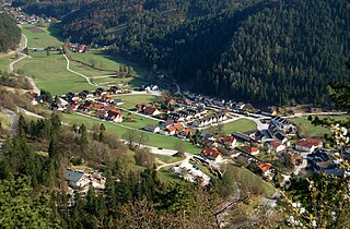
<span class="mw-page-title-main">Muggendorf</span> Municipality in Lower Austria, Austria

Muggendorf is a municipality in the district of Wiener Neustadt-Land in the Austrian state of Lower Austria.

<span class="mw-page-title-main">Lackenbach</span> Municipality in Burgenland, Austria

Lackenbach is an Austrian municipality in the District of Oberpullendorf, Burgenland.
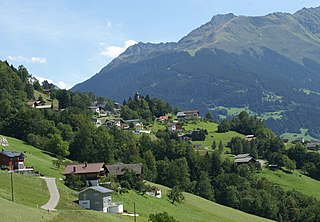
<span class="mw-page-title-main">Bartholomäberg</span> Place in Vorarlberg, Austria

Bartholomäberg is a municipality and a village in the district of Bludenz in the Austrian state of Vorarlberg.

<span class="mw-page-title-main">Fritzens</span> Place in Tyrol, Austria

Fritzens is a municipality in the district Innsbruck country in Tyrol (Austria). It lies 16 km east of Innsbruck on the left side of the Inn River. The Iron Age Fritzens-Sanzeno culture is named for archaeological finds from the village.

<span class="mw-page-title-main">Wölbling</span> Municipality in Lower Austria, Austria

Wölbling is a municipality in the district of Sankt Pölten-Land in the Austrian state of Lower Austria.

<span class="mw-page-title-main">Hohe Wand</span> Municipality in Lower Austria, Austria

Hohe Wand is a municipality in the district of Wiener Neustadt-Land in the Austrian state of Lower Austria. In this municipality there are four villages: Stollhof, Maiersdorf, Gaaden, and Netting.

<span class="mw-page-title-main">Bürserberg</span> Place in Vorarlberg, Austria

Bürserberg is a municipality in Austria in Vorarlberg in the Bludenz district with 549 inhabitants.

<span class="mw-page-title-main">Raggal</span> Place in Vorarlberg, Austria

Raggal is a municipality in the district of Bludenz in the Austrian state of Vorarlberg.

<span class="mw-page-title-main">Silbertal</span> Place in Vorarlberg, Austria

Silbertal is a municipality in the district of Bludenz in the Austrian state of Vorarlberg.
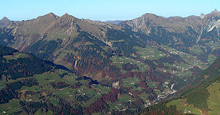
<span class="mw-page-title-main">Sonntag, Austria</span> Place in Vorarlberg, Austria

Sonntag is a municipality in the district of Bludenz in the Austrian state of Vorarlberg.

<span class="mw-page-title-main">Höchst, Austria</span> Place in Vorarlberg, Austria

Höchst is a municipality in the district of Bregenz in the Austrian state of Vorarlberg.

<span class="mw-page-title-main">Dünserberg</span> Place in Vorarlberg, Austria

Dünserberg is a municipality in the district of Feldkirch in the Austrian state of Vorarlberg.

<span class="mw-page-title-main">Koblach</span> Place in Vorarlberg, Austria

Koblach is a municipality in the district of Feldkirch in the Austrian state of Vorarlberg.

<span class="mw-page-title-main">Haigermoos</span> Municipality in Upper Austria, Austria

Haigermoos is a municipality in the district of Braunau am Inn in the Austrian state of Upper Austria. Today nothing remains of the infamous Weyer concentration camp for Roma placed here before 1945.

<span class="mw-page-title-main">Sankt Pantaleon</span> Municipality in Upper Austria, Austria

St. Pantaleon is a municipality in the Braunau district in Upper Austria, Austria. A monument was erected by the riverlet Moosach in memory of the slave workers engaged there in 1940/41 at the Weyer concentration camp.
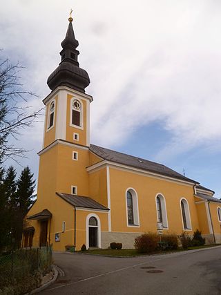
<span class="mw-page-title-main">Altschwendt</span> Municipality in Upper Austria, Austria

Altschwendt is a municipality in the district of Schärding in the Austrian state of Upper Austria.

Pfaffing is a municipality in the district of Vöcklabruck in the Austrian state of Upper Austria.

<span class="mw-page-title-main">Seewalchen am Attersee</span> Municipality in Upper Austria, Austria

Seewalchen am Attersee is a municipality in the district of Vöcklabruck in the Austrian state of Upper Austria.

<span class="mw-page-title-main">Frohnleiten</span> Municipality in Styria, Austria

Frohnleiten is a town in the district of Graz-Umgebung in the Austrian state of Styria.

References

  1. "Dauersiedlungsraum der Gemeinden Politischen Bezirke und Bundesländer - Gebietsstand 1.1.2018". Statistics Austria. Retrieved 10 March 2019.
  2. "Einwohnerzahl 1.1.2018 nach Gemeinden mit Status, Gebietsstand 1.1.2018". Statistics Austria. Retrieved 9 March 2019.
Parish church of Weyer Weyer (OO) - Kirche.JPG
Parish church of Weyer