Wheatland Township | |
|---|---|
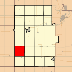 Location in Dickinson County | |
| Coordinates: 38°44′25″N097°19′01″W / 38.74028°N 97.31694°W | |
| Country | United States |
| State | Kansas |
| County | Dickinson |
| Area | |
• Total | 36.07 sq mi (93.43 km2) |
| • Land | 36.01 sq mi (93.26 km2) |
| • Water | 0.066 sq mi (0.17 km2) 0.18% |
| Elevation | 1,240 ft (378 m) |
| Population (2000) | |
• Total | 152 |
| • Density | 4.1/sq mi (1.6/km2) |
| GNIS feature ID | 0476841 |
Wheatland Township is a township in Dickinson County, Kansas, United States. As of the 2000 census, its population was 152.
