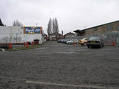
Haltemprice is an area in the East Riding of Yorkshire, England, directly to the west of Kingston upon Hull. Originally an extra-parochial area, it became a civil parish in 1858, in 1935 it was expanded by the combination of the urban districts of Cottingham, Anlaby, and Sculcoates to form a new urban district; the district included the villages of Anlaby, Cottingham, Hessle, Kirk Ella, Skidby, West Ella and Willerby. Urban districts were abolished 1974.

Skelbrooke is a village and former civil parish, now in the parish of Hampole, in the Doncaster district, in the county of South Yorkshire, England. In 1931 the civil parish had a population of 119.

Ardsley is a small village approximately 3 miles (5 km) east from Barnsley and forms part of the Metropolitan Borough of Barnsley of South Yorkshire, England. The village is in the Stairfoot ward of Barnsley Metropolitan Council. It is historically part of the West Riding of Yorkshire. The A635 divides the village into two parts.

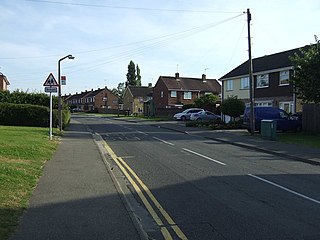
Lepton is a village near Huddersfield, in the civil parish of Kirkburton, in the Kirklees district of West Yorkshire, England. It is 4.25 miles (7 km) to the east of Huddersfield on the A642 road, 120 metres (390 ft) above the town centre directly north of Lepton Great Wood.
Gunthorpe is a residential area of the city of Peterborough, in the ceremonial county of Cambridgeshire, England. Since 2015 Gunthorpe has its own ward within Peterborough City Council that also encompasses parts of South Werrington.

Greasbrough is a small suburb in Rotherham, in South Yorkshire, England. The suburb falls in the Greasbrough Ward of Rotherham Metropolitan Borough Council. Greasbrough had its own local council, Greasbrough UDC, until its absorption into the County Borough of Rotherham in 1936. Until 1974 it was in the West Riding of Yorkshire.
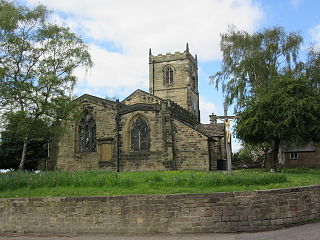
Thurlstone is a village and former civil parish, now in the parish of Penistone, in the metropolitan borough of Barnsley, in South Yorkshire, England. Originally it was a small farming community. Some industries developed using water power from the River Don such as corn milling, wire drawing and various wool and cloth processes. Most of these are now gone and only James Durrans and Service Direct owned by 'Don Eddie' remain. The village is now a dormitory for the urban areas of South and West Yorkshire. The village now falls in the Penistone West ward of the Barnsley MBC.

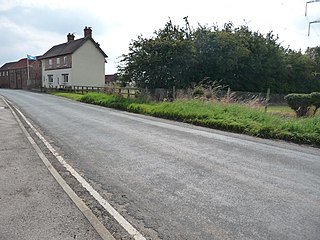
Pinchinthorpe is a small hamlet in the civil parish of Guisborough, in the Redcar and Cleveland district of North Yorkshire, England. It is a linear settlement spread along the A173. The postcode is TS14 8HE.
Bolton upon Dearne is a village in the Metropolitan Borough of Barnsley, South Yorkshire, England, in the part of the Dearne Valley through which the River Dearne passes. Historically part of the West Riding of Yorkshire, it is approximately 7 miles (11 km) east of Barnsley, 10 miles (16 km) west of Doncaster and 8 miles (13 km) north of Rotherham.

South Newbald is a hamlet and former civil parish, now in the parish of Newbald, in the East Riding of Yorkshire, England. It is situated approximately 12 miles (19 km) north-west of Hull city centre, 2.5 miles (4 km) north of South Cave and 4 miles (6.4 km) south of Market Weighton. It lies to the east of the A1034 road. The larger village of North Newbald is just to the north. In 1931 the parish had a population of 173.
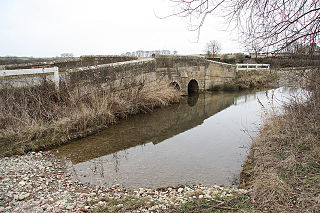
Ousefleet is a small hamlet and former civil parish, now in the parish of Twin Rivers, in the East Riding of Yorkshire, England approximately 5 miles (8 km) east of Goole. It is located just south of the River Ouse and north of the A161 road between Goole and Scunthorpe. In 1961 the parish had a population of 167.

Eastburn is a hamlet and former civil parish, now in the parish of Kirkburn, in the East Riding of Yorkshire, England. It is situated in the Yorkshire Wolds on the A164 road, approximately 2.5 miles (4 km) south-west of Driffield town centre and 3 miles (5 km) north-west of the village of Hutton Cranswick. In 1931 the parish had a population of 27.

Armston is a hamlet and former civil parish, now in the parish of Polebrook, in the North Northamptonshire district, in the ceremonial county of Northamptonshire, England. In 1931 the parish had a population of 22.
Aunby is a village in the civil parish of Careby Aunby and Holywell, in the South Kesteven district of Lincolnshire, England. It is situated north from Stamford on the B1176 road, and just south of Careby. In 1921 the parish had a population of 42. Aunby was formerly in the parish of Castle Bytham, in 1866 Aunby became a separate civil parish, on 1 April 1931 the parish was abolished to form "Careby, Aunby and Holywell".

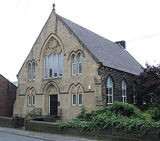
Soyland is a village in the civil parish of Ripponden, in Calderdale, West Yorkshire, England. It is just north of Ripponden off the A58 road and is 5 miles (8 km) south west of Halifax. The village referred to as Soyland Town, used to be the site of several textile mills, but these have closed down. The walking route Calderdale Way passes through the area.

Denton is a hamlet and former civil parish, now in the parish of Cuddesdon and Denton, in the South Oxfordshire district, in Oxfordshire, England. Denton's toponym is derived from the Old English den-tun meaning "valley farmstead". Denton is in a fold of the landscape, between the two hills on which Cuddesdon and Garsington stand. Denton is an ancient manor and had its own civil parish, but it was merged with neighbouring Cuddesdon in the 20th century.

Midgley is a hill-top village in Calderdale, West Yorkshire, England. It is situated approximately 12 miles (20 km) east from Burnley and 4 miles (6 km) west-north-west of Halifax, and just north of the A646 road. Nearby villages are Mytholmroyd 1 mile (1.6 km) to the west-south-west, and Hebden Bridge 2.5 miles (4.0 km) to the west-north-west.
Sutton is a small village and former civil parish, now in the parish of Norton, in the City of Doncaster in South Yorkshire, England. It lies at approximately 53° 36' 20" North, 1° 10' West, at an elevation of around 26 feet above sea level, west of Askern and south of Campsall. In 1931 the civil parish had a population of 156.

Leppington is a hamlet and former civil parish, now in the parish of Scrayingham, in North Yorkshire, England, and is 12 miles (19 km) north-east from the centre of the city and county town of York. In 1931 the parish had a population of 74.

Kennythorpe is a hamlet in the civil parish of Burythorpe, North Yorkshire, England. It is 4 miles (6 km) south from Malton, and between the village of Langton to the north, and Burythorpe to the south.