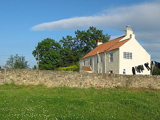
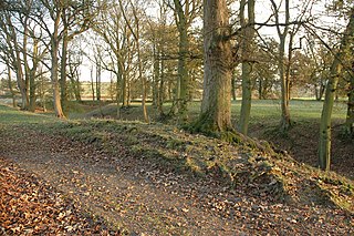
Archdeacon Newton is a hamlet and rural parish of several farms in the borough of Darlington and the ceremonial county of County Durham, in England. The population taken at the 2011 Census was less than 100. Details are maintained in the parish of Walworth. It is associated with an abandoned village site under pasture and farm buildings, and situated a short distance to the north-west of Darlington. The lost settlement was in existence by the early 15th century, and remained inhabited at least until the 1890s. There was a moated manor house at the southern end, part of which remains as the Old Hall, now a barn. At the north end of the site was the chapel, and in the middle were tofts and enclosures, with a ridge and furrow field and a trackway leading to the south-east. The site of the abandoned village is now a scheduled monument and the Old Hall is a listed building.
North Killingholme is a small village and civil parish in North Lincolnshire, England.
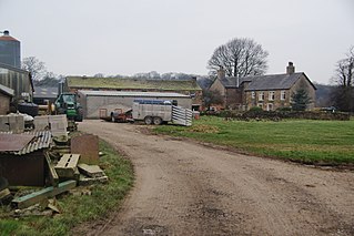
Cuerdale is a civil parish in the South Ribble district of Lancashire, England. It includes Cuerdale Hall and has no substantive settlements. It originated as a township in the parish of Blackburn, becoming a separate civil parish in 1866. From 1894, it formed part of the Preston Rural District, and under the Local Government Act 1972 became part of the South Ribble district in 1974.

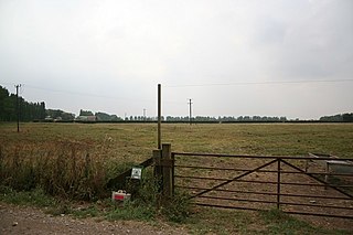
Stainsby, in North Yorkshire, England, is an abandoned village near the Acklam suburb of Middlesbrough and town of Thornaby. Little more than mounds near the A19 road are now visible. The site is a scheduled monument.

Cliffe is a small village and civil parish in the Selby District of North Yorkshire, England. It was historically part of the East Riding of Yorkshire until 1974.

Legsby is a small village and civil parish in the West Lindsey district of Lincolnshire, England. The population of the civil parish at the 2011 census was 193. It is situated approximately 13 miles (20 km) north-east from the city and county town of Lincoln and 3 miles (5 km) south-east from the town of Market Rasen.

Chiselbury is the site of an Iron Age univallate hillfort located in Wiltshire. The hillfort is sub-circular in plan, and encloses an area of approximately 10.5 acres (460,000 sq ft). It is defined by an earthen rampart up to 3.6 metres (12 ft) in height and an external ditch, up to a maximum of 1.6 metres (5.2 ft) in depth. A gap in the southeastern side of the rampart, and a corresponding causeway across the ditch, is thought to be the original entrance and is associated with a small 'D' shaped embanked enclosure, which is apparently visible on aerial photographs. Although the enclosure has subsequently been degraded by ploughing, it is still apparent as a series of low earthworks.

Elmley Lovett in Worcestershire, England is a civil parish whose residents' homes are quite loosely clustered east of its Hartlebury Trading Estate, as well as in minor neighbourhood Cutnall Green to the near south-east. The latter is a loosely linear settlement that includes a pub-restaurant and farm shop on the Elmley Lovett side of the boundaries; it continues passing its near-square public green into the parish of Elmbridge, a similarly sized parish over to the east.

Stratton Park Moated Enclosure is a scheduled ancient monument formed of a moat ditch circuit, counterscarp bank, central platform and walled garden compound located on the south-east edge of Biggleswade, Bedfordshire in the United Kingdom. Described by a 1982–83 survey of the landscape and wildlife features at Biggleswade as "one of the most exciting areas seen during the survey" and by English Heritage as "a site of regional significance", the moated enclosure consists of a number of earthwork features discovered through topographical analysis. Classified by the Royal Commission on the Historical Monuments of England as a Class A: Homestead Moat site, the moated enclosure is not currently open to the general public.

Hollingbury Castle, also known as Hollingbury Camp and Hollingbury Hillfort, is an Iron Age hillfort on the northern edge of Brighton, in East Sussex, England. It is adjacent to Hollingbury Park Golf Course.

Whittington Tump or Crookbarrow Hill is a partly artificial mound in central Worcestershire, England. There is evidence of prehistoric activity at the site and may have been used as a religious site or burial mound. A Romano-British settlement was established nearby in the early 2nd century AD but was apparently abandoned by the 4th century. An Anglo-Saxon enclosure was established on Whittington Tump by the 7th century and during the mediaeval period it is thought to have been the site of a motte castle. Crookbarrow Manor was established at the foot of the hill by 1314 and the site, including the former motte, was given over to agricultural use. The site was listed as a scheduled monument in 1923 and is a landmark for motorists on the nearby M5 motorway.
Coates medieval settlement is a deserted medieval village in Lincolnshire, England. It is in the hamlet of Coates-by-Stow, about 2 miles (3.2 km) east of the village of Stow. It is a Scheduled Monument.

Egmere medieval settlement is a deserted medieval village in Norfolk, England, about 2.5 miles (4.0 km) west of Walsingham. It is a Scheduled Monument.
Rock moated site and medieval village is an archaeological site, including a deserted medieval village, in Worcestershire, England, near the village of Rock and about 4 miles (6.4 km) south-west of Bewdley. It is a Scheduled Monument.

Waterden medieval settlement is a deserted medieval village in Norfolk, England, about 3 miles (4.8 km) west of Walsingham. It is a Scheduled Monument.
Cold Hanworth medieval settlement is a deserted medieval village in Lincolnshire, England, next to the village of Cold Hanworth and about 7 miles (11 km) north of Lincoln. It is a Scheduled Monument.

The Martin Down Enclosure is an archaeological site on Martin Down, near the village of Martin, in Hampshire, England. It is near the boundaries with Dorset and Wiltshire.

Thundersbarrow Hill is an archaeological site in West Sussex, England. It is on a chalk ridge, aligned north-west to south-east, on the South Downs north of Shoreham-by-Sea.

Alkmonton medieval settlement is an archaeological site, a deserted medieval village near the present-day village of Alkmonton, about 5 miles (8 km) south of Ashbourne in Derbyshire, England. It is a Scheduled Monument.

Little Carlton is a hamlet in the Newark and Sherwood district of Nottinghamshire, England, north-west of Newark-on-Trent. Little Carlton was recorded in the Domesday Book in 1086.

