
The Rural City of Murray Bridge is a local government area of South Australia centred on the regional city of Murray Bridge and stretching south to Lake Alexandrina. It was formed in 1977 by amalgamation of the District Council of Mobilong and the Corporation of Murray Bridge.

The Department of Conservation and Recreation (DCR) is a state agency of the Commonwealth of Massachusetts, situated in the Executive Office of Energy and Environmental Affairs. It is best known for its parks and parkways. As of December 9, 2015, the Commissioner of the DCR is Leo Roy. The DCR's mission is "To protect, promote and enhance our common wealth of natural, cultural and recreational resources for the well-being of all." The agency is the largest landowner in Massachusetts.

Monarto South is a locality in South Australia 16 km (9.9 mi) west of the Murray River and 65 km (40 mi) south east by road from Adelaide. The Monarto South railway station is north of the South Eastern Freeway between the Callington and Murray Bridge exits, but the locality spans south of the freeway to Chaunceys Line Road and Ferries McDonald Conservation Park.
The Murraylands is a geographical region in South Australia; generally, the lower part of the Murray River basin, in South-Eastern South Australia. The area stretches from Blanchetown; roughly 130 kilometres north-east of Adelaide, right down to Wellington, which is situated at the beginning of Lake Alexandrina.

Ferries McDonald Conservation Park is a protected area in the Australian state of South Australia located in the gazetted locality of Monarto South about 10 kilometres (6.2 mi) south-west of Murray Bridge. It covers an area of 845 hectares and provides a habitat for a range of native and endangered species. It is one of a number of protected patches of remnant mallee bushland within the region. Conservation organisations are now attempting to restore and connect these patches of the fragmented Murray plains in an attempt to heighten the prospects of various rare and endangered species.
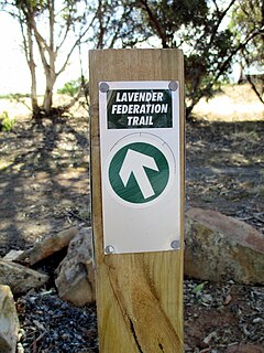
The Lavender Federation Trail is a long distance walking trail in the eastern Mount Lofty Ranges in South Australia. It extends 212 kilometres (132 mi) from Murray Bridge to Eudunda. It is named after Terry Lavender OAM and development started in 1999. The ultimate goal is to extend it to a total of 350 kilometres (220 mi) to Clare.

The Hundred of Mobilong is a cadastral unit of hundred on the west bank of the Murray River in South Australia and centred on Murray Bridge. One of the ten hundreds of the County of Sturt, it is bounded on the east entirely by the Murray River. It was created in 1860 by Governor Richard MacDonnell from a portion of the former Hundred of the Murray, which covered lands beside the Murray River for more than 300 kilometres (190 mi) of its course from mouth to Waikerie. It was named after an aboriginal name for the swamplands in the vicinity on the west bank of the Murray.
Cocata Conservation Park is a protected area in the Australian state of South Australia located on the Eyre Peninsula in the gazetted localities of Cocata and Warramboo about 26 kilometres (16 mi) south-west of the town centre in Kyancutta.
Tucknott Scrub Conservation Park is a protected area located in the Australian state of South Australia on the Eyre Peninsula in the gazetted locality of Whites Flat about 12 kilometres north-east of the town centre in Wanilla and about 30 kilometres north of the municipal seat of Port Lincoln.
Kathai Conservation Park is a protected area in the Australian state of South Australia located on the Eyre Peninsula in the gazetted locality of Duck Ponds about 5 kilometres south-west of Port Lincoln.
Media Island Conservation Park is a protected area in the Australian state of South Australia located in the Riverland in the gazetted locality of Loxton about 3 kilometres (1.9 mi) north-east of the Loxton town centre.
Rilli Island Conservation Park is a protected area in the Australian state of South Australia located on the Riverland in the gazetted locality of Loxton North about 6.5 kilometres (4.0 mi) north-east of the Loxton town centre.
Kapunda Island Conservation Park is a protected area in the Australian state of South Australia located on the Riverland in the gazetted locality of Loxton about 1 kilometre (0.62 mi) north-west of the Loxton town centre.
Ramco Point Conservation Park is a protected area located in the Australian state of South Australia in the locality of Sunlands about 150 kilometres (93 mi) north-east of the state capital of Adelaide and about 7 kilometres (4.3 mi) north-west of the municipal seat of Waikerie.
Ettrick Conservation Park is a protected area located in the Australian state of South Australia in the locality of Ettrick about 80 kilometres (50 mi) east of the state capital of Adelaide and about 24 kilometres (15 mi) north-east of the city of Murray Bridge.
Hogwash Bend Conservation Park is a protected area located in the Australian state of South Australia in the Riverland in the localities of Cadell and Taylorville in the state's east about 148 kilometres (92 mi) north-east of the state capital of Adelaide and about 8 kilometres (5.0 mi) east of the town of Cadell.


