The fictional world in which the A Song of Ice and Fire novels by George R. R. Martin take place is divided into several continents, known collectively as The Known World.

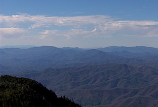
The Appalachian Mountains, often called the Appalachians, are a mountain range in eastern to northeastern North America. The term "Appalachian" refers to several different regions associated with the mountain range, and its surrounding terrain. The general definition used is one followed by the United States Geological Survey and the Geological Survey of Canada to describe the respective countries' physiographic regions. The U.S. uses the term Appalachian Highlands and Canada uses the term Appalachian Uplands; the Appalachian Mountains are not synonymous with the Appalachian Plateau, which is one of the provinces of the Appalachian Highlands.

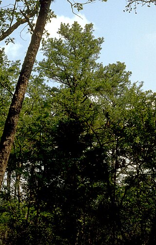
White County is a county located in the northeastern part of the U.S. state of Georgia. As of the 2020 census, the population was 28,003. The county seat is Cleveland. The county was created on December 22, 1857, formerly a part of Habersham County and most likely was named for Newton County Representative David T. White, who helped a Habersham representative successfully attain passage of an act creating the new county.

Middle Paxton Township is a township in Dauphin County, Pennsylvania, United States. The population was 5,046 at the 2020 census.

The Boston Mountains is a Level III ecoregion designated by the Environmental Protection Agency (EPA) in the U.S. states of Arkansas and Oklahoma. Part of the Ozarks, the Boston Mountains are a deeply dissected plateau. The ecoregion is steeper than the adjacent Springfield Plateau to the north, and bordered on the south by the Arkansas Valley. The Oklahoma portion of the range is locally referred to as the Cookson Hills. There are several theories of how the mountains were named, though apparently none are related to the Massachusetts city.

The Ozark – St. Francis National Forest is a United States National Forest that is located in the state of Arkansas. It is composed of two separate forests, Ozark National Forest in the Ozark Mountains; and St. Francis National Forest on Crowley's Ridge. Each forest has distinct biological, topographical, and geological differences.

The Inyo Mountains are a short mountain range east of the Sierra Nevada in eastern California in the United States. The range separates the Owens Valley to the west from Saline Valley to the east, extending for approximately 70 miles (110 km) south-southeast from the southern end of the White Mountains, from which they are separated by Westgard Pass, to the east of Owens Lake.

White Mountain Peak, at 14,252 feet (4,344 m), is the highest peak in the White Mountains of California, the highest peak in Mono County, and the third highest peak in the state after Mount Whitney and Mount Williamson. In spite of its name, the summit block of the peak has large swaths of very dark and colorful orange scree and rock; it is composed of Mesozoic metavolcanic rock, which is igneous rock altered by rising granite.

The Unaka Range is a mountain range on the border of Tennessee and North Carolina, in the southeastern United States. It is a subrange of the Appalachian Mountains and is part of the Blue Ridge Mountains physiographic province. The Unakas stretch approximately from the Nolichucky River in the south to the Watauga River in the north.

White Americans are Americans who identify as white people. In a more official sense, the U.S. Census Bureau, which collects demographic data on Americans, defines "white" as "A person having origins in any of the original peoples of Europe, the Middle East, or North Africa." This group constitutes the majority of the people in the United States. According to the 2020 census, 71%, or 235,411,507 people, were White alone or in combination, and 61.6%, or 204,277,273 people, were White alone. This represented a national white demographic decline from a 72.4% white alone share of the U.S. population in 2010.

The Fort Apache Indian Reservation is an Indian reservation in Arizona, United States, encompassing parts of Navajo, Gila, and Apache counties. It is home to the federally recognized White Mountain Apache Tribe of the Fort Apache Reservation, a Western Apache tribe. It has a land area of 1.6 million acres and a population of 12,429 people as of the 2000 census. The largest community is in Whiteriver.

The Golden Throne is a 7,041-foot (2,146 m) mountain in Capitol Reef National Park in Wayne County, Utah, United States. It is a rock formation dome made of a gold color stained Navajo Sandstone, which is particularly special because normally the sandstone is creamy white or red. The presence of a small amount of the Carmel Formation on top of the Navajo Sandstone is the reason for this staining.

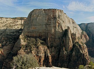
The Great White Throne is a monolith, predominantly composed of white Navajo Sandstone in Zion National Park in Washington County in southwestern Utah, United States. The north-west "main" face rises 2,350 feet (720 m) in 1,500 feet (460 m) from the floor of Zion Canyon near Angels Landing. It is often used as a symbol of Zion National Park. The Great White Throne can be seen from most locations along the scenic drive running through Zion Canyon.

The U.S. Interior Highlands is a mountainous region in the Central United States spanning northern and western Arkansas, southern Missouri, eastern Oklahoma, and extreme southeastern Kansas. The name is designated by the United States Geological Survey to refer to the combined subregions of the Ouachita Mountains south of the Arkansas River and the Ozark Plateaus north of the Arkansas. The U.S. Interior Highlands is one of few mountainous regions between the Appalachians and Rockies.
United States v. White Mountain Apache Tribe, 537 U.S. 465 (2003), was a case in which the Supreme Court of the United States held in a 5–4 decision that when the federal government used land or property held in trust for an Indian tribe, it had the duty to maintain that land or property and was liable for any damages for a breach of that duty. In the 1870s, the White Mountain Apache Tribe was placed on a reservation in Arizona. The case involved Fort Apache, a collection of buildings on the reservation which were transferred to the tribe by the United States Congress in 1960.
Blair Mountain is the highest summit of the White River Plateau in the Rocky Mountains of North America. The prominent 11,465-foot (3,495 m) peak is located in White River National Forest, 17.5 miles (28.2 km) north by west of the City of Glenwood Springs in Garfield County, Colorado, United States.

"The Mountain and the Viper" is the eighth episode of the fourth season of HBO's medieval fantasy television series Game of Thrones. The 38th episode overall, it was written by series co-creators David Benioff and D. B. Weiss, and directed by Alex Graves. It first aired on HBO on June 1, 2014.
Devils Throne is a summit in Idaho County, Idaho, in the United States. It forms part of the Seven Devils Mountains. With an elevation of 9,045 feet (2,757 m), Devils Throne is the 312th highest summit in the state of Idaho.

Observation Point is a 6,507-foot (1,983 m) elevation Navajo Sandstone feature located in Zion National Park, in Washington County of southwest Utah, United States. Observation Point is situated at the north end of Zion Canyon, towering 2,100 feet above the canyon floor and the North Fork of the Virgin River which drains precipitation runoff from this viewpoint. A popular 8-mile round-trip trail climbs from the Weeping Rock trailhead along Zion Canyon Road to reach the top. Neighbors visible from the point include The Great White Throne, Cathedral Mountain, Angels Landing, and Cable Mountain. This geographical feature's name was officially adopted in 1934 by the U.S. Board on Geographic Names.

The Organ is a 5,080-foot (1,550 m) elevation Navajo Sandstone summit located in Zion National Park, in Washington County of southwest Utah, United States. The Organ is situated in the Big Bend at the north end of Zion Canyon, rising 700 feet above the canyon floor and the North Fork of the Virgin River which drains precipitation runoff from this rock. Neighbors include The Great White Throne, Cathedral Mountain, Angels Landing, Observation Point, and Cable Mountain. The Organ is believed to have been named by Claud Hirschi and Ethelbert Bingham, residents of Rockville, on their 1916 trip with Methodist Minister Frederick Vining Fisher, who also named geographical formations in Zion. This geographical feature's descriptive name was officially adopted in 1934 by the U.S. Board on Geographic Names.


