Wiggensbach

Last updated
Wiggensbach
Wiggensbach 5.jpg
Wiggensbach
DEU Wiggensbach COA.svg
Location of Wiggensbach within Oberallgäu district
Wiggensbach in OA.svgKempter WaldSulzbergHaldenwang
Germany adm location map.svg
Red pog.svg
Wiggensbach
Bavaria location map.svg
Red pog.svg
Wiggensbach
Coordinates: 47°44′45″N10°13′55″E / 47.74583°N 10.23194°E / 47.74583; 10.23194 Coordinates: 47°44′45″N10°13′55″E / 47.74583°N 10.23194°E / 47.74583; 10.23194
Country Germany
State Bavaria
Admin. region Schwaben
District Oberallgäu
Subdivisions3 Ortsteile und 72 Weiler/Einöden
Government
   Mayor (202228) Thomas Eigstler [1] (CSU)
Area
  Total31.83 km2 (12.29 sq mi)
Highest elevation
1,077 m (3,533 ft)
Lowest elevation
870 m (2,850 ft)
Population
 (2020-12-31) [2]
  Total5,049
  Density160/km2 (410/sq mi)
Time zone UTC+01:00 (CET)
  Summer (DST) UTC+02:00 (CEST)
Postal codes
87487
Dialling codes 08370
Vehicle registration OA
Website www.wiggensbach.de

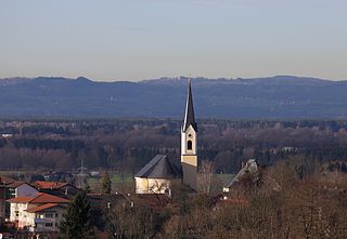
Wiggensbach is a municipality in Bavaria. It is situated about 7 kilometres west of Kempten, the next greater town.

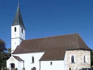
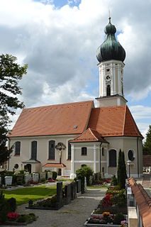
Neighbour municipalities are Altusried in the north and Buchenberg in the south of the village. The municipality consists of Wiggensbach as the main village and Ermengerst and Westenried as two districts of Wiggensbach. There are furthermore 72 hamlets in the area of the municipality.

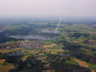
The height of the village is between 870 and 1.077 metres above sea level.

Partner township of Wiggensbach is Hattstatt in France, in 2003 the two communes commemorate 20th anniversary of the partnership.

First settlements in the current boundaries of the municipality are documented for the district Ermengerst in 1037, for Wiggensbach itself in 1182. In 1888, the Wiggensbach treasure was found, its coins were dated back to the first to third century A.C. This proves the early settlement of humans in the area.

Related Research Articles

<span class="mw-page-title-main">Rohrdorf, Bavaria</span> Municipality in Bavaria, Germany

Rohrdorf is a municipality in the district of Rosenheim in Upper Bavaria, Germany. It is located in the Inn valley.

<span class="mw-page-title-main">Petting, Bavaria</span> Municipality in Bavaria, Germany

Petting is a municipality in the district Traunstein, Bavaria, Germany. It is located on the shore of the Waginger See, a diluvial lake.

<span class="mw-page-title-main">Schäftlarn</span> Municipality in Bavaria, Germany

Schäftlarn is a municipality in the district of Munich in Bavaria in Germany. It consists of the villages Ebenhausen, Hohenschäftlarn, Kloster Schäftlarn, Neufahrn and Zell. The river Isar runs through it. A human settlement with the name "Schäftlarn" does not exist.

<span class="mw-page-title-main">Manching</span> Municipality in Bavaria, Germany

Manching is a municipality in the district of Pfaffenhofen, in Bavaria, Germany. It is situated on the river Paar, 7 km southeast of Ingolstadt. In the late Iron Age, there was a Celtic settlement, the Oppidum of Manching, on the location of present-day Manching.

<span class="mw-page-title-main">Eggolsheim</span> Municipality in Bavaria, Germany

Eggolsheim is a municipality in the district of Forchheim in Bavaria in Germany.

<span class="mw-page-title-main">Sondheim vor der Rhön</span> Municipality in Bavaria, Germany

Sondheim vor der Rhön is a municipality in the district Rhön-Grabfeld, Bavaria, Germany. It is administrated by the Verwaltungsgemeinschaft Ostheim. As of 2002 it had a population of 1123, and covers an area of 18.58 km².

<span class="mw-page-title-main">Teising</span> Municipality in Bavaria, Germany

Teising is a municipality in the district of Altötting in Bavaria in Germany and belongs to the parish Burgkirchen am Wald. The village is located very centrally between the towns of Altötting and Mühldorf am Inn. Since 2008 most traffic is rerouted to the nearby freeway A94, which help the village center gain considerably in attractiveness.

<span class="mw-page-title-main">Maßbach</span> Municipality in Bavaria, Germany

Maßbach is a market town and municipality in the district of Bad Kissingen in Bavaria in Germany.

<span class="mw-page-title-main">Münsing</span> Municipality in Bavaria, Germany

Münsing is a municipality in the district of Bad Tölz-Wolfratshausen in Bavaria in Germany.

<span class="mw-page-title-main">Geltendorf</span> Municipality in Bavaria, Germany

Geltendorf is a municipality in the district of Landsberg in Bavaria, Germany.

<span class="mw-page-title-main">Hohenbrunn</span> Municipality in Bavaria, Germany

Hohenbrunn is a municipality in the district of Munich in Bavaria, Germany.

<span class="mw-page-title-main">Mühlhausen, Upper Palatinate</span> Municipality in Bavaria, Germany

Mühlhausen is a municipality in the district of Neumarkt in Bavaria in Germany. It lies in the Sulz River valley.

<span class="mw-page-title-main">Tegernheim</span> Municipality in Bavaria, Germany

Tegernheim is a municipality in the district of Regensburg in Bavaria in Germany. The Danube flows through the cadastrial area of the village.

<span class="mw-page-title-main">Wülfershausen</span> Municipality in Bavaria, Germany

Wülfershausen is a municipality in the district of Rhön-Grabfeld in Bavaria in Germany, located on the Saale River. The municipality consists of these two villages: Wülfershausen and Eichenhausen. The township is a member of the administrative community called "Verwaltungsgemeinschaft" Saal an der Saale.

<span class="mw-page-title-main">Eggstätt</span> Municipality in Bavaria, Germany

Eggstätt is a municipality in the district of Rosenheim in Bavaria in Germany.

<span class="mw-page-title-main">Julbach</span> Municipality in Bavaria, Germany

Julbach is a village and municipality in the district of Rottal-Inn in Bavaria in Germany. In addition to the village of Julbach, the municipality includes 16 other settlements.

<span class="mw-page-title-main">Oberschneiding</span> Municipality in Bavaria, Germany

Oberschneiding is a municipality in the district of Straubing-Bogen in Bavaria, Germany.

<span class="mw-page-title-main">Kastl, Amberg-Sulzbach</span> Municipality in Bavaria, Germany

Kastl is a municipality in the district of Amberg-Sulzbach in Bavaria in Germany. A gem of the village is Kastl Abbey, one of the most beautiful monasteries in the area.

<span class="mw-page-title-main">Halfing</span> Municipality in Bavaria, Germany

Halfing is a municipality in the district of Rosenheim in Bavaria in Germany. It is located in the western part of the Chiemgau area, half-way between Chiemsee and Wasserburg am Inn.

<span class="mw-page-title-main">Schwarzach bei Nabburg</span> Municipality in Bavaria, Germany

Schwarzach bei Nabburg is a municipality in the district of Schwandorf in Bavaria, Germany.

References

  1. Liste der ersten Bürgermeister/Oberbürgermeister in kreisangehörigen Gemeinden, Bayerisches Landesamt für Statistik, 19 October 2022.
  2. "Tabellenblatt "Daten 2", Statistischer Bericht A1200C 202041 Einwohnerzahlen der Gemeinden, Kreise und Regierungsbezirke". Bayerisches Landesamt für Statistik (in German). June 2021.