
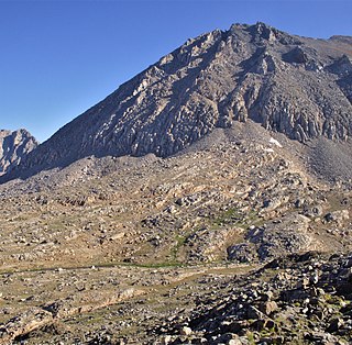
Mount Whitney is the highest mountain in the contiguous United States, with an elevation of 14,505 feet (4,421 m). It is in East–Central California, in the Sierra Nevada, on the boundary between California's Inyo and Tulare counties, and 84.6 miles (136.2 km) west-northwest of North America's lowest topographic point, Badwater Basin in Death Valley National Park, at 282 ft (86 m) below sea level. The mountain's west slope is in Sequoia National Park and the summit is the southern terminus of the John Muir Trail, which runs 211.9 mi (341.0 km) from Happy Isles in Yosemite Valley. The eastern slopes are in Inyo National Forest in Inyo County. Mount Whitney is ranked 18th by topographic isolation.

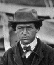
Clarence Rivers King was an American geologist, mountaineer, and author. He was the first director of the United States Geological Survey from 1879 to 1881. Nominated by Republican President Rutherford B. Hayes, King was noted for his exploration of the Sierra Nevada mountain range.

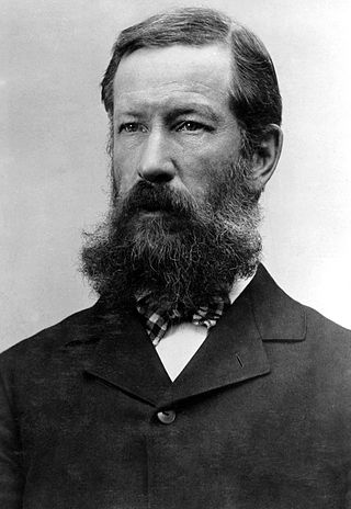
Josiah Dwight Whitney was an American geologist, professor of geology at Harvard University, and chief of the California Geological Survey (1860–1874). Through his travels and studies in the principal mining regions of the United States, Whitney became the foremost authority of his day on the economic geology of the U.S. Mount Whitney, the highest point in the contiguous 48 United States, and the Whitney Glacier, the first confirmed glacier in the United States, on Mount Shasta, were both named after him by members of the Survey.

Mount Ritter is the highest mountain in Madera County, California, in the Western United States, at an elevation of 13,149 feet (4,008 m). It is also the highest and most prominent peak of its namesake, the Ritter Range, a subrange of the Sierra Nevada in the Ansel Adams Wilderness of the Inyo and Sierra National Forests. Mount Ritter is the 15th highest mountain peak in California with at least 500 meters of topographic prominence.

Mount Humphreys is a mountain peak in the Sierra Nevada on the Fresno-Inyo county line in the U.S. state of California. It is the 13th highest peak in California, and the highest peak in the Bishop area. The mountain was named by the California Geological Survey of 1873 for Andrew A. Humphreys, the chief engineer of the United States Army at the time.

Mount Morrison is located in the Sierra Nevada, in the Sherwin Range. It rises south of Convict Lake near the town of Mammoth Lakes.
Henry Gannett was an American geographer who is described as the "father of mapmaking in America." He was the chief geographer for the United States Geological Survey essentially from its founding until 1902.

Mount Conness is a 12,590 foot (3,840 m) mountain in the Sierra Nevada range, to the west of the Hall Natural Area. Conness is on the boundary between the Inyo National Forest and Yosemite National Park. The Conness Glacier lies north of the summit.

James Terry Gardiner was an American surveyor and engineer.
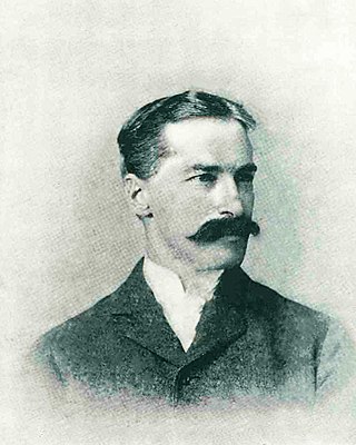
Richard D. Cotter, also known as Dick Cotter and R. D. Cotter, was an Irish born American member of the first California Geological Survey.

Mount Brewer is on the Great Western Divide, a sub-range of the Sierra Nevada in California. It is located in Kings Canyon National Park,

Mount Clarence King, located in the Kings Canyon National Park, is named for Clarence King, who worked on the Whitney Survey, the first geological survey of California. King later became the first chief of the United States Geological Survey.

Mount Abbot is a mountain in California's Sierra Nevada, in the John Muir Wilderness. It is located between Mount Mills and Mount Dade along the Sierra Crest and straddles the border between Fresno and Inyo counties.
Richard Urquhart Goode was an American geographer and topographer with the United States Geological Survey (USGS) Northern Transcontinental Railroad Survey, and the Panama Canal Company. Goode was in charge of the Western Division of the USGS. which included all lands west of the Mississippi River, and worked on the boundary between the United States and Canada.

Mount Gabb is in the central Sierra Nevada in the U.S. state of California. Mount Gabb is in the John Muir Wilderness of Sierra National Forest and is named after William More Gabb, a paleontologist and member of the Whitney Survey.
Mount Pinchot is in the Sierra Nevada in the U.S. state of California. Mount Pinchot is in the Sequoia-Kings Canyon Wilderness of Kings Canyon National Park. The peak lies just northeast of Pinchot Pass and just east of the John Muir Trail.

Mount Young is a 13,176-foot-elevation (4,016-meter) mountain summit located west of the crest of the Sierra Nevada mountain range in Tulare County, California. It is situated in Sequoia National Park, and is two miles (3.2 km) west of Mount Whitney, one mile northwest of Guitar Lake, and one mile southwest of Mount Hale, the nearest higher neighbor. The John Muir Trail traverses below the south and west aspects of the mountain, providing access. Topographic relief is significant as the southwest aspect rises 2,300 feet above Whitney Creek in approximately one mile. Mt. Young ranks as the 117th highest summit in California.

Mount Johnson is a 12,871-foot-elevation mountain summit located on the crest of the Sierra Nevada mountain range in California, United States. It is situated on the boundary between Kings Canyon National Park and John Muir Wilderness, and along the county line between Fresno County and Inyo County. It is also 18 miles (29 km) west of the community of Big Pine, 0.9 miles (1.4 km) southeast of Mount Gilbert, and one mile (1.6 km) west-northwest of Mount Goode. Mount Johnson ranks as the 187th-highest summit in California. Topographic relief is significant as the southwest aspect rises 3,670 feet above LeConte Canyon in 1.5 mile, and the north aspect rises 3,100 feet above South Lake in 2.5 miles.

Mount Crocker is a remote 12,458-foot-elevation mountain summit located on the crest of the Sierra Nevada mountain range in northern California, United States. It is situated in the John Muir Wilderness, on the boundary shared by Sierra National Forest with Inyo National Forest, and along the common border of Fresno County with Mono County. Crocker ranks as the 291st-highest summit in California. Topographic relief is significant as the north aspect rises 2,500 feet above McGee Creek in approximately one mile. It is nine miles northeast of Lake Thomas A Edison, and approximately 15 miles (24 km) southeast of the community of Mammoth Lakes.

Mount Lewis is a 12,350-foot-elevation mountain summit located along the crest of the Sierra Nevada mountain range, in Mono County of northern California, United States. It is situated in the Ansel Adams Wilderness, on land managed by Inyo National Forest. The summit lies less than one mile outside of Yosemite National Park's eastern boundary, and some of the lower western slope lies within the park. The mountain rises 1.8 miles (2.9 km) southeast of Mono Pass, 1.5 miles (2.4 km) northeast of Parker Pass, and two miles north of Parker Peak, which is the nearest higher neighbor. Topographic relief is significant as it rises over 5,200 feet above Grant Lake in four miles which makes the mountain visible from Highway 395.
