Rugby is a market town in eastern Warwickshire, England, close to the River Avon. At the 2021 census, its population was 78,117, making it the second-largest town in Warwickshire. It is the main settlement within the larger Borough of Rugby, which had a population of 114,400 in 2021.

Barby is a village and civil parish about 5 miles (8 km) north of Daventry in Northamptonshire, England. The 2011 Census recorded the parish population as 2,336. Barby is located right off the M45 motorway a short spur from the M1 motorway to the A45 Trunk Road.
Long Lawford is a village and civil parish in the Rugby borough of Warwickshire, England, located just west of Rugby, around 1.75 miles (2.82 km) west of Rugby town centre. In the 2021 census, the population of the parish was 4,545, a significant increase from 3,180 at the 2011 census, and 2,863 in 2001.

Newton is a small village in the civil parish of Newton and Biggin in the Rugby borough of Warwickshire, England. The civil parish population taken at the 2021 census was 1,273.

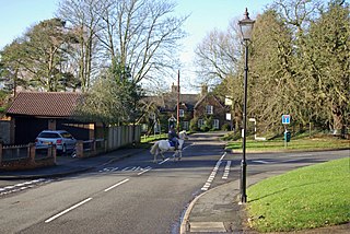
Thurlaston is a village and civil parish in the Rugby district of Warwickshire, England. According to the 2001 census the parish had a population of 352, increasing to 368 at the 2011 census, and again to 379 at the 2021 census.

Bilton is a suburb of Rugby in Warwickshire, England, located about 1.5 miles (2.4 km) south-west of Rugby town centre. It is also a ward of the Borough of Rugby, which at the 2021 Census had a population of 6,544. It comprises much of the western half of the town. Historically a village in its own right, Bilton was incorporated into Rugby in 1932.

Withybrook is a rural village and civil parish in the English county of Warwickshire. Its population was 255 at the 2021 census, increased slightly from 242 at the 2011 census.

Birdingbury is a village and civil parish in the Rugby district of Warwickshire, England, just south of the River Leam, and not far from Draycote Water. It is located roughly halfway between Rugby and Leamington Spa, about eight miles from each. According to the 2001 census it had a population of 327, increasing to 362 at the 2011 Census, decreasing to 341 at the 2021 Census.

Long Itchington is a large village and civil parish in Warwickshire, England, which at the 2011 Census had a population of 2,013. The village is named after the River Itchen which flows to the south and west of the village. Long Itchington is around two miles north of Southam on the A423 road, just north of the Grand Union Canal.
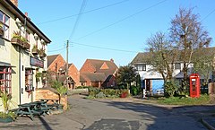
Marton is a village and civil parish in Warwickshire, England. The parish is within the Borough of Rugby and in the 2011 Census' had a population of 484. The hamlet of Marton Moor lies south of the village.

Whichford is a village and civil parish in Warwickshire, England, about 5 miles (8 km) southeast of Shipston-on-Stour. The parish adjoins the county boundary with Oxfordshire and the village is about 4+1⁄2 miles (7 km) north of the Oxfordshire town of Chipping Norton.
Kirkland is a civil parish, located on the banks of the River Wyre, midway between Preston and Lancaster, in the English county of Lancashire. It is also the historic name of what is now the village of Churchtown, within the parish. It is part of the Wyre district. In 2001 the parish had a population of 343, decreasing to 314 at the 2011 census.

Longworth is a village and civil parish in the Vale of White Horse, England. Historically within the north-west projection of Berkshire, boundary changes transferred it to Oxfordshire in 1974. The village is between Faringdon, 7 miles (11 km) to the west, and Oxford, 9 miles (14 km) to the northeast. The 2021 Census recorded the parish's population as 543.
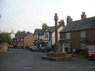
Churchover is a small village and civil parish in Warwickshire, England. The population of the parish in the 2001 census was 230, increasing to 251 at the 2011 census. It is located around 4 miles (7 km) north of Rugby, and is administratively part of the borough of Rugby. The village lies just west of the A426 road, and just north of the M6 motorway on the border with Leicestershire. It was named in the Domesday Book as Church Wavre.
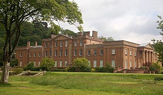
Himley is a small village and civil parish in Staffordshire, England, 4 miles (6.4 km) west of Dudley and 5 mi (8.0 km) southwest of Wolverhampton. At the 2011 Census, it had a population of 802. Himley Hall was the home of the Lords of Dudley.

Clifton-upon-Dunsmore is a village and civil parish in the Rugby borough of Warwickshire in England on the north-eastern outskirts of Rugby, approximately 2 miles (3.2 km) from Rugby town centre. The population of the parish taken at the 2011 census was 1,304, increasing to 2,991 at the 2021 census. Clifton is counted as being part of the Rugby built-up area, but is considered separate from the town. The parish also includes the new development of Houlton to the south of the old village, which may account for the large population increase since 2011.

Ratley is a village in the civil parish of Ratley and Upton, Stratford-on-Avon District, Warwickshire, England. The population of the civil parish in 2011 was 327. It is on the northwest side of the Edge Hill escarpment about 200 metres (660 ft) above sea level. The village is close to the county border with north Oxfordshire, some 7 miles northwest of Banbury, the closest town.

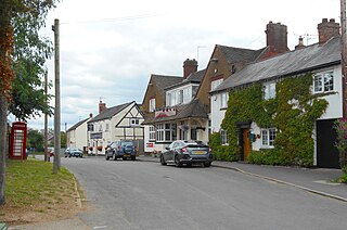
Frankton is a village and civil parish in the Rugby borough of Warwickshire in England. In the 2021 Census it had a population of 382,

Wigginton is a village and former civil parish, now in the parish of Wigginton and Hopwas, in the Lichfield district, in the county of Staffordshire, England.
Sherfield English is a small village and civil parish in the Test Valley borough of Hampshire, England. It is located on the A27 road, around 4 miles (6.4 km) west of Romsey.