Related Research Articles

Pocatello Regional Airport is a city-owned, public-use airport in the western United States, located in Bannock County, Idaho, seven nautical miles (13 km) northwest of central Pocatello.

McCall Municipal Airport is a city-owned public-use airport located in McCall, a city in Valley County, Idaho, United States. It is included in the FAA's National Plan of Integrated Airport Systems for 2011–2015, which categorized it as a general aviation facility.
Tanglefoot Seaplane Base is a privately owned, public-use seaplane base in Bonner County, Idaho, United States. It is located at Priest Lake, on west shore of Cavanaugh Bay.
Priest Lake USFS Airport is a public use airport located three nautical miles south of the central business district of Nordman, in Bonner County, Idaho, United States. It is owned by the United States Forest Service. The airport is located at the west side of Priest Lake.
Point Baker Seaplane Base is a state owned, public use seaplane base located in Point Baker, a community in the Prince of Wales-Hyder Census Area of the U.S. state of Alaska. It is included in the National Plan of Integrated Airport Systems for 2011–2015, which categorized it as a general aviation facility.
Port Protection Seaplane Base is a state owned, public use seaplane base located in Port Protection, a community in the Prince of Wales-Hyder Census Area of the U.S. state of Alaska. It is included in the National Plan of Integrated Airport Systems for 2011–2015, which categorized it as a general aviation facility.
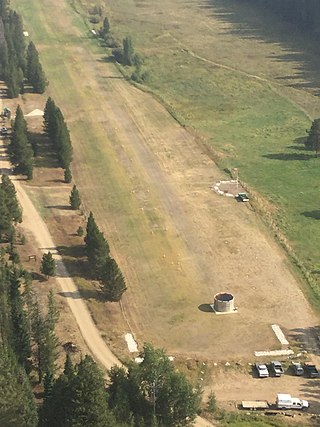
Condon USFS Airport is a public use airport located one nautical mile northwest of the central business district of Condon, in Missoula County, Montana, United States. It is owned by the United States Forest Service (USFS).
Boundary County Airport is a county-owned, public-use airport in Boundary County, Idaho, United States. It is located two nautical miles northeast of the central business district of Bonners Ferry. According to the FAA's National Plan of Integrated Airport Systems for 2009–2013, it is categorized as a general aviation airport.
Indian Creek USFS Airport is a public use airport located at Indian Creek in Valley County, Idaho, United States. It is owned by the U.S. Forest Service. The airstrip is situated next to the Middle Fork Salmon River.
Aberdeen Municipal Airport is a city-owned public-use airport located two nautical miles southwest of the central business district of Aberdeen, a city in Bingham County, Idaho, United States. According to the FAA's National Plan of Integrated Airport Systems for 2009–2013, it is categorized as a general aviation facility.
Alsek River Airport is a public-use airport located 44 nautical miles (81 km) southeast of the central business district of Yakutat, a city and borough in the U.S. state of Alaska. It is owned by the USFS Tongass National Forest. As per Federal Aviation Administration records, the airport had 507 passenger boardings (enplanements) in calendar year 2008.

Chamberlain USFS Airport is a public use airport located at Chamberlain Guard Station, in Idaho County, Idaho, United States. The airport is owned by the U.S. Forest Service. It is located near Chamberlain Creek in the Payette National Forest.
Cabin Creek USFS Airport is a public-use airport in Valley County, Idaho, United States. It is located 17 nautical miles east of Big Creek Ranger Station. The airport is owned by the U.S. Forest Service. The airstrip is near Cabin Creek in the Payette National Forest.
Big Creek Airport is a state-owned public-use airstrip in Valley County, Idaho, United States. It is located 12 nautical miles northeast of Yellow Pine, Idaho and 17 nautical miles west of the Cabin Creek USFS Airport . The airstrip is actually on Forest Service managed land. The state of Idaho Division of Aeronautics has a special use permit to perform annual maintenance on the strip and some facilities. The airport is located at the Big Creek Ranger Station in Payette National Forest, adjacent to the Big Creek Campground. The airstrip serves the Big Creek Lodge.
Dixie USFS Airport is a public-use U.S. Forest Service airport located three nautical miles southwest of the central business district of Dixie, in Idaho County, Idaho, United States.
Orogrande Airport is a public-use airport located one nautical mile northeast of the central business district of Orogrande, in Idaho County, Idaho, United States. It is owned by the U.S. Forest Service.
Idaho County Airport is a county-owned, public-use airport in Idaho County, Idaho. It is located one nautical mile north of the central business district of Grangeville, Idaho.
Reed Ranch Airport is a public use airport located 12 nautical miles southwest of the central business district of Yellow Pine, in Valley County, Idaho, United States. It is owned by the Idaho Division of Aeronautics / USFS.
Rexburg–Madison County Airport is a public use airport located one nautical mile (2 km) northwest of the central business district of Rexburg, a city in Madison County, Idaho, United States. It is owned by the City of Rexburg and Madison County. This airport is included in the National Plan of Integrated Airport Systems for 2011–2015, which categorized it as a general aviation facility.
References
- 1 2 3 FAA Airport Form 5010 for C48 PDF . Federal Aviation Administration. Effective 25 August 2011.