Lower Saxony is a German state (Land) situated in northwestern Germany. It is the second-largest state by land area, with 47,624 km2 (18,388 sq mi), and fourth-largest in population among the 16 Länder federated as the Federal Republic of Germany. In rural areas, Northern Low Saxon and Saterland Frisian are still spoken, but the number of speakers is declining.

The Leine is a river in Thuringia and Lower Saxony, Germany. It is a left tributary of the Aller and the Weser and it is 281 km (175 mi) long.

The Saale, also known as the Saxon Saale and Thuringian Saale, is a river in Germany and a left-bank tributary of the Elbe. It is not to be confused with the smaller Franconian Saale, a right-bank tributary of the Main, or the Saale in Lower Saxony, a tributary of the Leine.

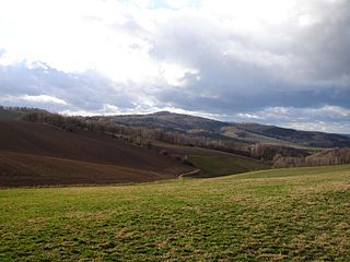
The Ore Mountains or Ore Mountain Range in Central Europe have formed a natural border between Saxony and Bohemia for around 800 years, from the 12th to the 20th centuries. Today, the border between Germany and the Czech Republic runs just north of the main crest of the mountain range. The highest peaks are the Klínovec, which rises to 1,244 metres (4,081 ft) above sea level and the Fichtelberg.

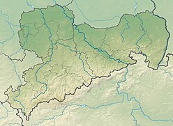
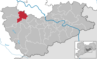
The Weißeritzkreis is a former district (Kreis) in the south of the Free State of Saxony, Germany. Neighboring districts were Freiberg, Meißen, the district-free city Dresden, Sächsische Schweiz, and to the south it bordered the Czech Republic.

The Fulda is a river of Hesse and Lower Saxony, Germany. It is one of two headstreams of the Weser. The Fulda is 220.4 kilometres (137.0 mi) long.
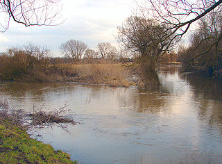
Schunter is a river in Lower Saxony, Germany. It has a length of 58 km (36 mi) and is a right tributary of the Oker.
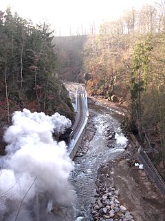
The Weißeritz Valley Railway is a steam operated narrow gauge railway in Saxony, Germany. The line connects Freital, near Dresden, with the spa of Kipsdorf in the Ore Mountains, and follows the valley of the Red Weißeritz.
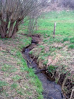
The Weißeritz is a river of Saxony, Germany. It is 13.7 km [8.5 mi] long and a left tiburary of the Elbe.
The Red Weißeritz is a river of Saxony, Germany.

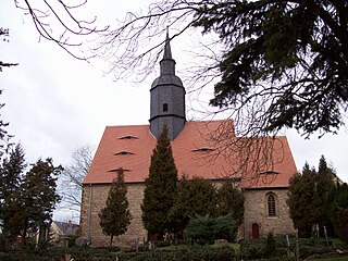
Batropetes is an extinct genus of brachystelechid microbrachomorphs. Although it was first classified as a reptile, Batropetes is now known to be a genus of microsaur amphibians. Batropetes lived during the Sakmarian stage of the Early Permian. Fossils attributable to the type species B. fritschi have been collected from the town of Freital in Saxony, Germany, near the city of Dresden. Additional material has been found from the Saar-Nahe Basin in southwestern Germany and has been assigned to three additional species: B. niederkirchensis, B. palatinus, and B. appelensis.
The Dresden–Werdau railway is an electrified, double-track main line in the German state of Saxony. It runs from Dresden via Freiberg, Chemnitz and Zwickau to Werdau wye, where it joins the Leipzig-Hof railway.
The Karsdorf Fault is a striking tectonic fracture line, which is part of the Central Saxon Fault, and is located in the eastern Ore Mountains and the Elbe Valley Slate Mountains of Germany. It forms the northern geological boundary of the Eastern Ore Mountains in the district of Sächsische Schweiz-Osterzgebirge with the Elbe zone, where it is adjoined by the Döhlen Basin and the Kreischa Basin.
The Bewer is a river of Lower Saxony, Germany. It is a left, northern tributary of the River Ilme. It flows solely through the municipal territory of the borough of Dassel.
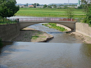
The Hammerbach is a river of Saxony, Germany. It is a left tributary of the Wiederitz, which it joins near Freital.

The Schneealpe or Schneealm is a limestone massif in the Northern Limestone Alps on the Styrian-Lower Austrian border. Its highest point is the Windberg at 1,903 metres above sea level. Other peaks are the Ameisbühel, the Schönhaltereck and the Donnerwand.
The Holy Way came about as a result of the canonization of Bishop Benno of Meissen. It led from Bohemia to Meissen and ran between Grillenburg and Wilsdruff in the present-day district of Sächsische Schweiz-Osterzgebirge in the opposite direction and parallel with the Saxon St. James' Way. Original sections of the route have survived, for example in the Tharandt Forest between Grillenburg and Spechtshausen.

A conical hill is a landform with a distinctly conical shape. It is usually isolated or rises above other surrounding foothills, and is often, but not always, of volcanic origin.
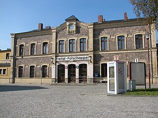
Freital-Potschappel station is a station on the Dresden–Werdau railway in the district of Potschappel of the municipality of Freital in the German state of Saxony. From 1884 to 1972, the station was the starting point of the 750 mm gauge Freital-Potschappel–Nossen railway. Today, Freital-Potschappel serves in particular as an access point to line S3 of the Dresden S-Bahn.