Windham Textile and History Museum

Last updated
Windham Textile and History Museum
Windham Textile and History Museum, Willimantic, CT.jpg
The museum in early-2018.
USA Connecticut location map.svg
Red pog.svg
Location within Connecticut
Established1995-2002 (1995-2002)
Location Willimantic, Connecticut
Type Textile museum
CEOJamie H. Eves
Website millmuseum.org

The Windham Textile and History Museum is a museum in Willimantic, Connecticut, in the New England region of the United States. It is currently located in Main St. [1]

Contents

Exhibits

Its main focus is the Willimantic Linen Company's Willimantic mill, later purchased by the American Thread Company and closed in 1985. [2] The museum is located in the former company store building. [3]

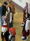
The museum features the Brooke Shannon Antique Sewing Machine Room, which is a room which features replica sewing machines from the factory in the late-19th century. [4] [5] Other exhibits include a re-creation of the manager's office, a replica of the boarding houses in the 1880s. [6] A tour of the mill property is part of the tour, but access inside in not included due to most of the mill being on private property. [7] There are many other displays that feature what was life like during the turn of the century at the mill in Willimantic. [8]

Associated people

Related Research Articles

Willimantic, Connecticut Census-designated place in Connecticut

Willimantic is a census-designated place located in the town of Windham in Windham County, Connecticut, United States. It is a former city and borough. Known as "Thread City" for the American Thread Company's mills along the Willimantic River, it was a center of the textile industry in the 19th century. Originally incorporated as a city in 1893, it entered a period of decline after the Second World War, culminating in the mill's closure and the city's reabsorption into the town of Windham in the 1980s. Heroin use, present since the 1960s, became a major public health problem in the early 2000s, declining somewhat by the 2010s. Though the city was a major rail hub, an Interstate Highway has never passed within ten miles, despite early plans to connect it.

Wright-Patterson Air Force Base US Air Force base near Dayton, Ohio, United States

Wright-Patterson Air Force Base (WPAFB) is a United States Air Force base and census-designated place just east of Dayton, Ohio, in Greene and Montgomery counties. It includes both Wright and Patterson Fields, which were originally Wilbur Wright Field and Fairfield Aviation General Supply Depot. Patterson Field is approximately 16 kilometres (10 mi) northeast of Dayton; Wright Field is approximately 8.0 kilometres (5 mi) northeast of Dayton.

Willimantic River

The Willimantic River is a tributary of the Shetucket River, approximately 25 mi (40 km) long in northeastern Connecticut in the New England region of the United States.

Pawtucket Canal Canal in Massachusetts, US

Completed in 1796, the Pawtucket Canal was originally built as a transportation canal to circumvent the Pawtucket Falls of the Merrimack River in East Chelmsford, Massachusetts. In the early 1820s it became a major component of the Lowell power canal system. with the founding of the textile industry at what became Lowell.

Union Station (New Haven) Main railway station in New Haven, CT

Union Station, also known as New Haven Railroad Station or simply New Haven, is the main railroad passenger station in New Haven, Connecticut. Designed by noted American architect Cass Gilbert, the beaux-arts Union Station was completed and opened in 1920 after the previous Union Station was destroyed by fire. It served the New York, New Haven and Hartford Railroad until it fell into decline, along with the rest of the railroad industry in North America after World War II. It was shuttered in 1972, leaving only the under-track 'subway' open for passengers, and listed on the National Register of Historic Places on September 3, 1975, but it was almost demolished before the Northeast Corridor Improvement Project in 1979. Reopened after extensive renovations in early 1985, it is now the premier gateway to the city.

Blackstone Canal United States historic place

The Blackstone Canal was a waterway linking Worcester, Massachusetts, to Providence, Rhode Island through the Blackstone Valley via a series of locks and canals during the early 19th century.

Merrimack Canal

The Merrimack Canal is a power canal in Lowell, Massachusetts. The canal, dug in the 1820s, begins at the Pawtucket Canal just above Swamp Locks, and empties into the Merrimack River near the Boott Cotton Mills. The Merrimack Canal was the first major canal to be dug at Lowell exclusively for power purposes, and delivered 32 feet (9.8 m) of hydraulic head to the mills of the Merrimack Manufacturing Company. The Merrimack Manufacturing Company was the first of the major textile mills constructed in Lowell. It was demolished around 1960.

Quiet Corner

Northeastern Connecticut, better known as the Quiet Corner, is a region of the state of Connecticut, located in the northeastern corner of the state. It is generally associated with Windham County, but also incorporates eastern sections of Tolland County and the northern portion of New London County. The most frequently cited boundary is the semi-rural town of Coventry, which is more rustic than the more suburban towns to the west.

Georgia State Railroad Museum United States historic place

The Georgia State Railroad Museum is a museum in Savannah, Georgia located at a historic Central of Georgia Railway site. It includes parts of the Central of Georgia Railway: Savannah Shops and Terminal Facilities National Historic Landmark District. The complex is considered the most complete antebellum railroad complex in the United States. The museum, located at 655 Louisville Road, is part of a historic district included in the National Register of Historic Places.

Lowell Power Canal System and Pawtucket Gatehouse United States historic place

The Lowell Power Canal System is the largest power canal system in the United States, at 5.6 miles in length. The system's estimated output is 10,000 horsepower, operating six major canals on two levels, controlled by numerous gates. The system was begun in the 1790s, beginning its life as a transportation canal called the Pawtucket Canal, which was constructed to get logs from New Hampshire down the Merrimack River to shipbuilding centers at Newburyport, Massachusetts, bypassing the 30-plus-foot drop of the Pawtucket Falls.

Riverview Historic District (Valley, Alabama) United States historic place

Riverview Historic District is a historic district along the Chattahoochee River in River View, Alabama. It was listed on the Alabama Register of Landmarks and Heritage on December 19, 1991 and on the National Register of Historic Places on November 12, 1999.

Langdale Historic District United States historic place

Langdale Historic District is a historic district in Valley, Alabama and Harris County, Georgia, United States. It was listed on the Alabama Register of Landmarks and Heritage on July 22, 1991 and the National Register of Historic Places (NRHP) on November 12, 1999. It lies primarily in Valley, Alabama, on the West side of the Chattahoochee River.

Greeneville (Norwich, Connecticut) United States historic place

Greeneville is a neighborhood of the city of Norwich, Connecticut, located northeast of downtown Norwich along the west bank of the Shetucket River. Most of the neighborhood is designated Greeneville Historic District, a historic district that is listed on the National Register of Historic Places.

Ehrick Kensett Rossiter was an American architect known for the country homes he designed.

Monadnock Mills United States historic place

The Monadnock Mills are a historic mill complex in Claremont, New Hampshire. They extend along the southern bank of the Sugar River on both sides of Water Street, between the Broad Street bridge to the east, and the junction of Main and Water Streets in the west, where they abut the industrial area formerly associated with the Sullivan Machinery Company; there also a small number of surviving elements on the north side of the river opposite this area. The complex represents the surviving elements of what was once the largest manufacturing complex in the upper Connecticut River watershed area, and one of its oldest. The mills were listed on the National Register of Historic Places in 1979. Many of its buildings have been repurposed to other uses.

Buffalo Mill Historic District United States historic place

Buffalo Mill Historic District is a national historic district located at Buffalo, Union County, South Carolina. The district encompasses 190 contributing buildings and 2 contributing structures associated with the Buffalo Mill textile mill complex and mill village. The mill complex includes the main mill, mill office, power house, ice factory, mill warehouse, company store, and company bank/drug store. The main mill building features applied stylized Romanesque Revival detailing. The mill village housing varies from large, free-classic, Queen Anne style supervisor's houses, to shingle-style bungalows, to simple, one-story, workers residences. The village also includes a school and a baseball field/park.

Frog Bridge

The Frog Bridge is a bridge located in Willimantic, Connecticut which carries South Street across the Willimantic River. It is known as the Frog Bridge because it has 4 copper frogs located on each end of the bridge, sitting on top of concrete thread spools. They were designed and created by artist Leo Jensen of Ivoryton, Connecticut.

Jillson Mills Mill complex in Connecticut, U.S.

The Jillson Mills is a mill complex in Willimantic, Connecticut. The mills produced cotton thread throughout the lifespan of the operation of the mill.

Windham Town Hall

The Windham Town Hall is a town hall in Willimantic, Windham, Connecticut.

Jillson Square Park

Jillson Square Park is park located in Willimantic, Connecticut. It holds the William Jillson Stone House on its area, and is home to the Willimantic Carnival. The park was created after the Windham Historical Society bought the property in 1972, and gave the area to the Town of Windham Recreation Department for park development. The park was the former land of William Jillson, the creator of the Jillson Mills nearby. The Air Line Trail starts less than 200 feet (61 m) away from here.

References

  1. "Windham Textile & History Museum | The Mill Museum". millmuseum.org. Retrieved 2016-11-11.
  2. Eves, Jamie H. "The Rise and Fall of Connecticut's Textile Industry". Windham Textile & History Museum. Retrieved January 18, 2015.
  3. "The Mill Museum" (PDF). Windham Textile & History Museum. Retrieved January 18, 2015.
  4. "Brooke Shannon Antique Sewing Machine Room | Windham Textile & History Museum". www.millmuseum.org. Retrieved 2016-11-08.
  5. "A Trip To Windham Textile Museum (Part 2) - The Working Textile Artist". The Working Textile Artist. 2016-06-20. Retrieved 2016-11-08.
  6. "The Workers' House | Windham Textile & History Museum". www.millmuseum.org. Retrieved 2016-11-08.
  7. "The Mills | Windham Textile & History Museum". www.millmuseum.org. Retrieved 2016-11-08.
  8. "Permanent Exhibits | Windham Textile & History Museum". www.millmuseum.org. Retrieved 2016-11-08.

Further reading

Historic American Engineering Record (HAER) documentation:

Coordinates: 41°42′40″N72°12′23″W / 41.7111°N 72.2064°W / 41.7111; -72.2064