Winona, Indiana | |
|---|---|
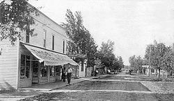 Winona, circa 1910 | |
 Winona  Winona | |
| Coordinates: 41°14′10″N86°34′10″W / 41.23611°N 86.56944°W | |
| Country | United States |
| State | Indiana |
| County | Starke |
| Township | North Bend |
| Elevation | 725 ft (221 m) |
| Time zone | UTC-6 (Central (CST)) |
| • Summer (DST) | UTC-5 (CDT) |
| ZIP code | 46534 |
| Area code | 574 |
| GNIS feature ID | 446187 [1] |
Winona is an unincorporated community in North Bend Township, Starke County, in the U.S. state of Indiana. [1]
